MyTopo
Powellsville North Carolina US Topo Map
Couldn't load pickup availability
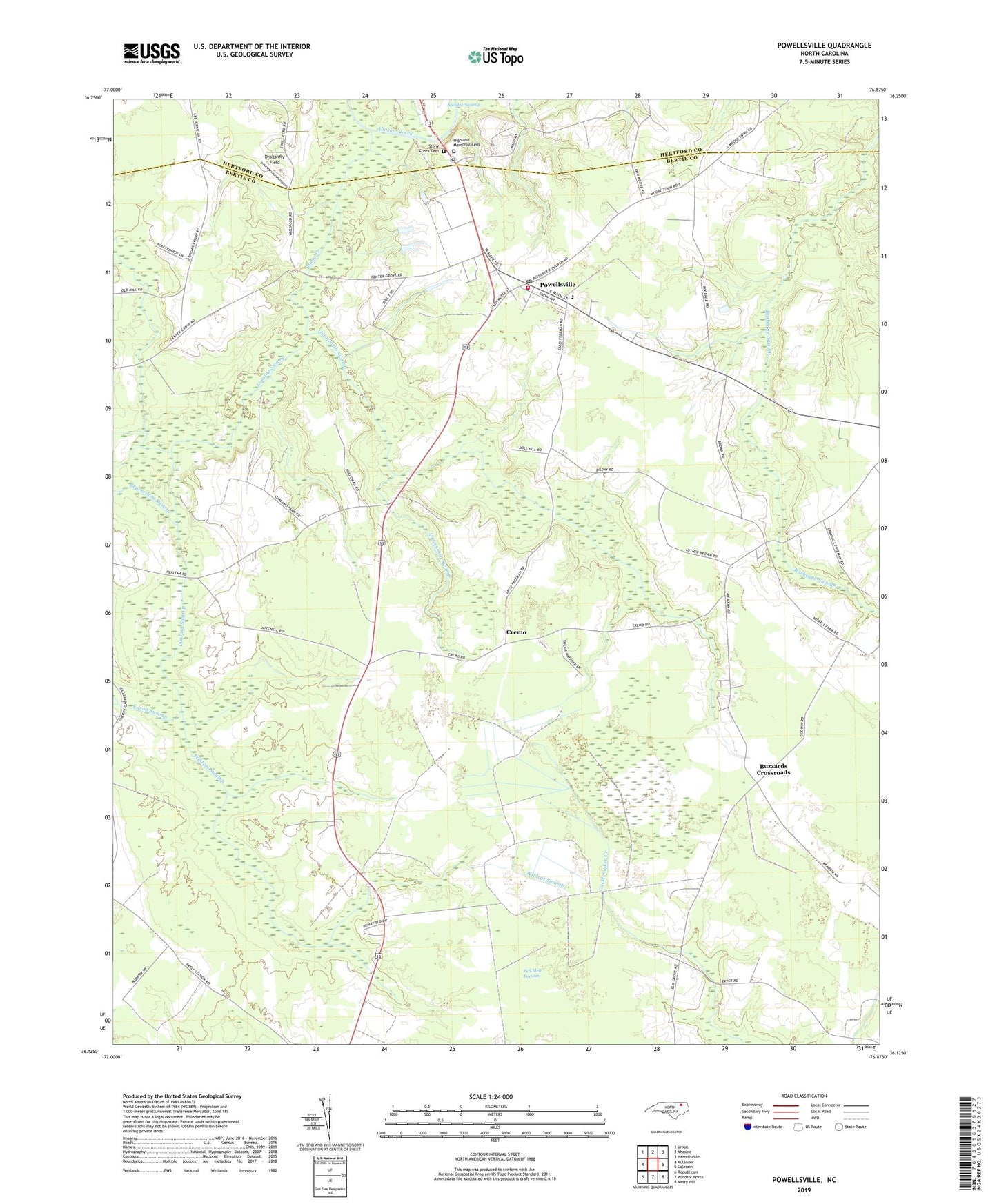
2022 topographic map quadrangle Powellsville in the state of North Carolina. Scale: 1:24000. Based on the newly updated USGS 7.5' US Topo map series, this map is in the following counties: Bertie, Hertford. The map contains contour data, water features, and other items you are used to seeing on USGS maps, but also has updated roads and other features. This is the next generation of topographic maps. Printed on high-quality waterproof paper with UV fade-resistant inks.
Quads adjacent to this one:
West: Aulander
Northwest: Union
North: Ahoskie
Northeast: Harrellsville
East: Colerain
Southeast: Merry Hill
South: Windsor North
Southwest: Republican
This map covers the same area as the classic USGS quad with code o36076b8.
Contains the following named places: Beaverdam Swamp, Buzzards Crossroads, Cremo, Dragonfly Field, Eason Swamp, Elm Grove, Elm Grove Church, Highland Memorial Cemetery, Holly Grove, Holly Grove Church, Loosing Swamp, Piney Wood, Piney Wood Chapel, Powellsville, Powellsville Post Office, Powellsville Volunteer Fire Department, Quioccosin Swamp, Roundtree Temple, Saint Marks Church, Stony Creek, Stony Creek Cemetery, Town of Powellsville, White School, Wildcat Swamp, ZIP Code: 27967