MyTopo
Ahoskie North Carolina US Topo Map
Couldn't load pickup availability
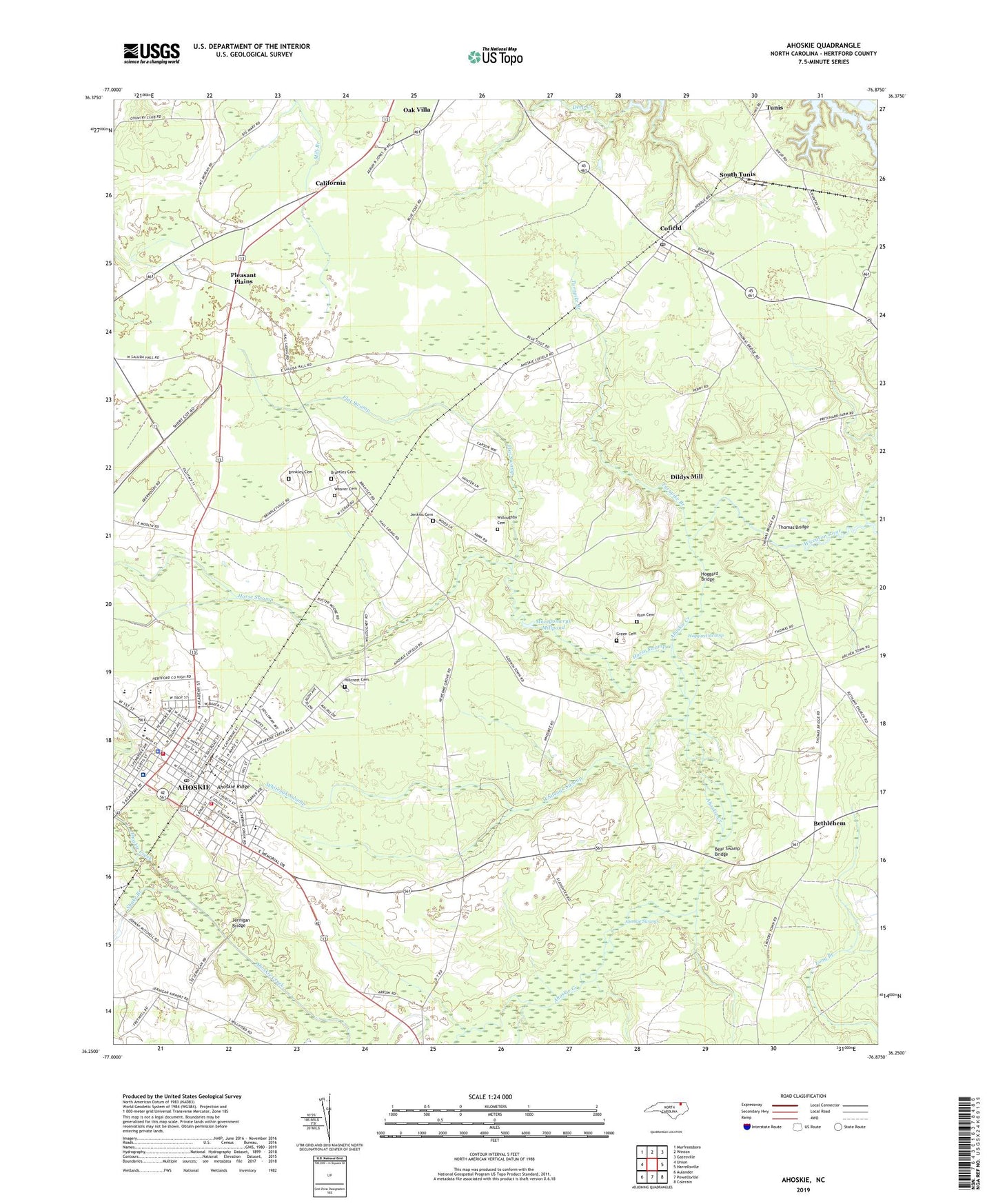
2022 topographic map quadrangle Ahoskie in the state of North Carolina. Scale: 1:24000. Based on the newly updated USGS 7.5' US Topo map series, this map is in the following counties: Hertford. The map contains contour data, water features, and other items you are used to seeing on USGS maps, but also has updated roads and other features. This is the next generation of topographic maps. Printed on high-quality waterproof paper with UV fade-resistant inks.
Quads adjacent to this one:
West: Union
Northwest: Murfreesboro
North: Winton
Northeast: Gatesville
East: Harrellsville
Southeast: Colerain
South: Powellsville
Southwest: Aulander
This map covers the same area as the classic USGS quad with code o36076c8.
Contains the following named places: Ahoskie, Ahoskie Church of God, Ahoskie City Hall, Ahoskie Creek, Ahoskie Fire Department, Ahoskie Free Will Baptist Church, Ahoskie Graded School, Ahoskie Middle School, Ahoskie Police Department, Ahoskie Post Office, Ahoskie Public Library, Ahoskie Rescue Squad, Ahoskie Ridge, Ahoskie Rural Volunteer Fire Department, Ahoskie Swamp, Ahoskie United Methodist Church, Alcohol Law Enforcement Division, Bear Swamp, Bear Swamp Bridge, Bethlehem, Brantley Cemetery, Brantley Grove Church, Brantleys Grove, Brinkley Cemetery, Brinkleyville, California, Calvary Church, Canaan Missionary Baptist Church, Carpenters Shop Church, Cofield, Cofield Post Office, Creech Memorial Church, Dildys Mill, Dildys Mills, Farmers Chemical Assoc Lake, First Church, Flat Swamp, Green Cemetery, Halls, Hertford County, Hickory Chapel, Higher Ground Pentecostal Church, Hillcrest Cemetery, Hoggard Bridge, Hoggard Swamp, Holly Springs Church, Horse Swamp, Jenkins Cemetery, Jernigan Airport, Jernigan Bridge, Meherrin State Designated Tribal Statistical Area, Montgomerys Millpond, New Life Ministry Church, New Market Shopping Center, Newsoms Grove Church, Northside Behavioral Health Services, Oak Villa, Philippi Church, Pleasant Plains, Pleasant Plains Baptist Church, Pleasant Ridge Church, Proctors Corner, Roanoke Place, Snake Branch, South Tunis, Thomas Bridge, Town of Ahoskie, Township of Ahoskie, Township of Winton, Turnpike Branch, Vann Cemetery, Vann School, Vidant Roanoke - Chowan Hospital, Village of Cofield, Weaver Cemetery, Whiteoak Swamp, Willoughby Cemetery, ZIP Code: 27910