MyTopo
Hobgood North Carolina US Topo Map
Couldn't load pickup availability
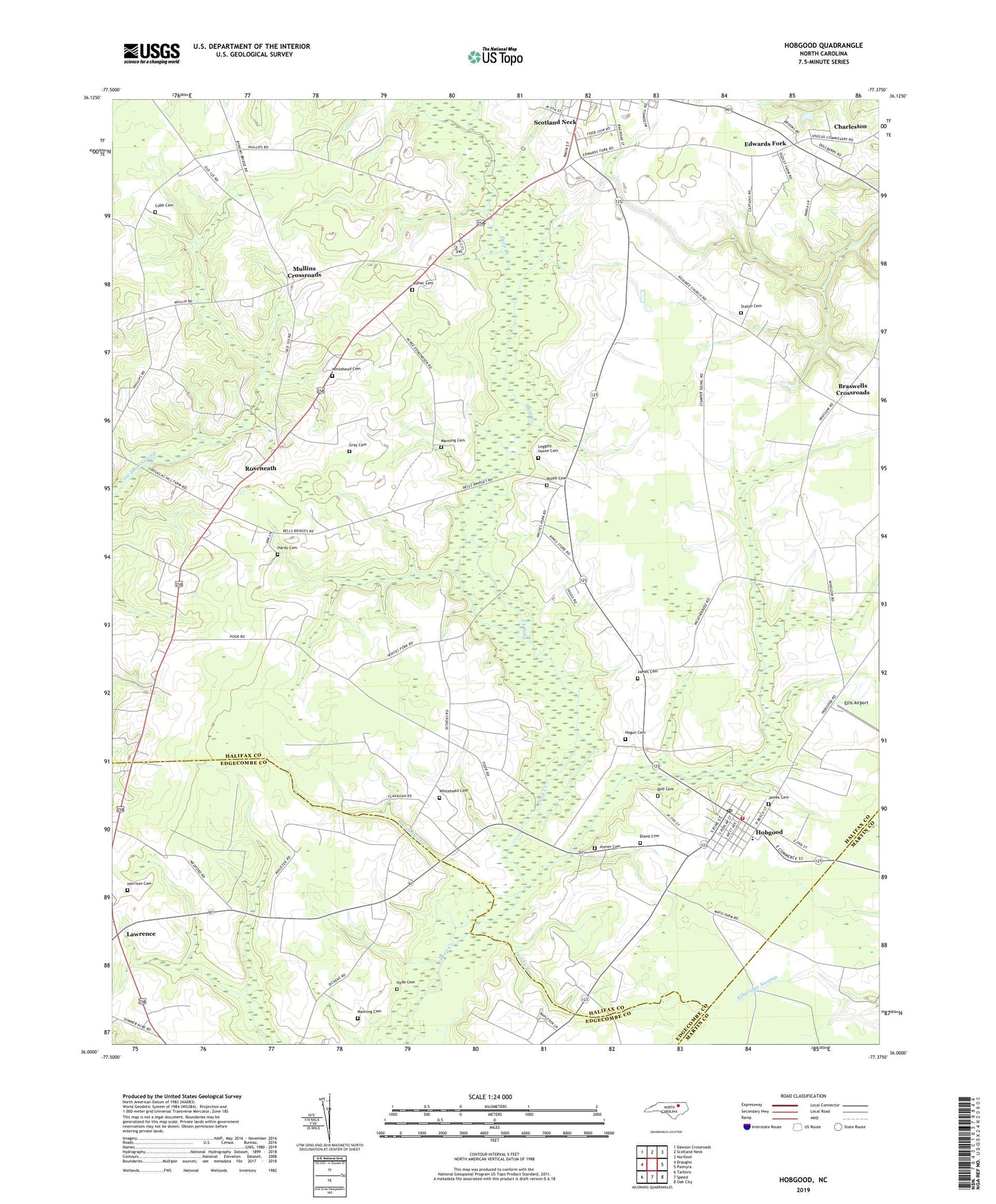
2019 topographic map quadrangle Hobgood in the state of North Carolina. Scale: 1:24000. Based on the newly updated USGS 7.5' US Topo map series, this map is in the following counties: Halifax, Edgecombe, Martin. The map contains contour data, water features, and other items you are used to seeing on USGS maps, but also has updated roads and other features. This is the next generation of topographic maps. Printed on high-quality waterproof paper with UV fade-resistant inks.
Quads adjacent to this one:
West: Draughn
Northwest: Dawson Crossroads
North: Scotland Neck
Northeast: Norfleet
East: Palmyra
Southeast: Oak City
South: Speed
Southwest: Tarboro
Contains the following named places: Bell Cemetery, Bland Cemetery, Braswells Crossroads, Charleston, Cherry Church, Cobb Cemetery, East Pork Farms, Edwards Fork, Ellis Airport, End Street Church, Grace Church, Gray Cemetery, Hardy Cemetery, Harrison Cemetery, Hobgood, Hobgood Post Office, Hobgood Volunteer Fire Department, Hogun Cemetery, Hyde Cemetery, Indian Branch, James Cemetery, Joyner Cemetery, Kehukee Church, Lawrence, Leggett House Cemetery, Long Church, Manning Cemetery, Marsh Swamp, Meetinghouse Church, Mizell Cemetery, Mullins Crossroads, Nahalah Church, Pleasant Hill Church, Roseneath, Shield School, Staton Cemetery, Town of Hobgood, Township of Roseneath, Whitehead Cemetery