MyTopo
Scotland Neck North Carolina US Topo Map
Couldn't load pickup availability
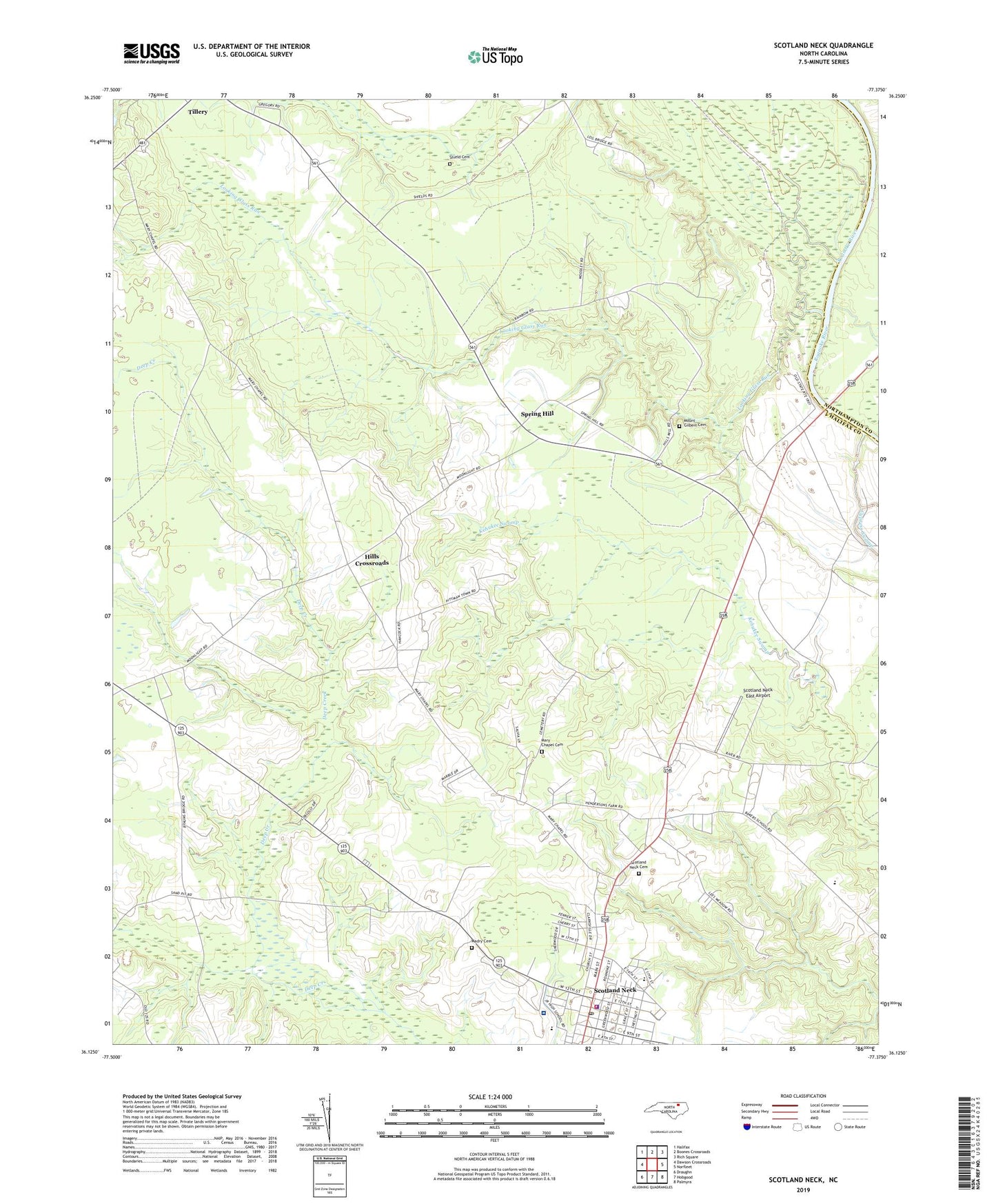
2022 topographic map quadrangle Scotland Neck in the state of North Carolina. Scale: 1:24000. Based on the newly updated USGS 7.5' US Topo map series, this map is in the following counties: Halifax, Northampton. The map contains contour data, water features, and other items you are used to seeing on USGS maps, but also has updated roads and other features. This is the next generation of topographic maps. Printed on high-quality waterproof paper with UV fade-resistant inks.
Quads adjacent to this one:
West: Dawson Crossroads
Northwest: Halifax
North: Boones Crossroads
Northeast: Rich Square
East: Norfleet
Southeast: Palmyra
South: Hobgood
Southwest: Draughn
This map covers the same area as the classic USGS quad with code o36077b4.
Contains the following named places: Baker School, Brawley High School, Chestnut Grove Church, Dawson Grove Church, Galilee Church, Halifax Emergency Medical Services Station 3 - Scotland Neck Rescue Squad, Hills Crossroads, Kitchins Siding, Looking Glass Run, Madry Cemetery, Mary Chapel, Marys Chapel Baptist Church Cemetery, Mount Gilbert Cemetery, Mount Gilbert Church, Our Community Hospital, Scotland Neck, Scotland Neck Cemetery, Scotland Neck East Airport, Scotland Neck Fire Department Station 8, Scotland Neck Police Department, Scotland Neck Post Office, Shield Cemetery, Spring Hill, Tillery Chapel School, Town of Scotland Neck, Township of Conoconnara, Township of Scotland Neck, Trinity Church, WYAL-AM (Scotland Neck), ZIP Code: 27874