MyTopo
Speed North Carolina US Topo Map
Couldn't load pickup availability
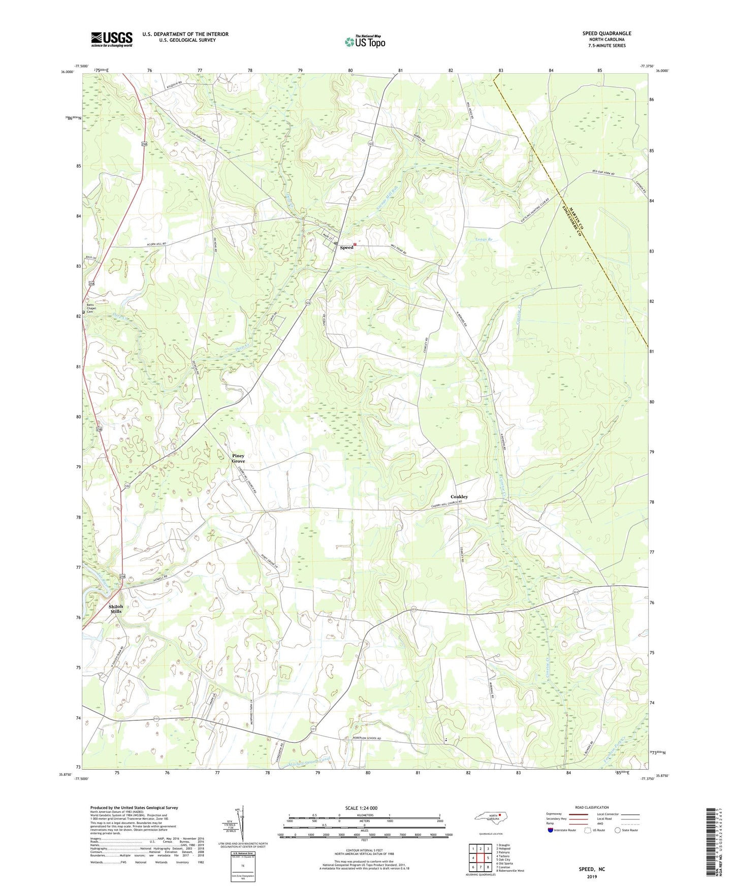
2022 topographic map quadrangle Speed in the state of North Carolina. Scale: 1:24000. Based on the newly updated USGS 7.5' US Topo map series, this map is in the following counties: Edgecombe, Martin. The map contains contour data, water features, and other items you are used to seeing on USGS maps, but also has updated roads and other features. This is the next generation of topographic maps. Printed on high-quality waterproof paper with UV fade-resistant inks.
Quads adjacent to this one:
West: Tarboro
Northwest: Draughn
North: Hobgood
Northeast: Palmyra
East: Oak City
Southeast: Robersonville West
South: Conetoe
Southwest: Old Sparta
This map covers the same area as the classic USGS quad with code o35077h4.
Contains the following named places: Acorn Hill Church, Batts Chapel, Batts Chapel Cemetery, Cherry Hill Church, Coakley, Longs Branch, Mitchell Swamp Canal, Piney Grove, Roberson School, Savage Mill Run, Shiloh Mills, Speed, Speed Post Office, Speed Volunteer Fire Department, Town of Speed, Township 3-Upper Conetoe, Township 4-Deep Creek, Weeping Mary Church, White Chapel, ZIP Codes: 27843, 27881