MyTopo
Dawson Crossroads North Carolina US Topo Map
Couldn't load pickup availability
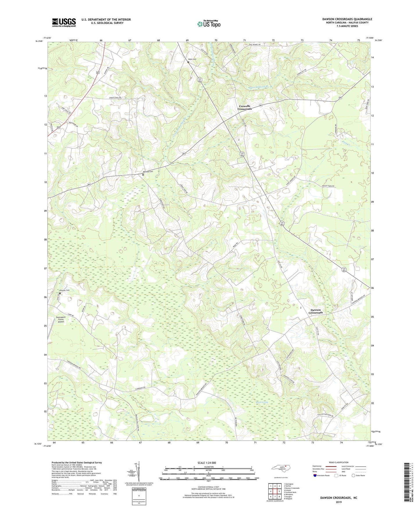
2022 topographic map quadrangle Dawson Crossroads in the state of North Carolina. Scale: 1:24000. Based on the newly updated USGS 7.5' US Topo map series, this map is in the following counties: Halifax. The map contains contour data, water features, and other items you are used to seeing on USGS maps, but also has updated roads and other features. This is the next generation of topographic maps. Printed on high-quality waterproof paper with UV fade-resistant inks.
Quads adjacent to this one:
West: Enfield
Northwest: Darlington
North: Halifax
Northeast: Boones Crossroads
East: Scotland Neck
Southeast: Hobgood
South: Draughn
Southwest: Whitakers
This map covers the same area as the classic USGS quad with code o36077b5.
Contains the following named places: Crowells Church, Crowells Crossroads, Dawson Crossroads, Dawson School, Dunns Store, Dunroamin Farms Airport, Hales Cemetery, Hales Millpond Branch, Mount Calvary Church, Pittman Cemetery, Southeast High School, Westray Cemetery, Whitaker Chapel