MyTopo
Jason North Carolina US Topo Map
Couldn't load pickup availability
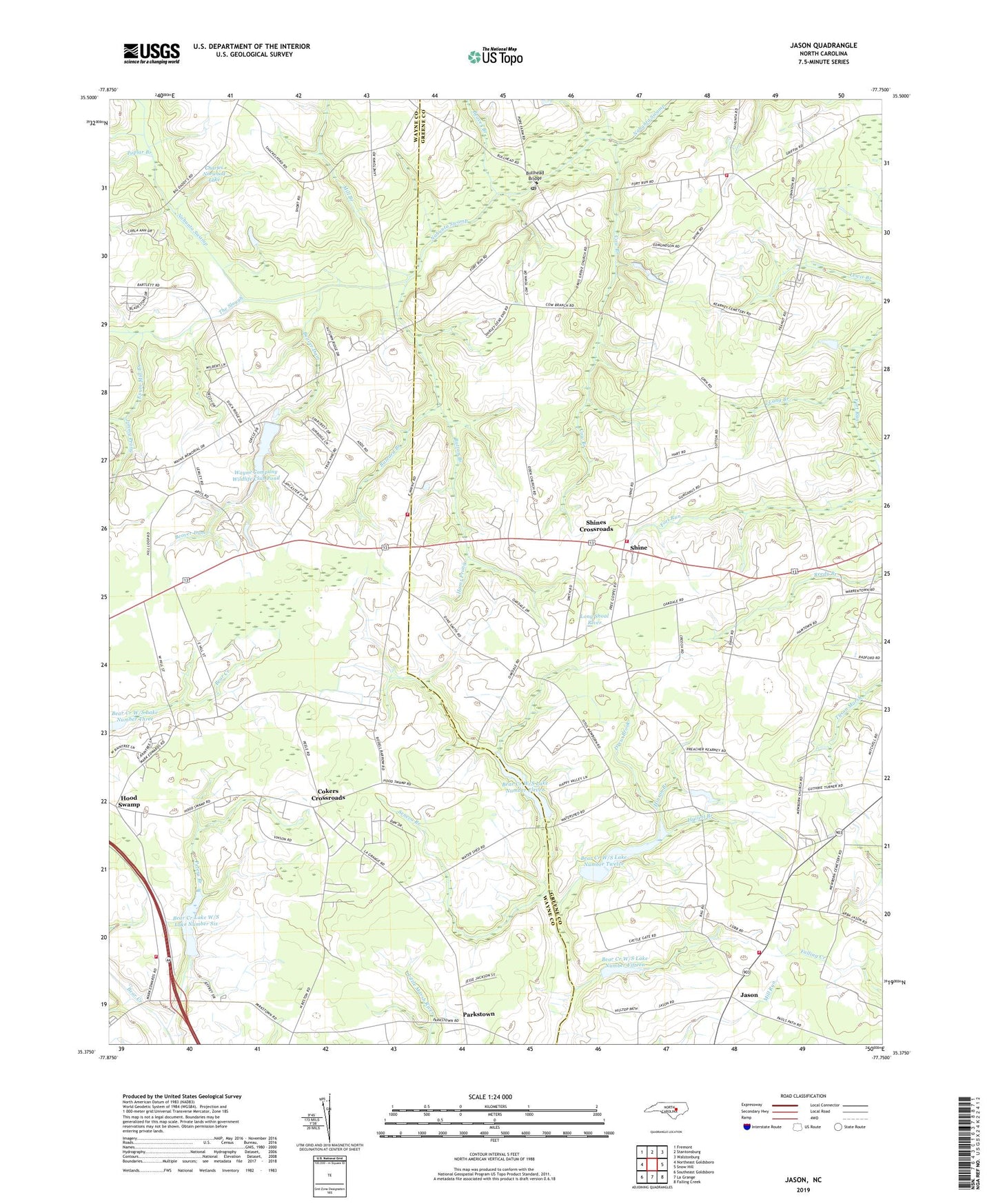
2019 topographic map quadrangle Jason in the state of North Carolina. Scale: 1:24000. Based on the newly updated USGS 7.5' US Topo map series, this map is in the following counties: Greene, Wayne. The map contains contour data, water features, and other items you are used to seeing on USGS maps, but also has updated roads and other features. This is the next generation of topographic maps. Printed on high-quality waterproof paper with UV fade-resistant inks.
Quads adjacent to this one:
West: Northeast Goldsboro
Northwest: Fremont
North: Stantonsburg
Northeast: Walstonburg
East: Snow Hill
Southeast: Falling Creek
South: La Grange
Southwest: Southeast Goldsboro
Contains the following named places: A G Phelps Dam, A P Cobb Dam, Bear Creek Lake W/S Lake Number Six, Bear Creek W/S Lake Number Eleven, Bear Creek W/S Lake Number Fifteen, Bear Creek W/S Lake Number Twelve, Beaver Branch, Beaver Dam, Bethel Church, Buck Meadow Branch, Bullhead Bridge, Bullhead Post Office, Button Branch, Buzzard Branch, Charles Norwood Lake, Charles Norwood Lake Dam, Church on the Rock, Cokers Crossroads, Cow Branch, Davis Grove Church, Drew Brook, East Wayne County Fire Department Station 26, Eden Church, Exum Mill Branch, Fort Run Church, Fort Run Fire Department / Emergency Medical Services, Fort Run Post Office, Free Tabernacle, Hams Prong, Hams Store, Hinson Branch, Hood Swamp, Hullett Branch, Invitation Church, Invitation School, Jason, Jason Corner, Jason Rural Volunteer Fire Department, Jason School, Jerusalem Methodist, Jimmy Prong, Lang Branch, Long Shoal River, Lovicks Chapel, Mewborn Church, Mill Branch, Mount Pleasant Church, Nahunta Church, Oakdale, Parkstown, Peanut Crossroads, Peters Branch, Poplar Branch, Rudy Hill Dam, Saint Delight Church, Saint Johns Church, Saint Mary Church, Saint Matthews Church, Sally Whitley Dam, Seneca Branch, Shine, Shine Rural Fire and Rescue Association, Shines Crossroads, The Slough, Thompsons Chapel, Township of Saulston, Township of Shine, Wayne Company Wildlife Club Pond, Wayne County Fire Station 2 - New Hope, Wayne County Wildlife Pond Dam