MyTopo
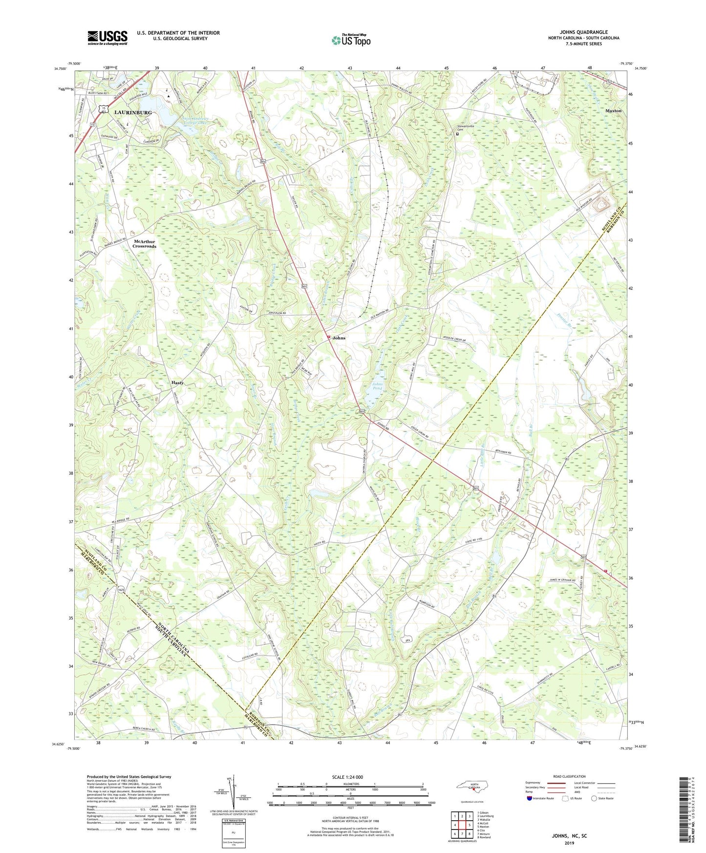
Johns North Carolina US Topo Map
Couldn't load pickup availability
2019 topographic map quadrangle Johns in the states of North Carolina, South Carolina. Scale: 1:24000. Based on the newly updated USGS 7.5' US Topo map series, this map is in the following counties: Scotland, Robeson, Marlboro. The map contains contour data, water features, and other items you are used to seeing on USGS maps, but also has updated roads and other features. This is the next generation of topographic maps. Printed on high-quality waterproof paper with UV fade-resistant inks.
Quads adjacent to this one:
West: McColl
Northwest: Gibson
North: Laurinburg
Northeast: Wakulla
East: Maxton
Southeast: Rowland
South: Minturn
Southwest: Clio
Contains the following named places: Big Branch, Black Branch, Bridge Creek, Cabin Branch, Caledonia Church, Camelin Acres, Eastover Estates, Edgeland Park, Frazier Branch, Good News Chapel, Grey Pond Church, Hasion Church, Hasty, Hunters Chapel, Jerusalem Church, Johns, Johns Pond, Johns Pond Dam, Jones Chapel, Leach Creek Church, Little Bull Branch, Macland, Maxton Southeastern Rural Volunteer Fire Department, McArthur Crossroads, McKenzie Acres East, Oak Grove School, Piney Grove Church, Plains Church, Reedy Branch Church, Saint Andrews College, Saint Andrews College Lake, Saint Andrews College Lake Dam, Saint Lukes Church, Shady Grove Church, Smyrna Church, South Scotland School, Steer Branch, Stewartsville Cemetery, Stewartsville Volunteer Fire Department, Sunny Acres, Sycamore Lane Middle School, Township of Stewartsville, Turnout, Whispering Pines Number Two, Zion Hill Church