MyTopo
Lake Lure North Carolina US Topo Map
Couldn't load pickup availability
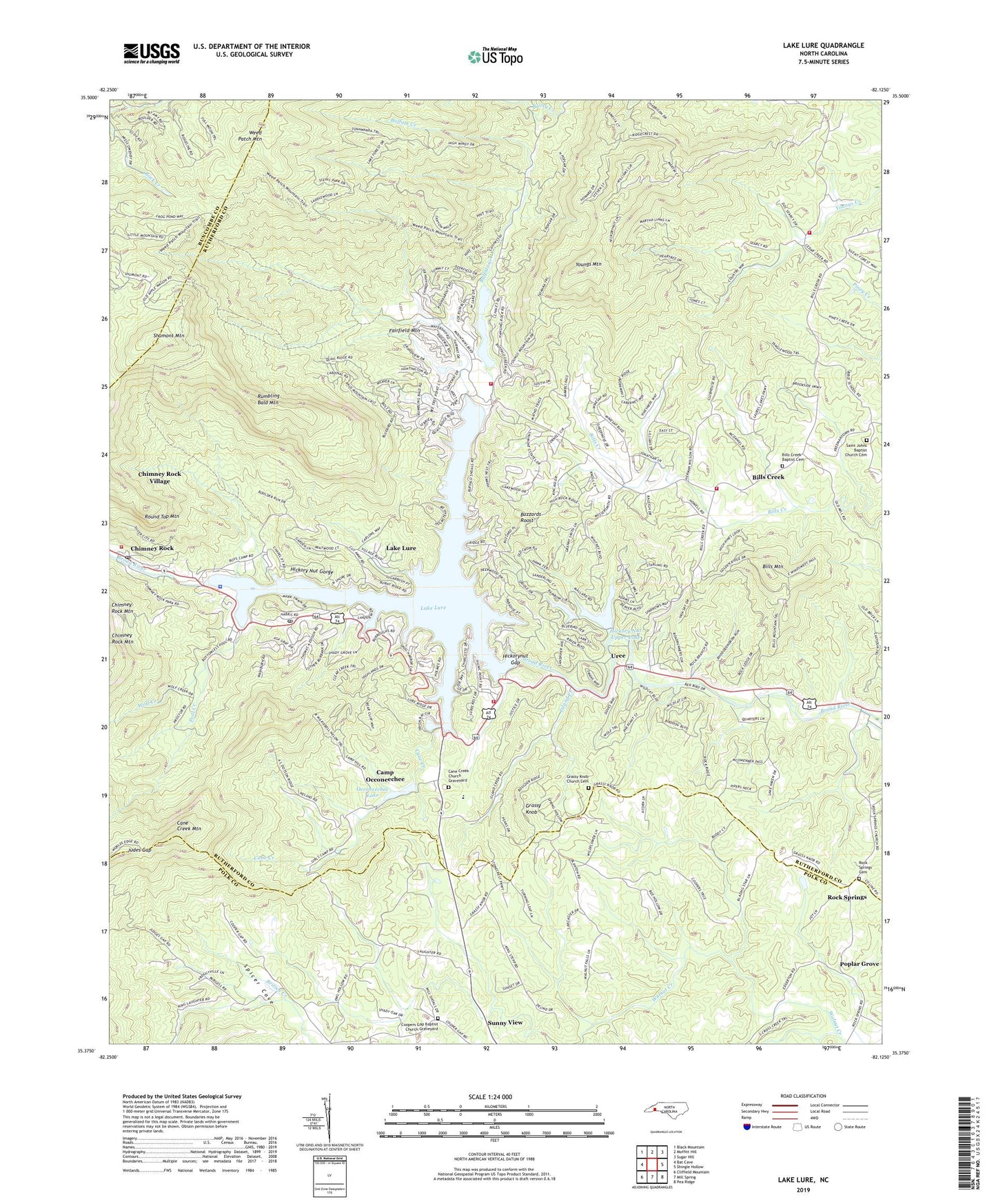
2019 topographic map quadrangle Lake Lure in the state of North Carolina. Scale: 1:24000. Based on the newly updated USGS 7.5' US Topo map series, this map is in the following counties: Rutherford, Polk, Buncombe. The map contains contour data, water features, and other items you are used to seeing on USGS maps, but also has updated roads and other features. This is the next generation of topographic maps. Printed on high-quality waterproof paper with UV fade-resistant inks.
Quads adjacent to this one:
West: Bat Cave
Northwest: Black Mountain
North: Moffitt Hill
Northeast: Sugar Hill
East: Shingle Hollow
Southeast: Pea Ridge
South: Mill Spring
Southwest: Cliffield Mountain
Contains the following named places: Bald Mountain Lake, Bald Mountain Lake Dam, Bills Creek, Bills Creek Baptist Cemetery, Bills Creek Baptist Church, Bills Creek Volunteer Fire Department Station 1, Bills Creek Volunteer Fire Department Station 2, Bills Mountain, Bob, Buffalo Creek, Buzzards Roost, Camp Lurecrest, Camp Occoneechee, Cane Creek, Cane Creek Church, Cane Creek Church Graveyard, Cane Creek Mountain, Carolina Mountains, Chimney Rock, Chimney Rock Baptist Church, Chimney Rock Post Office, Chimney Rock Volunteer Fire Department, Cooper Gap Church, Coopers Gap Baptist Church Graveyard, Deerfield, Fairfield Mountain, Fairfield Mountains, Fairfield Mountains Volunteer Fire Department Station 1, Fairfield Volunteer Fire Department, Golf Estates, Grassy Knob, Grassy Knob Church, Grassy Knob Church Cemetery, Hickory Nut Gorge, Hickory Nut Gorge Volunteer Emergency Medical Services and Rescue, Hickory Nut Lower Dam, Hickory Nut Lower Lake, Hickory Nut Upper Dam, Hickory Nut Upper Lake, Hickorynut Gap, Island Creek, Judes Gap, Lake Lure, Lake Lure Dam, Lake Lure Municipal Golf Course, Lake Lure Police Department, Lake Lure Post Office, Occoneechee Lake, Occoneechee Lake Dam, Pool Creek, Poplar Grove, Quail Ridge, Riverbend, Rock Spring Church, Rock Springs, Rock Springs Cemetery, Round Top Mountain, Rumbling Bald Mountain, Rutherford County Emergency Medical Services Station 2, Saint Johns Baptist Church Cemetery, Saint Johns Church, Shumont Mountain, The Mountains Dam, The Mountains Lake, The Pools, Town of Lake Lure, Township of Chimney Rock, Uree, Weed Patch Mountain, Whiteside Ford, Wolf Creek, Youngs Mountain, ZIP Code: 28746