MyTopo
Mill Spring North Carolina US Topo Map
Couldn't load pickup availability
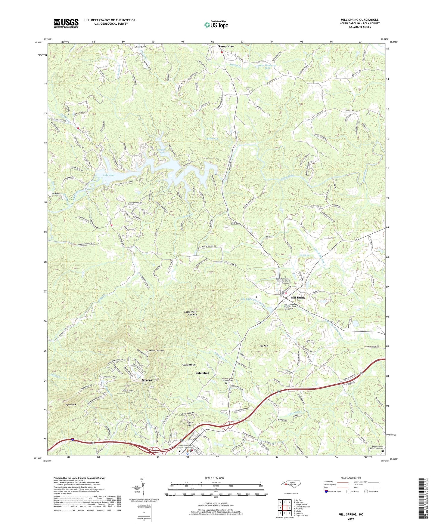
2022 topographic map quadrangle Mill Spring in the state of North Carolina. Scale: 1:24000. Based on the newly updated USGS 7.5' US Topo map series, this map is in the following counties: Polk. The map contains contour data, water features, and other items you are used to seeing on USGS maps, but also has updated roads and other features. This is the next generation of topographic maps. Printed on high-quality waterproof paper with UV fade-resistant inks.
Quads adjacent to this one:
West: Cliffield Mountain
Northwest: Bat Cave
North: Lake Lure
Northeast: Shingle Hollow
East: Pea Ridge
Southeast: Fingerville West
South: Landrum
This map covers the same area as the classic USGS quad with code o35082c2.
Contains the following named places: Bethlehem United Methodist Church Graveyard, Big Level Church, Brights Creek, Britten Creek, Canal Creek, Columbus, Columbus Baptist Church Graveyard, Columbus Fire Department, Columbus Police Department, Columbus Post Office, Deering Milliken Dam, Deering Milliken Lake, Faith Church, Faith Temple, Foster Mountain, Fox Mountain, Jackson Cove, Kaye Thompson Dam, Kaye Thompson Lake, Lake Adger, Little White Oak Mountain, Midway Baptist Church Cemetery, Midway Church, Mill Spring, Mill Spring Elementary, Mill Spring First Baptist Church Graveyard, Mill Spring Post Office, Mill Spring Quarry, Mill Spring Volunteer Fire Department Station 1, Mill Spring Volunteer Fire Department Substation, Mountain View Church, Ostin Creek, Panther Creek, Peniel Baptist Church Graveyard, Peniel Church, Polk Central School, Polk County, Polk County Sheriff's Office, Rash Creek, Red Barn Landing, Rotten Creek, Silver Creek, Silver Creek Church, Spicer Cove, Stearns, Stearns Post Office, Stearns School, Stony Knoll Church, Sunny View, Sunny View Elementary School, Sunny View Fire and Rescue Station 1, Sunny View Fire and Rescue Station 2, Township of Cooper Gap, Township of White Oak, Tryon Peak, Turner Shoals Dam, Victory Church, White Oak Mountain, ZIP Code: 28756