MyTopo
Cliffield Mountain North Carolina US Topo Map
Couldn't load pickup availability
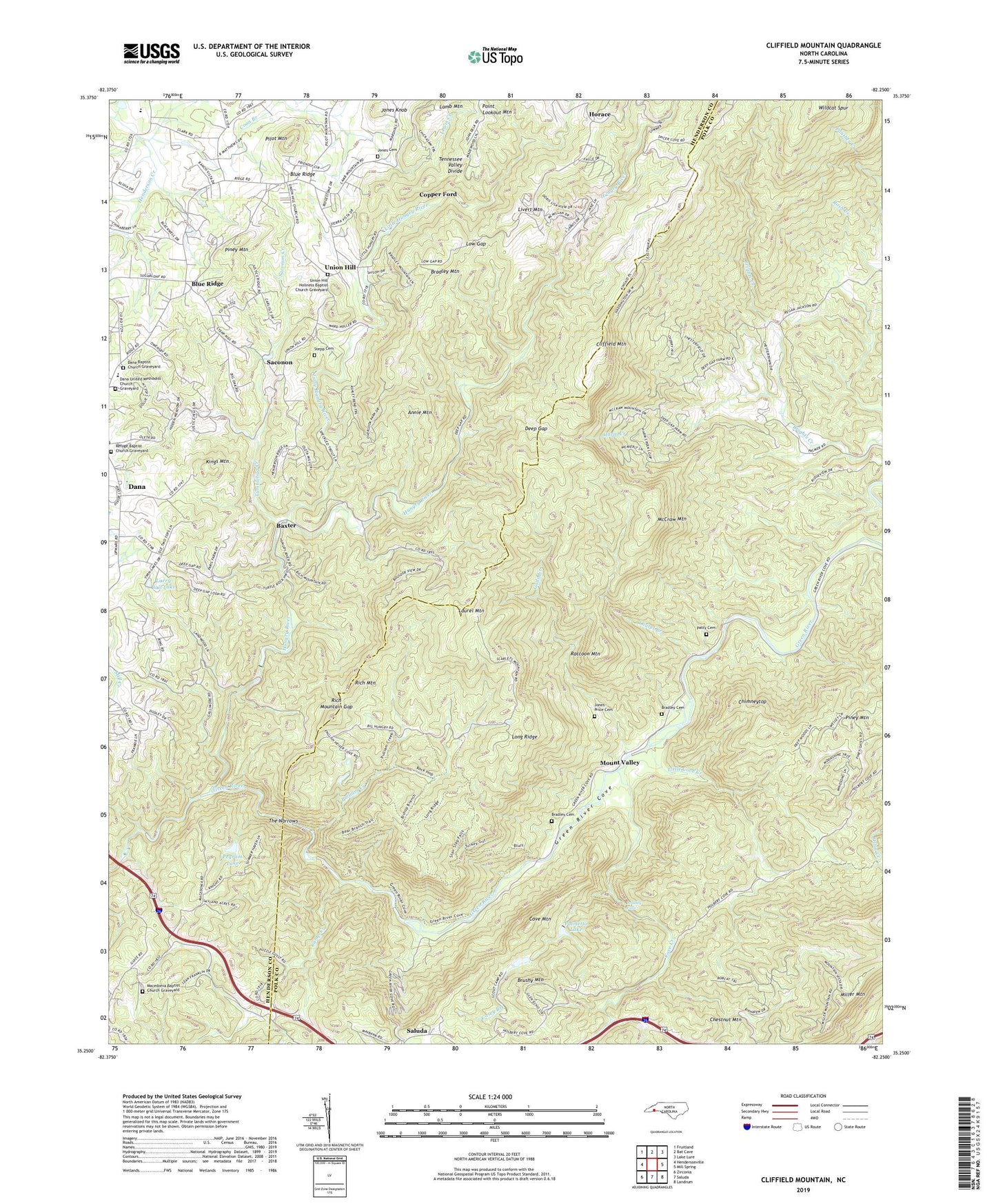
2022 topographic map quadrangle Cliffield Mountain in the state of North Carolina. Scale: 1:24000. Based on the newly updated USGS 7.5' US Topo map series, this map is in the following counties: Polk, Henderson. The map contains contour data, water features, and other items you are used to seeing on USGS maps, but also has updated roads and other features. This is the next generation of topographic maps. Printed on high-quality waterproof paper with UV fade-resistant inks.
Quads adjacent to this one:
West: Hendersonville
Northwest: Fruitland
North: Bat Cave
Northeast: Lake Lure
East: Mill Spring
Southeast: Landrum
Southwest: Zirconia
This map covers the same area as the classic USGS quad with code o35082c3.
Contains the following named places: Annie Mountain, Baxter, Big Branch, Blue Ridge, Bradley Cemetery, Bradley Falls, Bradley Mountain, Brushy Mountain, Byers Creek, Camp Creek, Casey Branch, Chestnut Mountain, Chimneytop, Cliffield Mountain, Copper Ford, Cove Creek, Cove Mountain, Dana Baptist Church Graveyard, Dana Census Designated Place, Dana School, Dana United Methodist Church Graveyard, Deep Gap, Edith Grove Church, Gadd Creek, Green River Cove, Harm Creek, Horace, Hungry River, Jones - Price Cemetery, Jones Cemetery, Jones Knob, Kings Mountain, Lamb Mountain, Larry Ball Dam, Larry Ball Lake, Laurel Branch, Laurel Mountain, Little Cove Creek, Little Hungry River, Livert Mountain, Long Ridge, Low Gap, Macedonia Baptist Church Graveyard, Macedonia Church, McCraw Mountain, Mill Corner, Mill Creek, Miller Mountain, Mount Valley, Palmetto Lake, Palmetto Lake Lower Dam, Palmetto Lake Upper Dam, Patty Cemetery, Pegram Lake, Pegram Lake Dam, Pilot Mountain, Piney Mountain, Pulliam Creek, Raccoon Mountain, Refuge Baptist Church Graveyard, Rich Mountain, Rich Mountain Gap, Saconon, Saconon Creek, Stepp Round Hill Cemetery, The Narrows, Township of Blue Ridge, Township of Saluda, Tumblebug Creek, Union Hill, Union Hill Holiness Baptist Church Graveyard, Wildcat Spur, ZIP Code: 28773