MyTopo
Horse Gap North Carolina US Topo Map
Couldn't load pickup availability
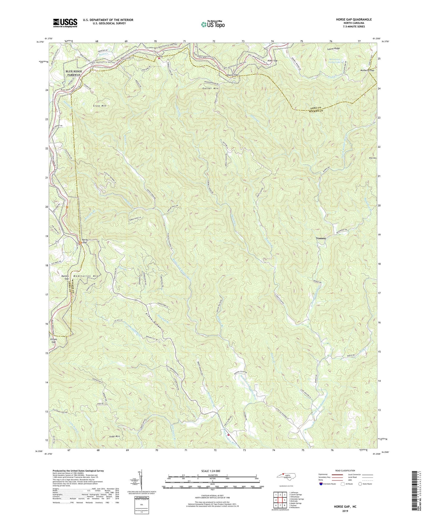
2022 topographic map quadrangle Horse Gap in the state of North Carolina. Scale: 1:24000. Based on the newly updated USGS 7.5' US Topo map series, this map is in the following counties: Wilkes, Ashe, Alleghany. The map contains contour data, water features, and other items you are used to seeing on USGS maps, but also has updated roads and other features. This is the next generation of topographic maps. Printed on high-quality waterproof paper with UV fade-resistant inks.
Quads adjacent to this one:
West: Glendale Springs
Northwest: Jefferson
North: Laurel Springs
Northeast: Whitehead
East: McGrady
Southeast: Wilkesboro
South: Purlear
Southwest: Maple Springs
This map covers the same area as the classic USGS quad with code o36081c3.
Contains the following named places: Alder Gap, Antioch Church, Aren Beshears Dam, Bear Den Branch, Bethel Church, Bowlin Creek, Buckwheat Branch, Bumgarner Branch, Clear Branch, Cross Mountain, Daniels Gap, Darnell Creek, Daylo, Dogwood Branch, Garner Mountain, Gillam Gap, Horse Gap, Judd Mountain, Jumpinoff Rock Overlook, K O A Dam, Laurel Ridge, Lester, Meditation Mountain, Mill Creek, Miller Church, Miller Gap, Millers Store, Moravian Camp Lake, Moravian Camp Lake Dam, Mulberry Gap, New Light Church, Noname, Oak Grove Church, Old 16 Church, Old Taylor Branch, Osborn Creek, Piney Ridge, Piney Ridge Church, Poplar Cove Church, Reddies River Church, Robbins Branch, Roberts Store, Roten Creek, Royals Mill, Sheets Gap, Sheets Gap Overlook, Shepherds Store, Sherman, Shoe, Snider Branch, Stanley Branch, Township of Union, Union Church, Union Township School, Vannoy, Wilbar, Wilbar Volunteer Fire Department Main Station, Wilbar Volunteer Fire Department Substation, Wingler Creek, ZIP Codes: 28629, 28651