MyTopo
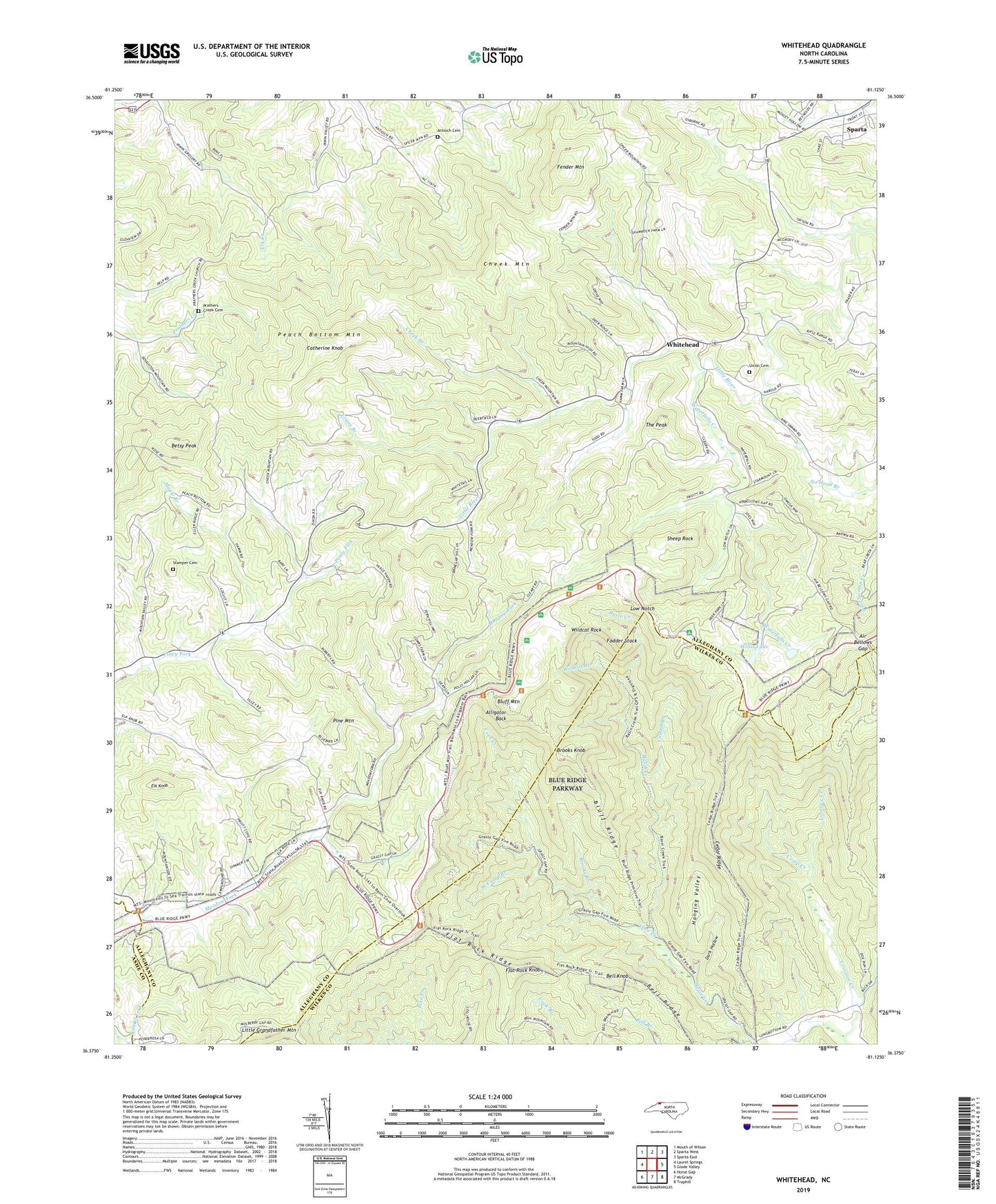
Whitehead North Carolina US Topo Map
Couldn't load pickup availability
2022 topographic map quadrangle Whitehead in the state of North Carolina. Scale: 1:24000. Based on the newly updated USGS 7.5' US Topo map series, this map is in the following counties: Alleghany, Wilkes, Ashe. The map contains contour data, water features, and other items you are used to seeing on USGS maps, but also has updated roads and other features. This is the next generation of topographic maps. Printed on high-quality waterproof paper with UV fade-resistant inks.
Quads adjacent to this one:
West: Laurel Springs
North: Sparta West
Northeast: Sparta East
East: Glade Valley
Southeast: Traphill
South: McGrady
Southwest: Horse Gap
This map covers the same area as the classic USGS quad with code o36081d2.
Contains the following named places: Air Bellows Dam, Air Bellows Gap, Alleghany County, Alligator Back, Antioch Cemetery, Antioch Primitive Baptist Church, Basin Coves Overlook, Basin Creek, Basin Creek Church, Bell Knob, Bell Ridge, Betsy Peak, Blue Ridge Parkway, Bluff Mountain, Bluff Mountain Overlook, Bluff Ridge, Brinegar Cabin, Brooks Branch, Brooks Knob, Camp Creek, Catherine Knob, Caudill Branch, Caudill Cabin, Cedar Ridge, Cheek Branch, Cheek Mill, Cheek Mountain, Civilian Conservation Corps Camp NP-21, Cove Creek, Dark Hollow, Dog Branch, Doughton Recreation Area, Elk Knob, Evans Branch, Fender Mountain, Flat Rock Knob, Flat Rock Ridge, Fodder Stack, Hanging Valley, Joines Mill, Landmark Union Baptist Church, Laurel Fork Church, Liberty Missionary Baptist Church, Little Grandfather Mountain, Lovelace Creek, Low Notch, Maple Branch, Meadow Fork Primitive Baptist Church, Miller Mill, Millers Camping, Noname, Peach Bottom Mountain, Petty Mill, Pine Fork, Pine Fork Missionary Baptist Church, Pine Mountain, Pleasant Grove, Pleasant Grove Baptist Church, Prathers Creek Baptist Church, Prathers Creek Cemetery, Sheep Rock, Stamper Cemetery, Stern Lake Dam, The Peak, Township of Cranberry, Township of Whitehead, Union Cemetery, Union Primitive Baptist Church, Waterfalls Creek, West Camp Branch, Whitehead, Whitehead Community Center, Whitehead Union Baptist Church, Wildcat Branch, Wildcat Rock, Wildcat Rock Water Tower, Willis Lake, Willis Lake Dam