MyTopo
Leasburg North Carolina US Topo Map
Couldn't load pickup availability
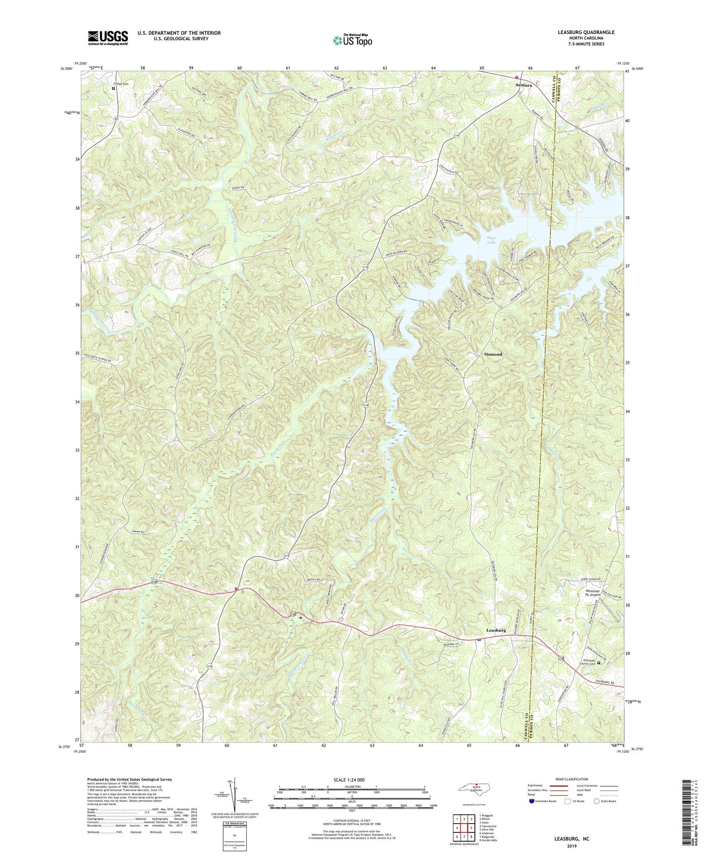
2019 topographic map quadrangle Leasburg in the state of North Carolina. Scale: 1:24000. Based on the newly updated USGS 7.5' US Topo map series, this map is in the following counties: Caswell, Person. The map contains contour data, water features, and other items you are used to seeing on USGS maps, but also has updated roads and other features. This is the next generation of topographic maps. Printed on high-quality waterproof paper with UV fade-resistant inks.
Quads adjacent to this one:
West: Yanceyville
Northwest: Ringgold
North: Milton
Northeast: Alton
East: Olive Hill
Southeast: Hurdle Mills
South: Ridgeville
Southwest: Anderson
Contains the following named places: Archibald Murphy Elementary School, Beulah Church, Blanch Prison, Caswell Wildlife Mgmt Area Pond T, Caswell Wildlife Mgmt Pond Dam Number Two, Ebenezer Church Cemetery, Ebenezer Primitive Baptist Church, Gilead Cemetery, High Rock Church, High Rock School, Kilgore Creek, Leasburg, Leasburg Post Office, Leasburg Volunteer Fire Department, Macedonia Church, New Hope Church, Oak View School, Olive Grove Church, Olive Hill Church, Osmond, Red House, Reedy Fork, Saint James Church, Semora, Semora Volunteer Fire Department, Township of Leasburg, Township of Milton, Union Church, Welcome Church, Winstead '76' Airport, Yarbro, ZIP Code: 27291