MyTopo
Anderson North Carolina US Topo Map
Couldn't load pickup availability
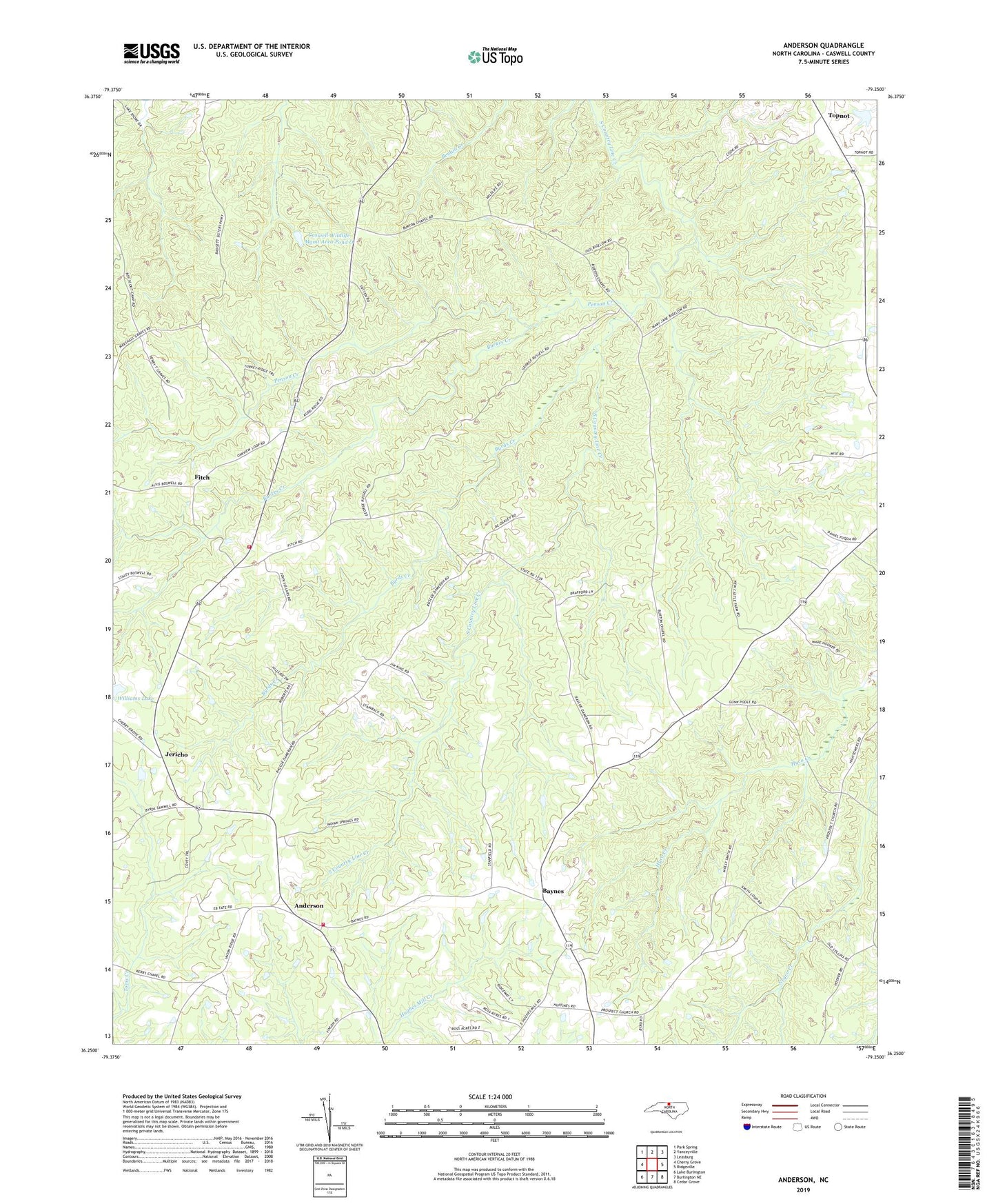
2022 topographic map quadrangle Anderson in the state of North Carolina. Scale: 1:24000. Based on the newly updated USGS 7.5' US Topo map series, this map is in the following counties: Caswell. The map contains contour data, water features, and other items you are used to seeing on USGS maps, but also has updated roads and other features. This is the next generation of topographic maps. Printed on high-quality waterproof paper with UV fade-resistant inks.
Quads adjacent to this one:
West: Cherry Grove
Northwest: Park Spring
North: Yanceyville
Northeast: Leasburg
East: Ridgeville
Southeast: Cedar Grove
South: Burlington NE
Southwest: Lake Burlington
This map covers the same area as the classic USGS quad with code o36079c3.
Contains the following named places: Allred Memorial Tabernacle, Anderson, Anderson Elementary School, Anderson Township Volunteer Fire Department, Anderson Township Volunteer Fire Department Station 2, Baynes, Baynes Church, Bethel Church, Burkes Creek, Burtons Chapel, Bush Arbor Church, Byrds Creek, Caswell Wildlife Management Pond Dam Number One, Caswell Wildlife Mgmt Area Pond O, Fitch, Grace Church, Graves Chapel, Jericho, Oakview Church, Penson Creek, Prospect Church, Sweet Gum Grove Church, Sweet Gum School, Topnot, Township of Anderson, Williams Lake, Williams Lake Dam, ZIP Code: 27379