MyTopo
Yanceyville North Carolina US Topo Map
Couldn't load pickup availability
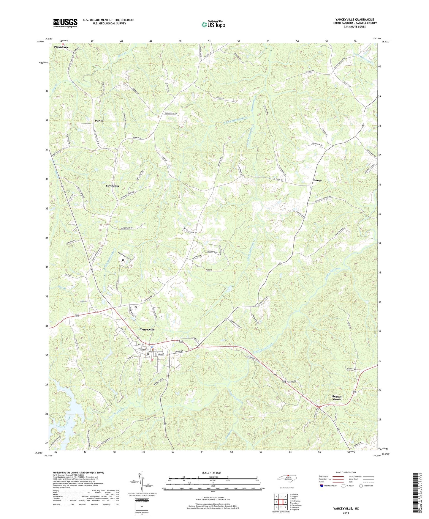
2022 topographic map quadrangle Yanceyville in the state of North Carolina. Scale: 1:24000. Based on the newly updated USGS 7.5' US Topo map series, this map is in the following counties: Caswell. The map contains contour data, water features, and other items you are used to seeing on USGS maps, but also has updated roads and other features. This is the next generation of topographic maps. Printed on high-quality waterproof paper with UV fade-resistant inks.
Quads adjacent to this one:
West: Park Spring
Northwest: Danville
North: Ringgold
Northeast: Milton
East: Leasburg
Southeast: Ridgeville
South: Anderson
Southwest: Cherry Grove
This map covers the same area as the classic USGS quad with code o36079d3.
Contains the following named places: Bartlett Yancey Elementary School, Benaja Creek, Caswell Correctional Center, Caswell County, Caswell County Emergency Medical Ambulance Services, Caswell County Sheriff's Office, Caswell Game Land, Covington, Dan River Prison Work Farm, Dillard Junior High School, Hamer, North Fork Rattlesnake Creek, Oakwood School, Pearson Chapel, Piedmont Academy, Pleasant Grove, Providence Church, Providence Fire and Rescue, Purley, Sassafras Grove Church, South Country Line Creek, South Fork Rattlesnake Creek, The Cornerstone Apostolic Tabernacle, Town of Yanceyville, Township of Dan River, Township of Yanceyville, WYNC-AM (Yanceyville), Yancey High School, Yanceyville, Yanceyville Municipal Volunteer Fire Department, Yanceyville Post Office, ZIP Code: 27212