MyTopo
Supply North Carolina US Topo Map
Couldn't load pickup availability
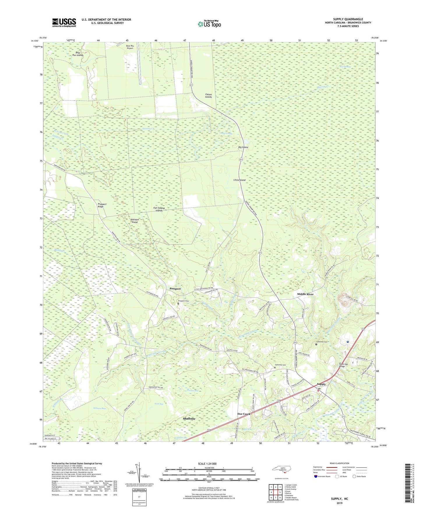
2022 topographic map quadrangle Supply in the state of North Carolina. Scale: 1:24000. Based on the newly updated USGS 7.5' US Topo map series, this map is in the following counties: Brunswick. The map contains contour data, water features, and other items you are used to seeing on USGS maps, but also has updated roads and other features. This is the next generation of topographic maps. Printed on high-quality waterproof paper with UV fade-resistant inks.
Quads adjacent to this one:
West: Exum
Northwest: Juniper Creek
North: Honey Island
Northeast: Lewis Swamp
East: Bolivia
Southeast: Lockwoods Folly
South: Holden Beach
Southwest: Shallotte
This map covers the same area as the classic USGS quad with code o34078a3.
Contains the following named places: Atkinson Island, Bear Pen Islands, Beaverdam Swamp, Big Island, Big Macedonia Church, Big Opening, Brunswick Community Hospital, Brunswick Technical College, Caison Islands, Concord Church, Cumbee Bay, Doe Creek, Driving Creek, Fall Swamp, Fall Swamp Islands, Galloway Cemetery, Huitt Bay, Little Doe Creek, Little Island, Little Macedonia Church, Little Royal Oak Swamp, Lockwoods Folly Township Park, Middle River, Novant Health Brunswick Medical Center, Prospect, Prospect Cemetery, Prospect Church, Prospect Ridge, Royal Oak Bridge, Royal Oak School, Royal Oak Swamp, Supply, Supply Post Office, Supply Volunteer Fire Department Station 13, Township of Lockwoods Folly, Williams Bays, Williams Branch, ZIP Code: 28462