MyTopo
Lowesville North Carolina US Topo Map
Couldn't load pickup availability
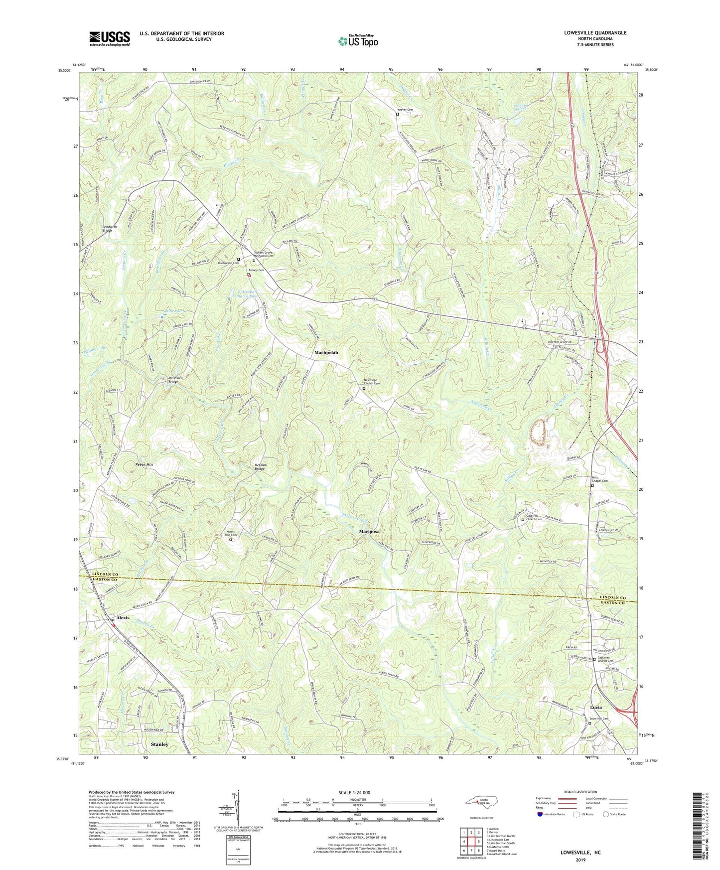
2019 topographic map quadrangle Lowesville in the state of North Carolina. Scale: 1:24000. Based on the newly updated USGS 7.5' US Topo map series, this map is in the following counties: Lincoln, Gaston. The map contains contour data, water features, and other items you are used to seeing on USGS maps, but also has updated roads and other features. This is the next generation of topographic maps. Printed on high-quality waterproof paper with UV fade-resistant inks.
Quads adjacent to this one:
West: Lincolnton East
Northwest: Maiden
North: Denver
Northeast: Lake Norman North
East: Lake Norman South
Southeast: Mountain Island Lake
South: Mount Holly
Southwest: Gastonia North
Contains the following named places: Alexis, Alexis Census Designated Place, Alexis Post Office, Alexis Volunteer Fire Department Station 20 Base 1, Alexis Volunteer Fire Department Station 20 Base 2, Amity Church, Anderson Creek, Armstrong Branch, Ballard Creek, Bradshaw Branch, Brevards Forge, Cansellers, Castanea Church, Castanea Church Cemetery, Catawba Springs, Catfish Lake, Catfish Lake Dam, Cottage Home, Craig Memorial Church, Crooked Creek, Dellinger Branch, East Lincoln High School, East Lincoln Junior High School, Episcopal Church Lake, Episcopal Church Lake Dam, Faith Church, Forney Cemetery, Forney Creek, Fortneys Forge, Gold Hill Church, Gold Hill Church Cemetery, Hills Chapel, Hills Chapel Cemetery, Hooper Branch, Keever Cemetery, Killian Creek, Leepers Creek, Lowesville, Lucia, Machpelah, Machpelah Cemetery, Machpelah Church, Mariposa, McClure Branch, McClure Bridge, McDowell Bridge, Mineral Spring, Mount Zion Cemetery, Mount Zion Church, New Hope Church, New Hope Church Cemetery, Pooles Chapel, Reed Creek, Reese Mountain, Rehobeth Furnace, Reinhardt Bridge, Rock Hill Church, Saint James Church, Smith Pond, Smith Pond Dam, Snow Hill Cemetery, Snow Hill Church, Snyder Creek, Township of Catawba Springs, Triangle, Tuckers Grove Campground, Tuckers Grove Church, Tuckers Grove Methodist Cemetery, Wingate Creek, ZIP Codes: 28006, 28037, 28080, 28164