
MyTopo
Luftee Knob North Carolina US Topo Map
Couldn't load pickup availability
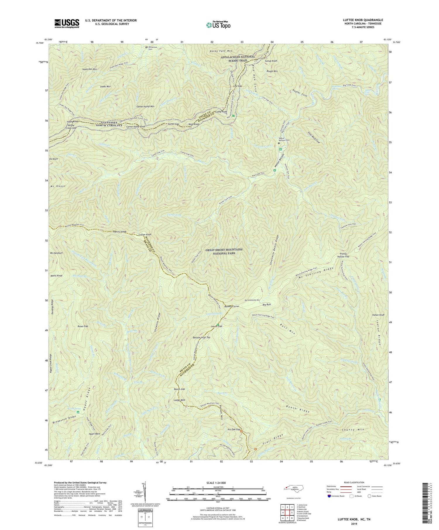
2019 topographic map quadrangle Luftee Knob in the states of North Carolina, Tennessee. Scale: 1:24000. Based on the newly updated USGS 7.5' US Topo map series, this map is in the following counties: Haywood, Swain, Cocke. The map contains contour data, water features, and other items you are used to seeing on USGS maps, but also has updated roads and other features. This is the next generation of topographic maps. Printed on high-quality waterproof paper with UV fade-resistant inks.
Quads adjacent to this one:
West: Mount Guyot
Northwest: Jones Cove
North: Hartford
Northeast: Waterville
East: Cove Creek Gap
Southeast: Dellwood
South: Bunches Bald
Southwest: Smokemont
Contains the following named places: Balsam Corner, Balsam Corner Creek, Balsam High Top, Balsam Mountain, Barnes Branch, Beech Creek, Beech Gap, Beech Ridge, Bettis Branch, Big Butt, Big Cataloochee Mountain, Big Head Branch, Brakeshoe Spring, Butt Mountain, Byrd Branch, Camel Gap, Camel Hump Creek, Camel Hump Knob, Camel Hump Mountain, Chestnut Cove Creek, Cooks Creek, Cosby Knob, Cosby Knob Shelter, Dans Branch, Dasohga Ridge, Deer Creek, Dry Branch, Falling Rock Creek, Flint Rock Cove, Good Spring Branch, Grass Branch, Gray Camp Branch, Gunter Fork, Hyatt Bald, Hyatt Ridge, Inadu Creek, Inadu Knob, Inadu Mountain, Indian Knob, Indian Ridge, John Mack Creek, Kahneska Branch, Kilby Branch, Laurel Gap, Laurel Gap Branch, Laurel Gap Shelter, Ledge Bald, Little Nettle Branch, Little Rock Creek, Lost Bottom Creek, Low Gap, Low Gap Branch, Luftee Knob, Lynn Camp Branch, Manse Branch, Marks Knob, Mc Gee Spring, Mc Ginty Creek, Miller Branch, Mount Hardison, Mount Sterling Ridge, Mount Yonaguska, Mouse Creek, Mouse Creek Falls, Nettle Branch, Onion Bed Branch, Oskodah Branch, Pin Oak Gap, Poplar Cove, Pretty Hollow Creek, Pretty Hollow Gap, Prophet Branch, Red Oak Cove, Rocky Branch, Rocky Face Mountain, Roses Branch, Roses Gap, Ross Knob, Rough Mountain, Sevenmile Beech Ridge, Shawano Ridge, Sinking Creek, Slide Branch, Snake Den Mountain, Snakeden Mountain Campsite, Sugar Cove Campsite, Sunup Knob, Swallow Fork, Table Rock Branch, Thermo Branch, Thermo Knob, Thicket Branch, Thumper Branch, Township of Cataloochee, Trail Ridge, Trap Branch, Turkey Pen Branch, Walnut Bottom, Walnut Bottoms Cemetery, Williamson Cemetery, Yellow Creek, Yellow Creek Gap, ZIP Code: 28785


