MyTopo
Mount Guyot Tennessee US Topo Map
Couldn't load pickup availability
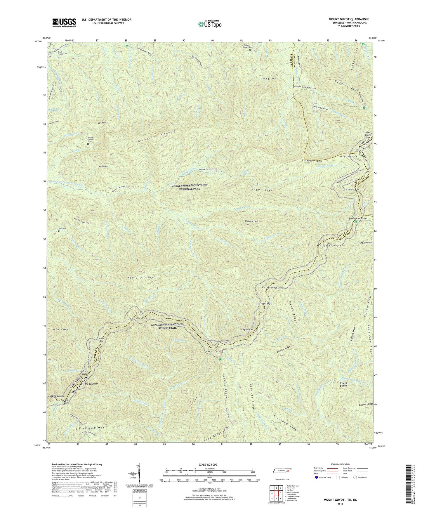
2022 topographic map quadrangle Mount Guyot in the states of Tennessee, North Carolina. Scale: 1:24000. Based on the newly updated USGS 7.5' US Topo map series, this map is in the following counties: Sevier, Swain, Cocke, Haywood. The map contains contour data, water features, and other items you are used to seeing on USGS maps, but also has updated roads and other features. This is the next generation of topographic maps. Printed on high-quality waterproof paper with UV fade-resistant inks.
Quads adjacent to this one:
West: Mount Le Conte
Northwest: Richardson Cove
North: Jones Cove
Northeast: Hartford
East: Luftee Knob
Southeast: Bunches Bald
South: Smokemont
Southwest: Clingmans Dome
This map covers the same area as the classic USGS quad with code o35083f3.
Contains the following named places: Bald Top Ridge, Balsam Ridge, Barnes Children Cemetery, Bills Creek, Breakneck Ridge, Breedlove Branch, Buck Fork, Buckeye Lead, Bulldie Creek, Bulldie Ridge, Cat Stairs, Cat Stairs Branch, Chapman Lead, Chapman Prong, Charlies Bunion, Chasm Prong, Copper Gap, Copperhead Branch, Deer Creek Gap, Devils Den, Devils Den Branch, Dock Green Cemetery, Dry Sluice Gap, Eagle Rocks, Eagle Rocks Prong, Evans Creek, False Gap, Frowning Rock Prong, Greenbrier Pinnacle, Gulf Prong, Guyot Spur, Highland Ridge, Huff Cemetery, Hughes Ridge, Kalanu Prong, Katalsta Ridge, Laurel Branch, Laurel Top, Left Fork Raven Fork, Little Laurel Branch, Little Niagara Creek, Long Ridge, Lost Prong, Maddron Bald, Middle Fork Raven Fork, Middle Fork Ridge, Millfield Branch, Mount Chapman, Mount Guyot, Mount Sequoyah, Old Black, Otter Creek, Otter Creek Campsite, Pecks branch, Pecks Corner, Pecks Corner Branch, Pecks Corner Shelter, Pinnacle Lead, Porters Gap, Porters Mountain, Ramsey Branch, Ramsey Cascades, Ramsey Prong, Rapid Creek, Rapid Creek Ridge, Raven Creek, Raven Ridge, Richland Mountain, Right Fork Raven Fork, Shirt Tail Branch, Snag Mountain, Snakefeeder Branch, The Sawteeth, Three Forks, Tricorner Knob, Tricorner Shelter, Tumbling Branch, Washout Branch, Williams - Ramsey Cemetery, Woolly Tops Mountain