MyTopo
Jones Cove Tennessee US Topo Map
Couldn't load pickup availability
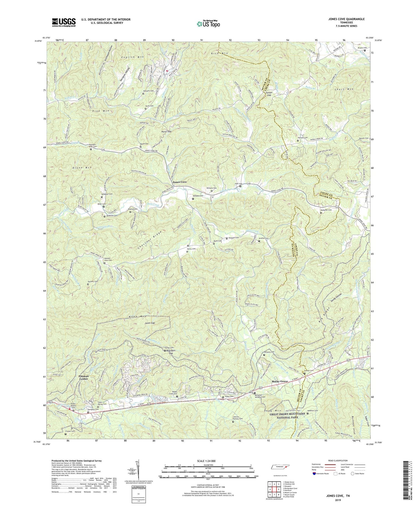
2022 topographic map quadrangle Jones Cove in the state of Tennessee. Scale: 1:24000. Based on the newly updated USGS 7.5' US Topo map series, this map is in the following counties: Sevier, Cocke. The map contains contour data, water features, and other items you are used to seeing on USGS maps, but also has updated roads and other features. This is the next generation of topographic maps. Printed on high-quality waterproof paper with UV fade-resistant inks.
Quads adjacent to this one:
West: Richardson Cove
Northwest: Shady Grove
North: Chestnut Hill
Northeast: Newport
East: Hartford
Southeast: Luftee Knob
South: Mount Guyot
Southwest: Mount Le Conte
This map covers the same area as the classic USGS quad with code o35083g3.
Contains the following named places: Baxter's Orchard, Big Ridge, Birdsville, Blackgun Gap, Bogard School, Bradley Chapel, Breeden-Rolen Cemetery, Bryant Cemetery, Buckeye Creek, Butler Branch, Camp Hollow, Chavis School, Chestnut Ridge, Chucky Creek, Civilian Conservation Corps Camp Number 423, Clear Spring Cemetery, Cole Creek, Cricket Branch, Darky Branch, Dixon Mountain, Dockery Branch, Dockery Cemetery, Elvin Branch, English Mountain Volunteer Fire Department, Fairview School, Flats School, Fowler Cemetery, Frazier Cemetery, Gabes Creek, Hartsell Cemetery, Henry Cemetery, Henry School, Holder Grove Church, Howard View Cemetery, Howard View Church, Huff Cemetery, Hurst Cemetery, Hurst Gap, Husky Cemetery, Johnnie Ramsey Cemetery, Jones Branch, Jones Cove, Jones Cove Elementary School, Jones Gap, Juniper School, Large Branch, Laurel Spring Church, Lin Creek, Long Branch, Maddron Cemetery, Maddron Creek, Matthew Creek, McCarter - Williams Cemetery, McKinney Branch, McMahan Cemetery, McMahan School, Mill Dam Branch, Miller Cemetery, Mitchell Wilson Mill, Mount Olive Church, New Salem Church, Noisy Creek, Ogle Spring Branch, Pearl Valley Church, Pine Mountain, Pittman Center Community Volunteer Fire Department, Pleasant Valley Church, Pleasant Valley School, Proffitt Cemetery, Ramsey Creek, Redwine Creek, Rich Mountain, Ringen Memorial Church, Rocky Grove, Rocky Grove Church, Rolen Cemetery, Sandy Hollow, Sheep Pen Branch, Short Mountain, Shults Grove Church, Shults-Whaley Cemetery, Snag Branch, Spurgeon Cemetery, Spurgeon Church, Spurgeon Hollow, Stillhouse Hollow, Stinnett Cemetery, Sugar Camp Branch, Sugar Cove, Sunset Gap, Sunset Gap School, Sutton Cemetery, Texas Creek, Texas Settlement, Timothy Creek, Upper Falling Branch, Valentine Branch, Warden Branch, Webb Mountain, Webb Springs School, Webbs Creek Cemetery, Webbs Creek School, Webbs Creek United Methodist Church, Whaley Church, Wilhite Church, Wilhite School, Williams Cemetery, Yellow Breeches Creek, Youngblood Branch