MyTopo
Masontown North Carolina US Topo Map
Couldn't load pickup availability
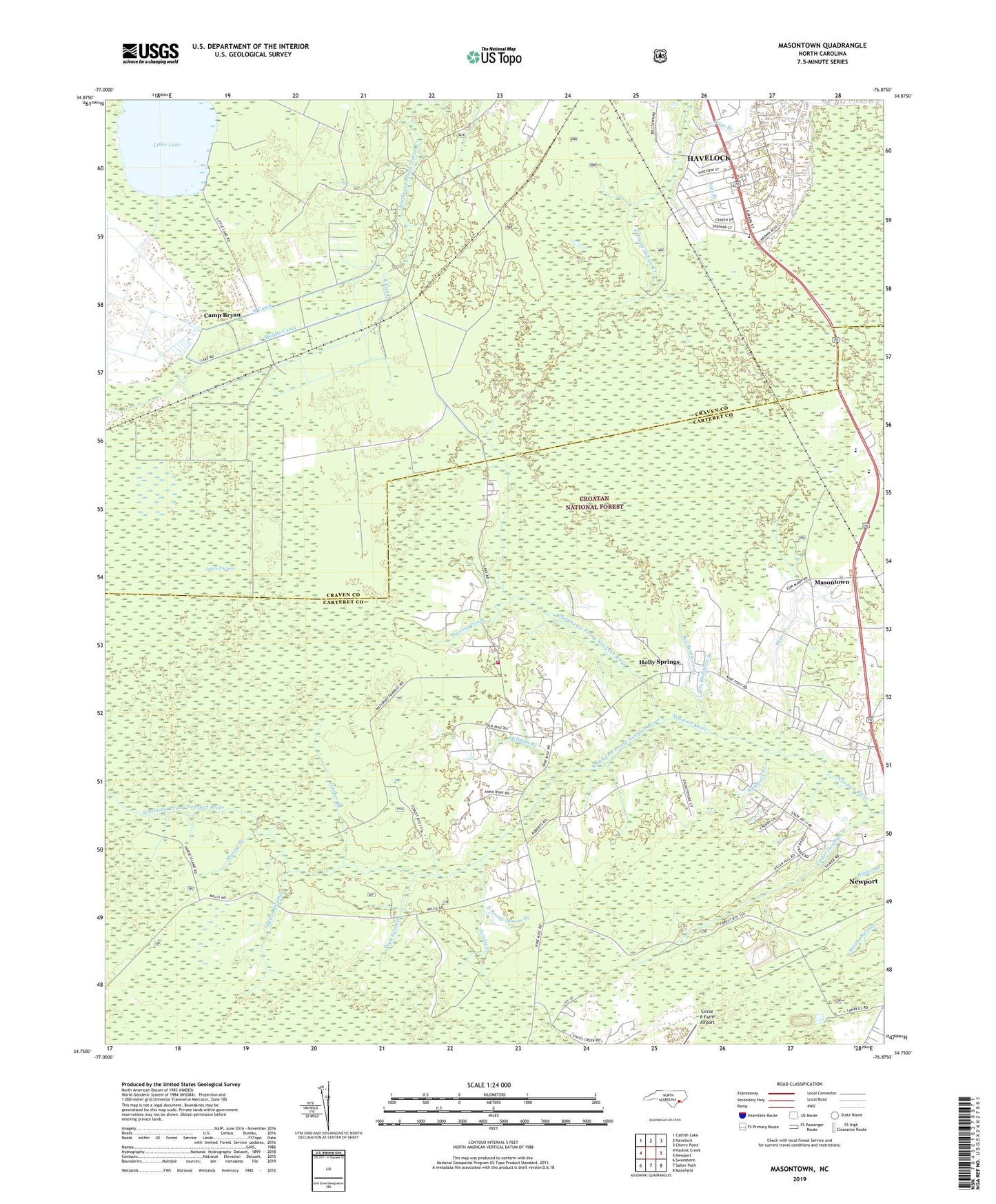
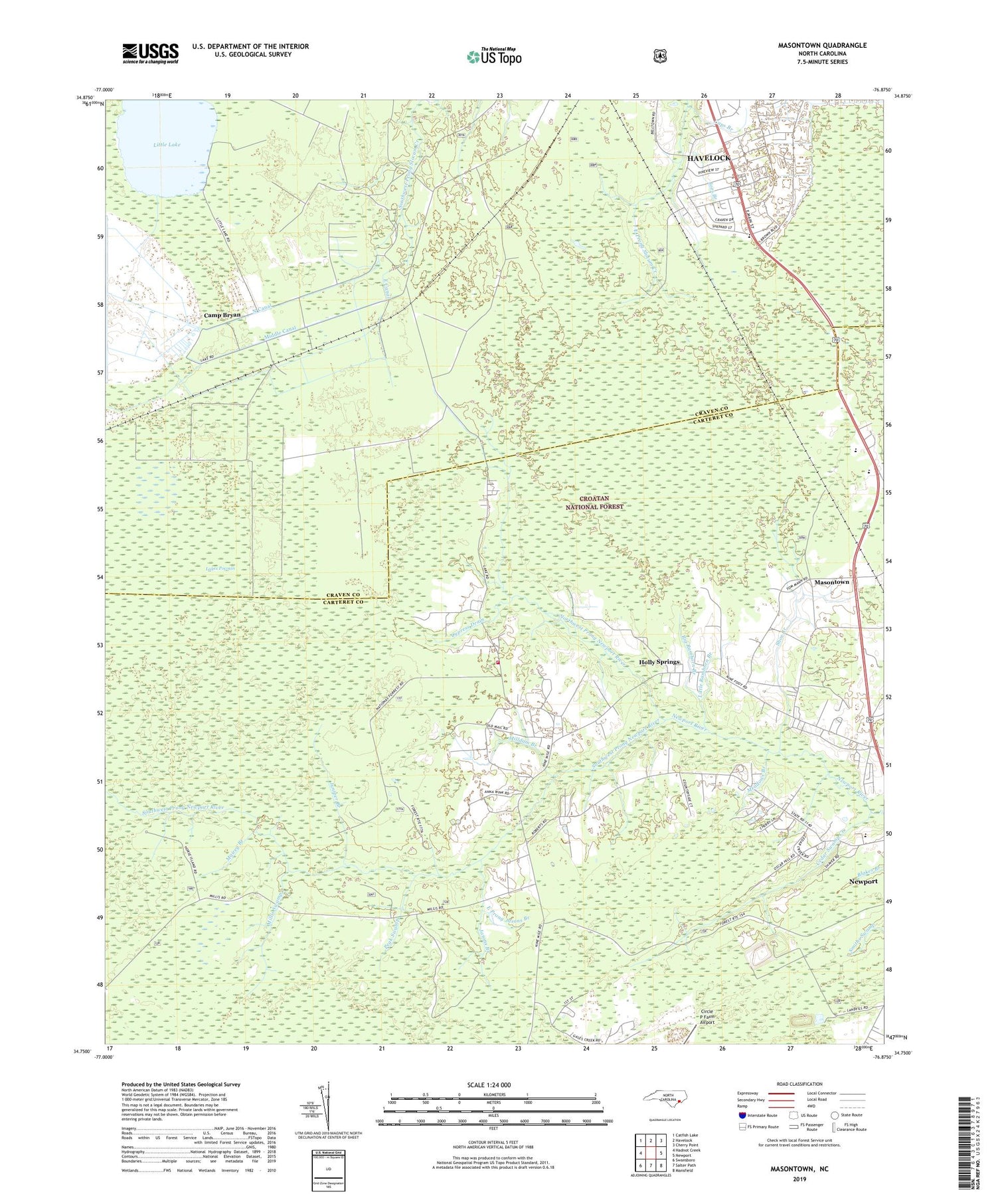
2019 topographic map quadrangle Masontown in the state of North Carolina. Scale: 1:24000. Based on the newly updated USGS 7.5' US Topo map series, this map is in the following counties: Carteret, Craven. The map contains contour data, water features, and other items you are used to seeing on USGS maps, but also has updated roads and other features. This is the next generation of topographic maps. Printed on high-quality waterproof paper with UV fade-resistant inks.
Quads adjacent to this one:
West: Hadnot Creek
Northwest: Catfish Lake
North: Havelock
Northeast: Cherry Point
East: Newport
Southeast: Mansfield
South: Salter Path
Southwest: Swansboro
Contains the following named places: Abundant Life Full Gospel Baptist Church, Ashley Place, Bay Woods, Big Ramhorn Branch, Camp Bryan, Caps Branch, Carteret County Landfill, Cedar Swamp Creek, Cherry Plaza Shopping Center, College Park, Conner Village, Cypress Drain, East Branch Southwest Prong Slocum Creek, East Canal, East Prong Jasons Branch, First Baptist Church, Havelock Church, Havelock Water Treatment Plant, Hilltop Acres, Holly Springs, Jasons Branch, Jerrett Estates, Joes Branch, Juniper Branch, Lakes Pocosin, Lakeside Mobile Home Park, Liberty Christian Church, Little Lake, Little Ramhorn Branch, Little Run, Mairey Branch, Masontown, Meadows Branch, Middle Canal, Milldam Branch, Millis Swamp, Newport Fire Department Station 2, North Canal, Northwest Prong Newport River, Peak Swamp, Shoe Branch, South Canal, Southwest Prong Newport River, Thornes Farm Trailer Park, Town of Newport, Trent Acres, West Branch Southwest Prong Slocum Creek, Winstead Mobile Home Park, WZYC-FM (Newport)