MyTopo
Cherry Point North Carolina US Topo Map
Couldn't load pickup availability
Also explore the Cherry Point Forest Service Topo of this same quad for updated USFS data
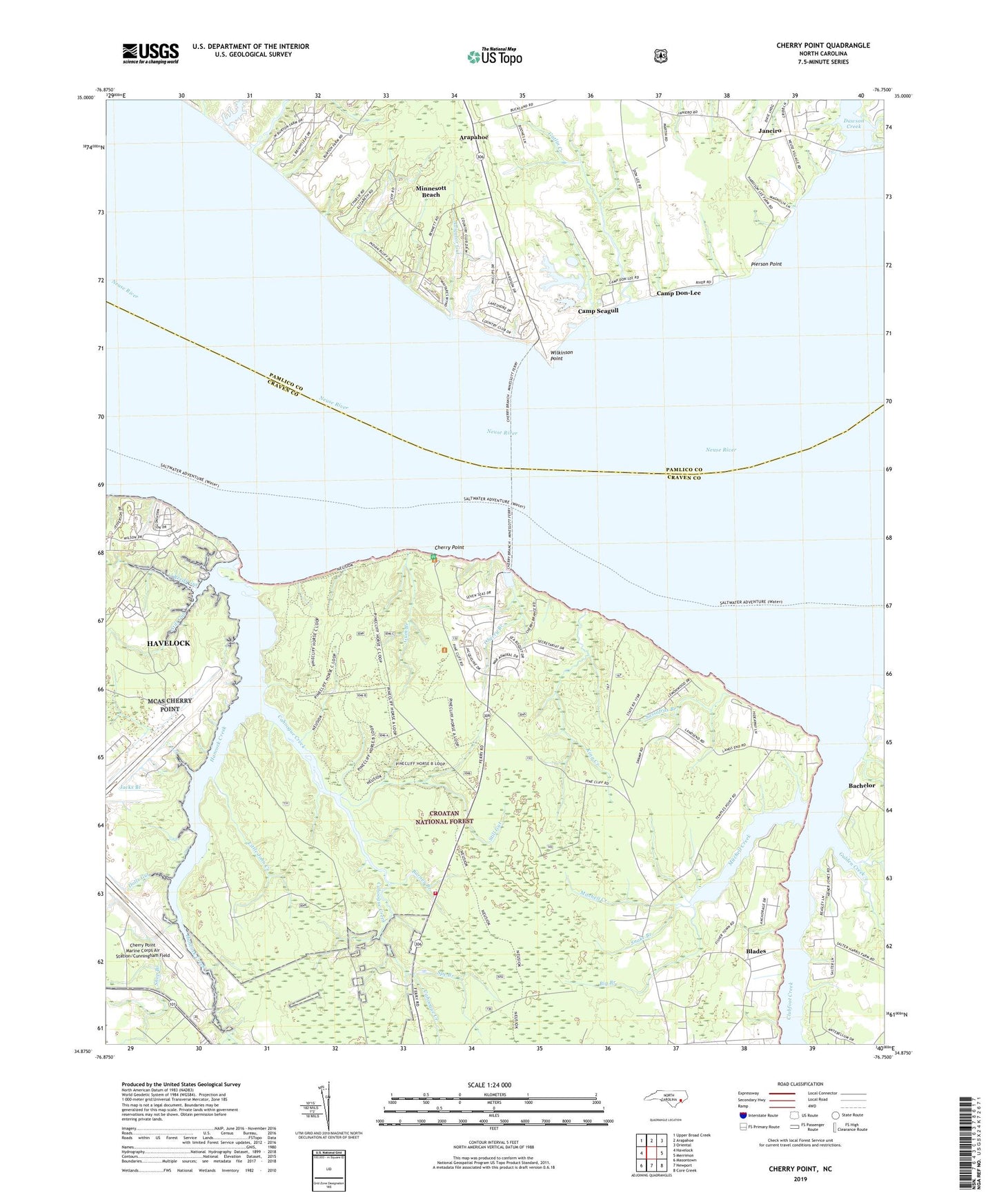
2022 topographic map quadrangle Cherry Point in the state of North Carolina. Scale: 1:24000. Based on the newly updated USGS 7.5' US Topo map series, this map is in the following counties: Craven, Pamlico. The map contains contour data, water features, and other items you are used to seeing on USGS maps, but also has updated roads and other features. This is the next generation of topographic maps. Printed on high-quality waterproof paper with UV fade-resistant inks.
Quads adjacent to this one:
West: Havelock
Northwest: Upper Broad Creek
North: Arapahoe
Northeast: Oriental
East: Merrimon
Southeast: Core Creek
South: Newport
Southwest: Masontown
This map covers the same area as the classic USGS quad with code o34076h7.
Contains the following named places: Alligator Gut, Bachelor, Barney Branch, Big Branch, Blades, Cahoogue Creek, Cahoogue Creek School, Cahooque Creek Recreation Site, Camp Don-Lee, Camp Seagull, Cherry Branch, Cherry Branch Census Designated Place, Cherry Point, Cherry Point Landing, Club Creek Mobile Home Park, Clubfoot Creek, Dawson Creek, Deep Branch, Dolls Gut, Gatlin Creek, Gatlin Creek School, Gulden Creek, Gum Branch, Hancock Creek, Harlowe Volunteer Fire Department Station 3, Jacks Branch, Janeiro, King Creek, Little John Creek, Mill Creek, Minnesott Beach, Mitchell Creek, Mount Zion Church, Pierson Point, Pine Cliff Lookout Tower, Pine Cliff Recreation Area, Piney Grove Church, Reeds Gut, Sassafras Branch, Shop Branch, Small Chapel, Smith Gut, Snake Branch, Spe Branch, Still Gut, Temple, Town of Minnesott Beach, Township 5, Weeping Mary Church, Wilkinson Point, ZIP Code: 28510