
MyTopo
Catfish Lake North Carolina US Topo Map
Couldn't load pickup availability
Also explore the Catfish Lake Forest Service Topo of this same quad for updated USFS data
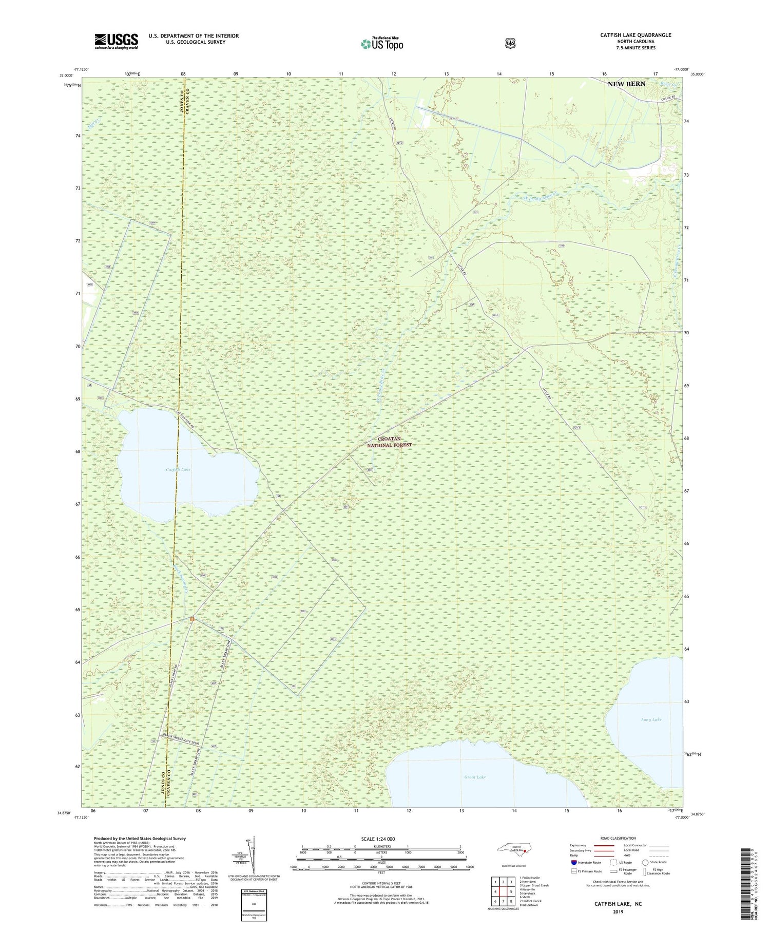
2022 topographic map quadrangle Catfish Lake in the state of North Carolina. Scale: 1:24000. Based on the newly updated USGS 7.5' US Topo map series, this map is in the following counties: Craven, Jones. The map contains contour data, water features, and other items you are used to seeing on USGS maps, but also has updated roads and other features. This is the next generation of topographic maps. Printed on high-quality waterproof paper with UV fade-resistant inks.
Quads adjacent to this one:
West: Maysville
Northwest: Pollocksville
North: New Bern
Northeast: Upper Broad Creek
East: Havelock
Southeast: Masontown
South: Hadnot Creek
Southwest: Stella
This map covers the same area as the classic USGS quad with code o34077h1.
Contains the following named places: Catfish Lake, East Prong Brice Creek, Great Branch, Long Lake, Sheep Ridge Wilderness, West Prong Brice Creek


