MyTopo
Merchants Millpond North Carolina US Topo Map
Couldn't load pickup availability
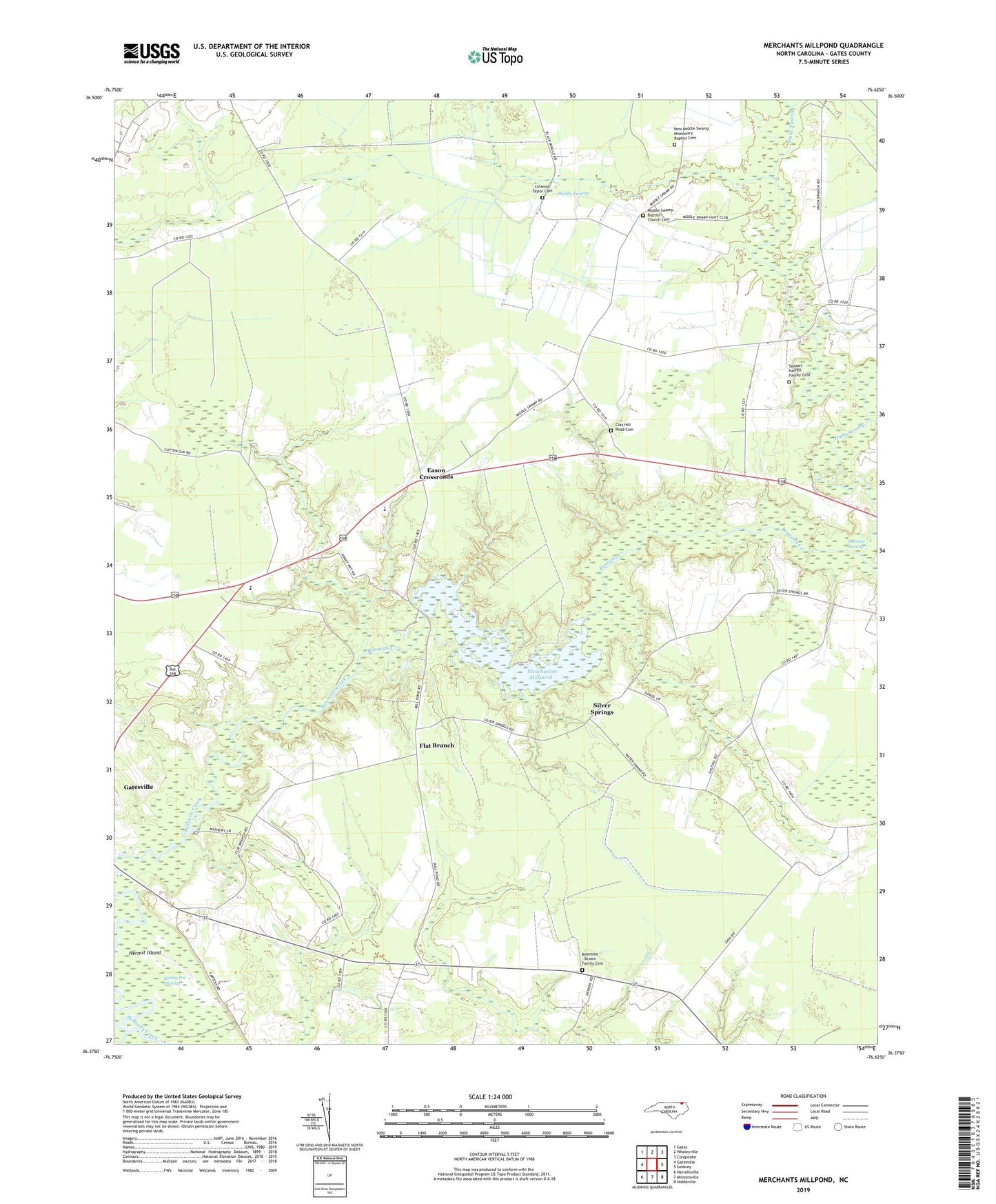
2019 topographic map quadrangle Merchants Millpond in the state of North Carolina. Scale: 1:24000. Based on the newly updated USGS 7.5' US Topo map series, this map is in the following counties: Gates. The map contains contour data, water features, and other items you are used to seeing on USGS maps, but also has updated roads and other features. This is the next generation of topographic maps. Printed on high-quality waterproof paper with UV fade-resistant inks.
Quads adjacent to this one:
West: Gatesville
Northwest: Gates
North: Whaleyville
Northeast: Corapeake
East: Sunbury
Southeast: Hobbsville
South: Mintonsville
Southwest: Harrellsville
Contains the following named places: Central Junior High School, Chesapeake Lookout Tower, Clay Hill Road Cemetery, Duke Swamp, Eason Crossroads, Flat Branch, Gates County, Gates County High School, Gates County Rescue Squad, Hayes Landing, Hermit Island, Lassiter Swamp, Lebanon Grove Church, Linwood Taylor Cemetery, Merchants Mill, Merchants Millpond, Merchants Millpond State Park, Middle Swamp, Middle Swamp Baptist Church Cemetery, Middle Swamp Church, New Middle Swamp Church, New Middle Swamp Missionary Baptist Cemetery, New Pine Grove Church, Raynor Swamp, Rountree - Brown Family Cemetery, Samuel Harrell Family Cemetery, Sandy Field Landing, Silver Springs, Sycamore Hill Church, Township of Gatesville, Vivian, Zion Church, ZIP Code: 27938