MyTopo
Gates North Carolina US Topo Map
Couldn't load pickup availability
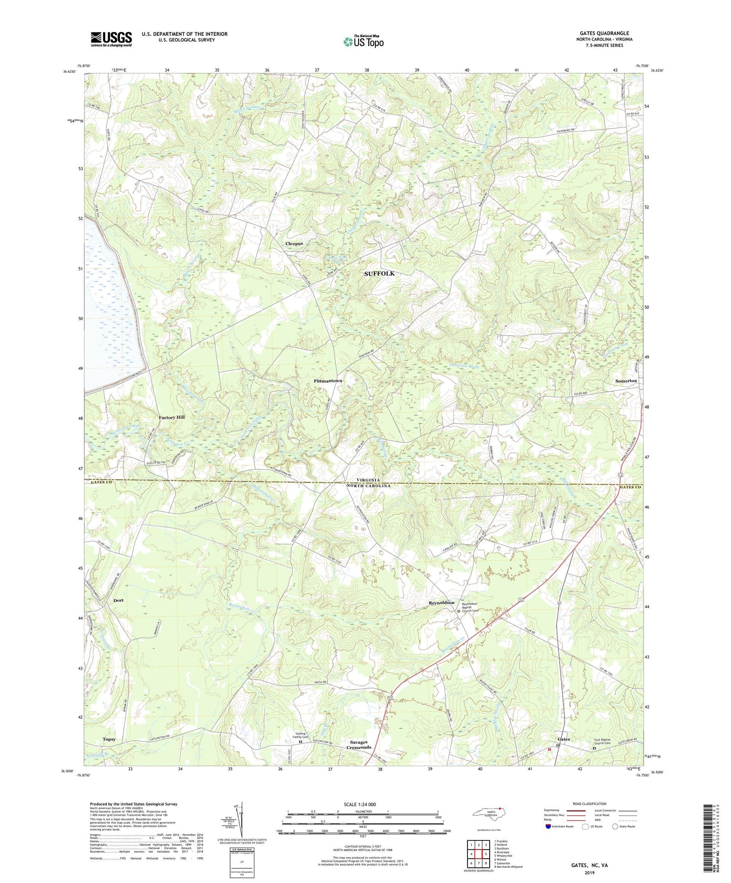
2022 topographic map quadrangle Gates in the states of Virginia, North Carolina. Scale: 1:24000. Based on the newly updated USGS 7.5' US Topo map series, this map is in the following counties: Gates, Suffolk (city). The map contains contour data, water features, and other items you are used to seeing on USGS maps, but also has updated roads and other features. This is the next generation of topographic maps. Printed on high-quality waterproof paper with UV fade-resistant inks.
Quads adjacent to this one:
West: Riverdale
Northwest: Franklin
North: Holland
Northeast: Buckhorn
East: Whaleyville
Southeast: Merchants Millpond
South: Gatesville
Southwest: Winton
Contains the following named places: Beaverdam Creek, Chapel Swamp, Cleopus, Corinth Chapel, Dort, Factory Hill, First Baptist Church Cemetery, Gates, Gates Post Office, Gates Volunteer Fire Department, Gatling Family Cemetery, Holly Neck School, Holy Neck Church, Holy Neck Pond, House of Prayer, March Swamp, Marsh Hill School, Marshs Millpond, Mill Swamp, Olive Branch Church, Pittmantown, Pleasant Grove Church, Pleasant Hill School, Red Oak Grove Church, Reynoldson, Reynoldson Baptist Church Cemetery, Sandy Hill School, Savages Crossroads, Somerton, Stony Branch Church, Topsy, Township of Reynoldson, ZIP Code: 27937