MyTopo
Millstone Lake North Carolina US Topo Map
Couldn't load pickup availability
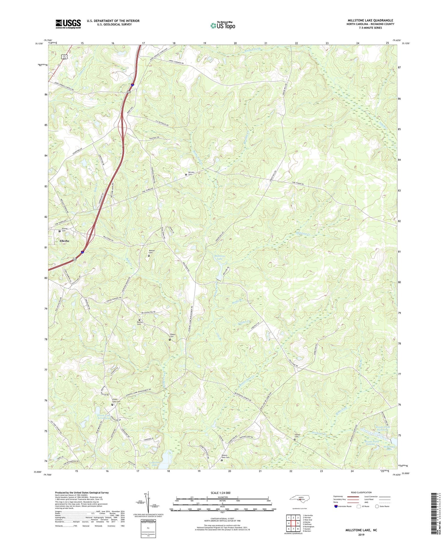
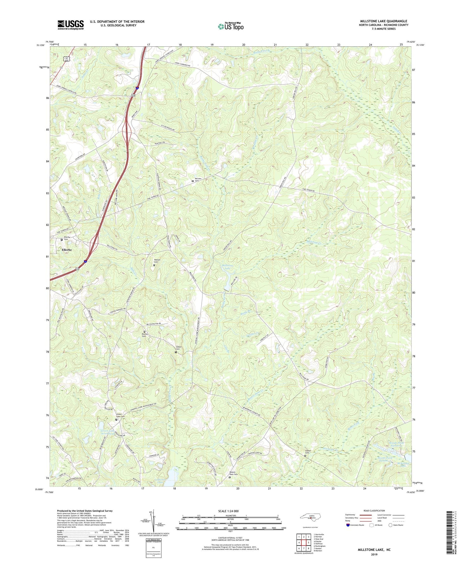
2019 topographic map quadrangle Millstone Lake in the state of North Carolina. Scale: 1:24000. Based on the newly updated USGS 7.5' US Topo map series, this map is in the following counties: Richmond. The map contains contour data, water features, and other items you are used to seeing on USGS maps, but also has updated roads and other features. This is the next generation of topographic maps. Printed on high-quality waterproof paper with UV fade-resistant inks.
Quads adjacent to this one:
West: Ellerbe
Northwest: Harrisville
North: Norman
Northeast: West End
East: Hoffman
Southeast: Marston
South: Hamlet
Southwest: Rockingham
Contains the following named places: Beaver Dam Cemetery, Beaver Dam Church, Beaver Dam Creek, Bells Creek, Big Branch, Bones Fork, Camp Millstone, Ellerbe Cemetery, Gibson Cemetery, Green Lake Acres Pond, Green Lake Acres Pond Dam, Green Lake Cemetery, Green Lake Church, Juniper Creek, Lincoln School, Line Branch, McKinney Lake Dam, McLean Cemetery, McLean Church, Millstone Creek, Millstone Lake, Paradise Creek, Reedy Branch, Richards Church, Richmond County, Rocky Ford Branch, Rourks Cemetery, Rourks Church, Sandy Level Church, Township of Mineral Springs, Watson Cemetery, Woods Pond Number 1, Woods Pond Number 2, ZIP Code: 28347