MyTopo
Ellerbe North Carolina US Topo Map
Couldn't load pickup availability
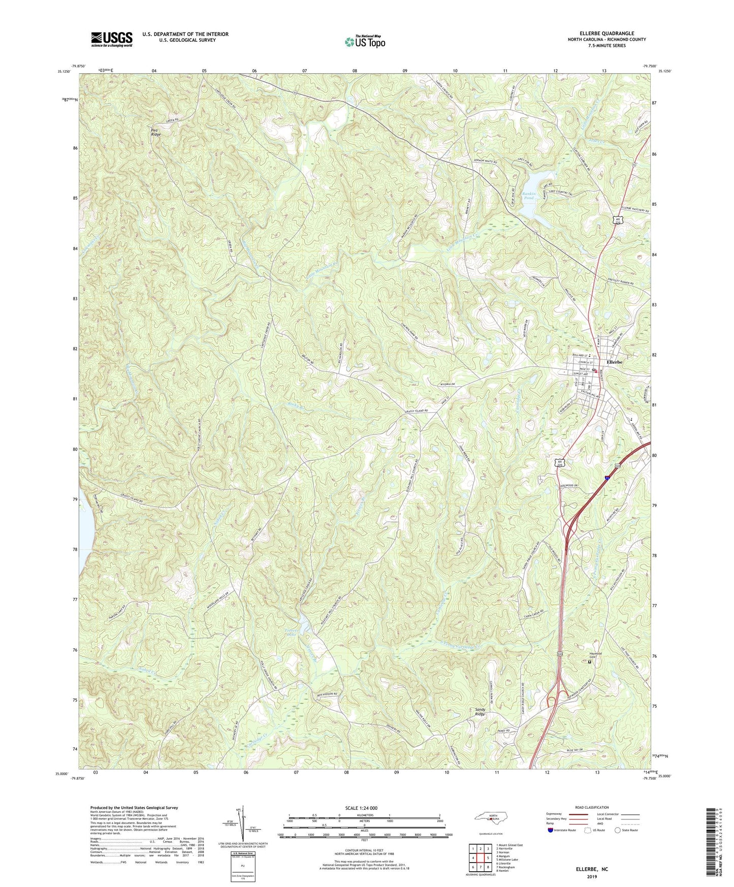
2022 topographic map quadrangle Ellerbe in the state of North Carolina. Scale: 1:24000. Based on the newly updated USGS 7.5' US Topo map series, this map is in the following counties: Richmond. The map contains contour data, water features, and other items you are used to seeing on USGS maps, but also has updated roads and other features. This is the next generation of topographic maps. Printed on high-quality waterproof paper with UV fade-resistant inks.
Quads adjacent to this one:
West: Mangum
Northwest: Mount Gilead East
North: Harrisville
Northeast: Norman
East: Millstone Lake
Southeast: Hamlet
South: Rockingham
Southwest: Lilesville
This map covers the same area as the classic USGS quad with code o35079a7.
Contains the following named places: Bethel Church, Camp Dick Henning, Cartledge Creek Church, Chappell Grove Church, Ellerbe, Ellerbe Elementary School, Ellerbe Fire Department, Ellerbe Middle School, Ellerbe Post Office, Ellerbe Rescue Squad, Flinty Knoll Church, Haywood Cemetery, Holly Grove Church, Jobes Creek, Lathea Church, Lentzton, Little Mountain Creek, Mineral Springs School, Mount Pleasant Church, New Hope Church, Rankin Pond, Rankin Pond Dam, Rocky Branch, Sandy Ridge, Sandy Ridge Church, Saron Church, South Prong Cartledge Creek, Town of Ellerbe, Township of Black Jack, Treeces Branch, Treeces Lake, ZIP Code: 28338