MyTopo
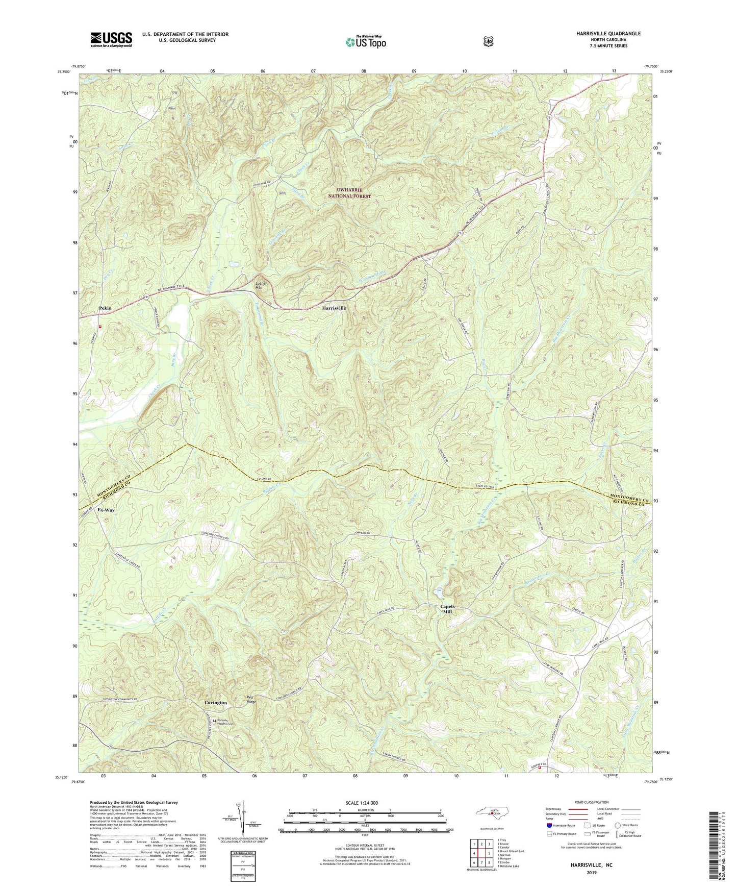
Harrisville North Carolina US Topo Map
Couldn't load pickup availability
Also explore the Harrisville Forest Service Topo of this same quad for updated USFS data
2022 topographic map quadrangle Harrisville in the state of North Carolina. Scale: 1:24000. Based on the newly updated USGS 7.5' US Topo map series, this map is in the following counties: Montgomery, Richmond. The map contains contour data, water features, and other items you are used to seeing on USGS maps, but also has updated roads and other features. This is the next generation of topographic maps. Printed on high-quality waterproof paper with UV fade-resistant inks.
Quads adjacent to this one:
West: Mount Gilead East
Northwest: Troy
North: Biscoe
Northeast: Candor
East: Norman
Southeast: Millstone Lake
South: Ellerbe
Southwest: Mangum
This map covers the same area as the classic USGS quad with code o35079b7.
Contains the following named places: Beaverdam Creek, Blackwood Chapel, Blue Branch, Capels Mill, Concord Church, Covington, Dry Creek, Dry Creek Church, Ex-Way, Gravelly Branch, Hamer Branch, Harrisville, Harrisville Lookout Tower, Indian Branch, Ivy Branch, Luther Mountain, Mount Carmel Church, Mountain Creek Volunteer Fire Department, Nells Branch, Parsons-Howell Cemetery, Pea Ridge, Pekin, Pekin Volunteer Fire Department, Polly Branch, Sand Branch, Sardis Church, Saron Church, Silver Creek, Townsend Branch, Woodwards Branch