MyTopo
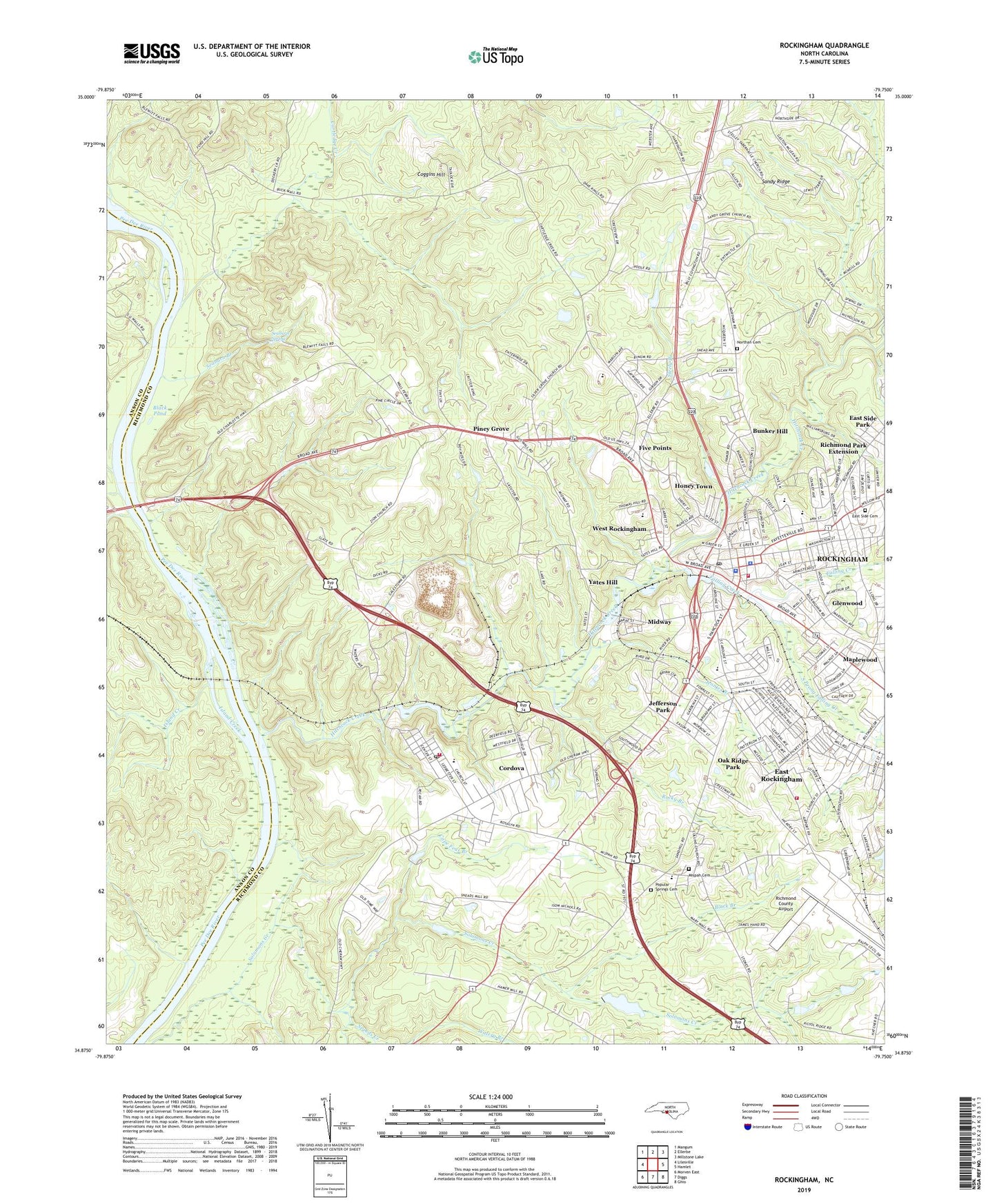
Rockingham North Carolina US Topo Map
Couldn't load pickup availability
2022 topographic map quadrangle Rockingham in the state of North Carolina. Scale: 1:24000. Based on the newly updated USGS 7.5' US Topo map series, this map is in the following counties: Richmond, Anson. The map contains contour data, water features, and other items you are used to seeing on USGS maps, but also has updated roads and other features. This is the next generation of topographic maps. Printed on high-quality waterproof paper with UV fade-resistant inks.
Quads adjacent to this one:
West: Lilesville
Northwest: Mangum
North: Ellerbe
Northeast: Millstone Lake
East: Hamlet
Southeast: Ghio
South: Diggs
Southwest: Morven East
This map covers the same area as the classic USGS quad with code o34079h7.
Contains the following named places: Aleo Church, Ashley Chapel, Ashley Chapel School, Baggetts Creek, Bell School, Black Branch, Black Pond, Bunker Hill, Cape Fear Branch, Cartledge Creek, City of Rockingham, Cobb Church, Coggins Hill, Cordova, Cordova Census Designated Place, Cordova Church, Cordova Elementary School, Cordova Fire and Rescue, Cordova Post Office, East Rockingham, East Rockingham Census Designated Place, East Rockingham Fire Department, East Side Cemetery, East Side Park, Falling Creek, Falls Ferry, Five Points, Glenwood, Great Falls Pond, Great Falls School, Hitchcock Creek, Honey Town, Island Creek, Jefferson Park, Jennies Branch, Leak Street Elementary School, Maple Street Church, Maplewood, McCoy Creek, Midway, Midway Pond, Mispah Cemetery, Mount Beaula Church, New Diggs Chapel, Northan Cemetery, Oak Ridge Park, Old Diggs Chapel, Pee Dee School, Pine Grove Church, Piney Grove, Popular Springs Cemetery, Popular Springs Church, Richmond County Airport, Richmond County Mine, Richmond County Rescue Squad, Richmond County Sheriff's Office, Richmond Park Extension, Rockingham, Rockingham Fire Department Station 1 Headquarters, Rockingham Junior High School, Rockingham Police Department, Rockingham Post Office, Rockingham Quarry, Rocky Branch, Rohanen School, Sandy Ridge School, Seaburn Branch, Seaburn Spring, Solomons Creek, South Prong Falling Creek, Speeds Creek, Steele Millpond Dam, Steeles Mill Pond, Steely Branch, Stelley Tabernacle, Township of Rockingham, Walls Chapel, Walls Landing, Watery Branch, West Rockingham, West Rockingham Elementary School, WLWL-AM (Rockingham), Yates Hill, Zion Church, ZIP Codes: 28330, 28379