MyTopo
Milton North Carolina US Topo Map
Couldn't load pickup availability
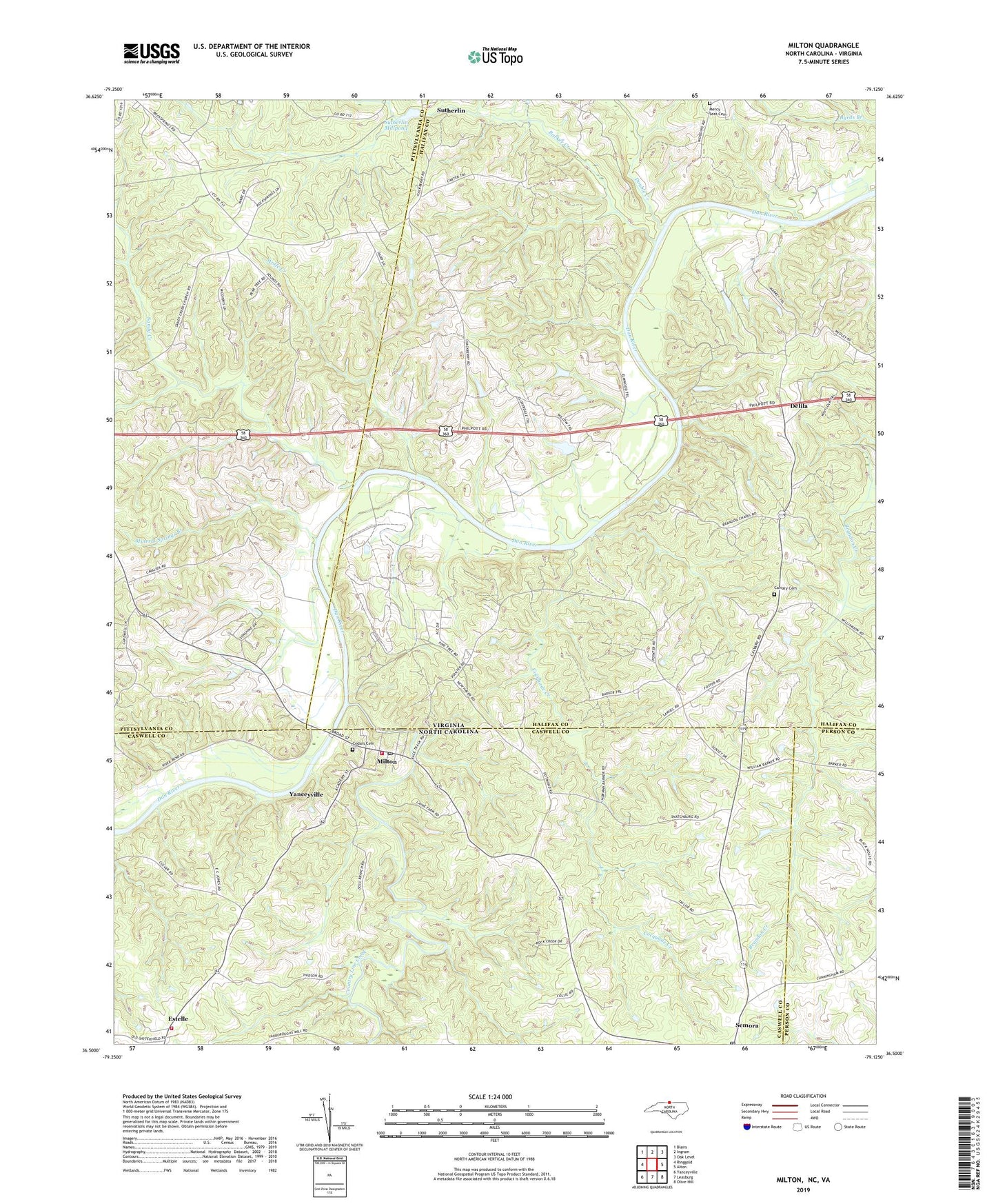
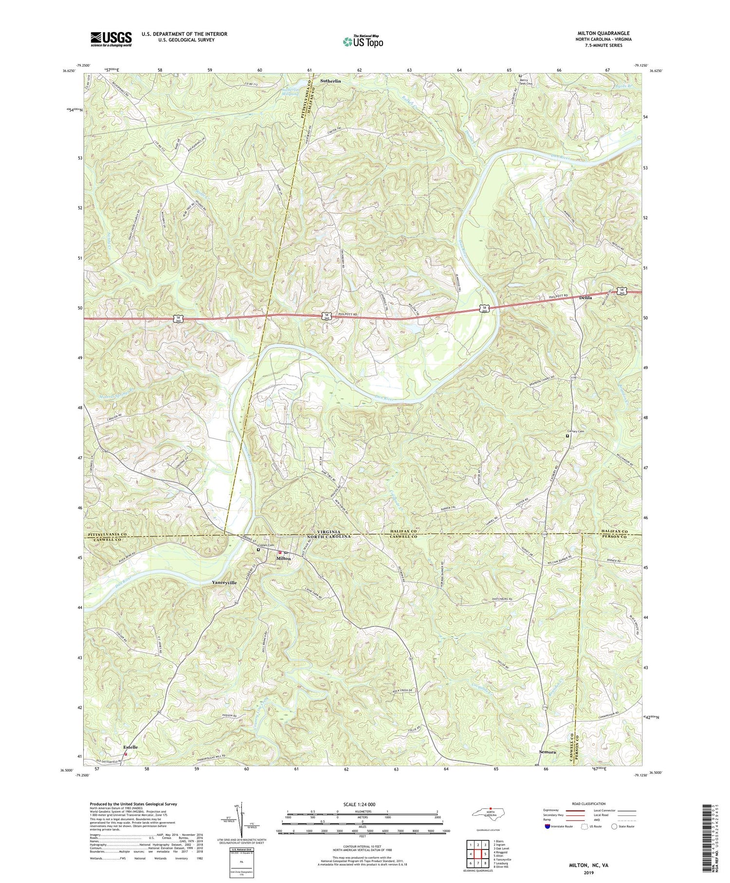
2019 topographic map quadrangle Milton in the states of Virginia, North Carolina. Scale: 1:24000. Based on the newly updated USGS 7.5' US Topo map series, this map is in the following counties: Caswell, Halifax, Pittsylvania, Person. The map contains contour data, water features, and other items you are used to seeing on USGS maps, but also has updated roads and other features. This is the next generation of topographic maps. Printed on high-quality waterproof paper with UV fade-resistant inks.
Quads adjacent to this one:
West: Ringgold
Northwest: Blairs
North: Ingram
Northeast: Oak Level
East: Alton
Southeast: Olive Hill
South: Leasburg
Southwest: Yanceyville
Contains the following named places: Anderson Dam, Barker Creek, Barksdale, Brandon Chapel, Brandon School, Calvary Cemetery, Calvary Church, Cedars Cemetery, Cocquade Creek, Connally Church, Country Line Creek, Delila, Dotmond, Double Creek, Estelle, Hackberry Church, Lebanon Church, Mercy Seat Cemetery, Mercy Seat Church, Milton, Milton Post Office, Milton Volunteer Fire Department, Milton Volunteer Fire Department Station 2, Mineral Springs Branch, New Dotmond School, New Haven Church, New Zion Church, Norfleet Dam, Oak Level Church, Palmer Church, Pounds School, Prevette Dam, Sandy Creek, Sandy Creek Church, Semora Post Office, Shiloh Church, Sutherlin, Sutherlin Millpond, Town of Milton, Virginia International Racetrack, White Stone Church, Wolfe Creek, ZIP Code: 27305