MyTopo
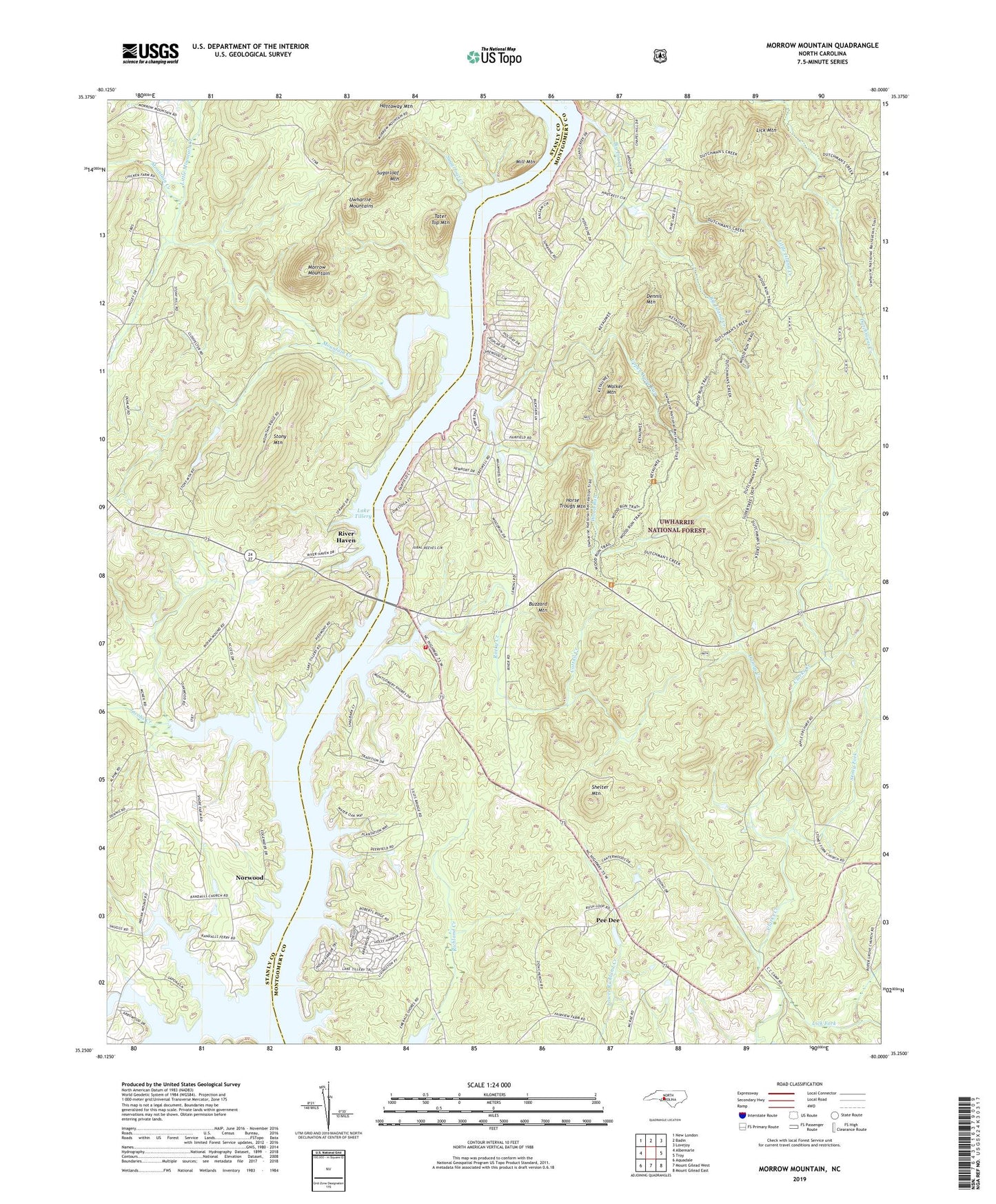
Morrow Mountain North Carolina US Topo Map
Couldn't load pickup availability
Also explore the Morrow Mountain Forest Service Topo of this same quad for updated USFS data
2022 topographic map quadrangle Morrow Mountain in the state of North Carolina. Scale: 1:24000. Based on the newly updated USGS 7.5' US Topo map series, this map is in the following counties: Montgomery, Stanly. The map contains contour data, water features, and other items you are used to seeing on USGS maps, but also has updated roads and other features. This is the next generation of topographic maps. Printed on high-quality waterproof paper with UV fade-resistant inks.
Quads adjacent to this one:
West: Albemarle
Northwest: New London
North: Badin
Northeast: Lovejoy
East: Troy
Southeast: Mount Gilead East
South: Mount Gilead West
Southwest: Aquadale
This map covers the same area as the classic USGS quad with code o35080c1.
Contains the following named places: Big Island Creek, Buzzard Mountain, Carolina Forest, Cattail Creek, Cedar Creek, Dennis Mountain, Dumas Creek, Emerald Shores, Hall Branch, Holiday Shores, Horse Trough Mountain, Jacobs Creek, Lake in the Pine, Lake Tillery Volunteer Fire Department and Rescue Squad 10, Lather Branch, Lawrenceville, Lick Fork, Lick Mountain, Little Island Creek, Little Mountain Creek, Mill Mountain, Morrow Mountain, Mount Zion Church, Mountain Creek, Pee Dee, Randell Church, River Haven, Rocky Creek, Rocky Hill Church, Shelter Mountain, Shiloh Church, Stony Fork, Stony Fork Church, Stony Hill Church, Stony Mountain, Stony Mountain Lake Number One, Stony Mountain Lake Number Two, Stony Mountain Number One Dam, Stony Mountain Number Two Dam, Sugarloaf Creek, Sugarloaf Mountain, Sugarloaf Shores, Swift Island, Tater Top Mountain, Tindalsville, Township of Pee Dee, Township of Uwharrie, Upper Wood Run, Uwharrie National Recreation Trail, Walker Mountain, White Crest Church, Wood Run, Woodrun, Zion Church