MyTopo
Mount Pleasant North Carolina US Topo Map
Couldn't load pickup availability
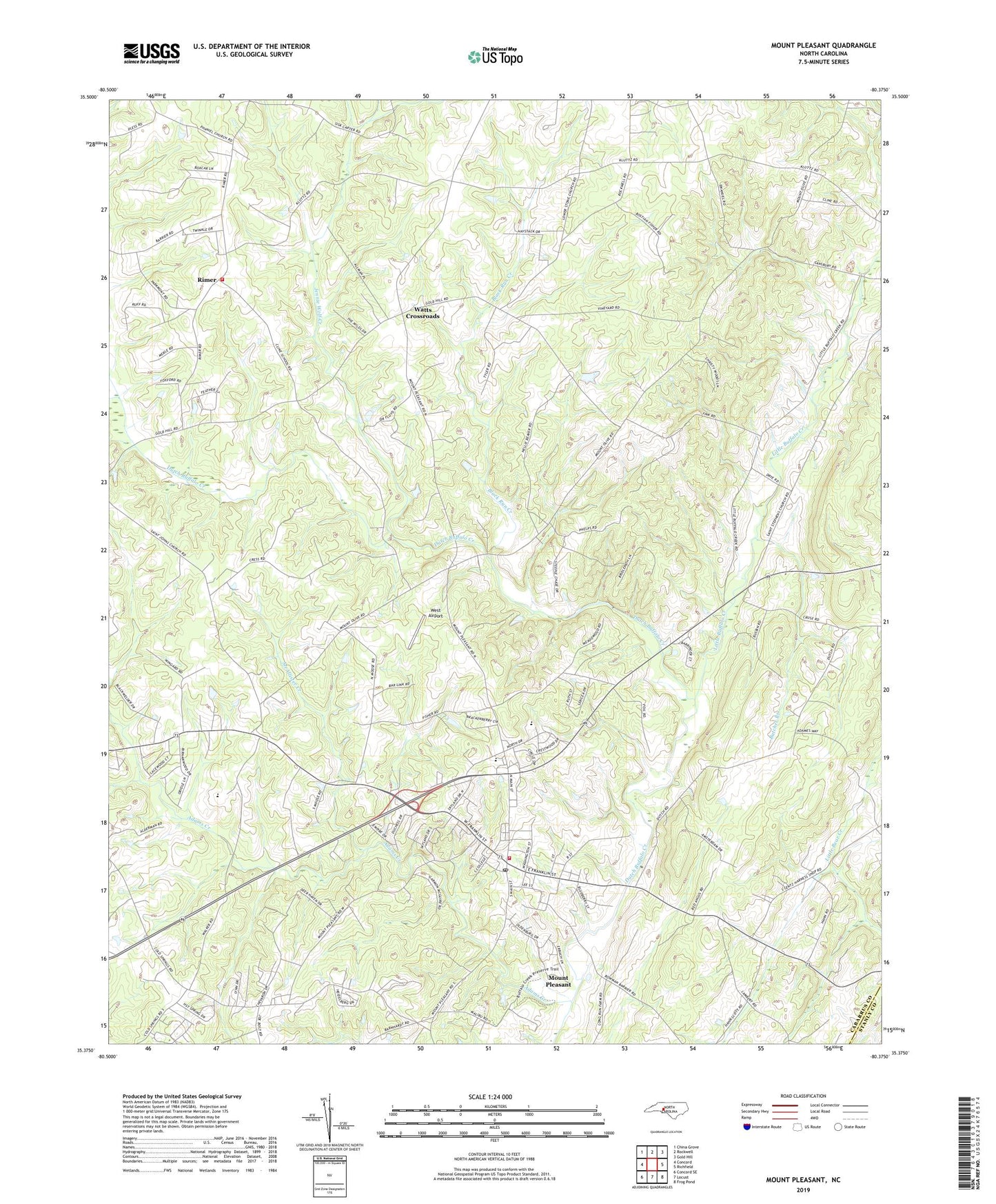
2019 topographic map quadrangle Mount Pleasant in the state of North Carolina. Scale: 1:24000. Based on the newly updated USGS 7.5' US Topo map series, this map is in the following counties: Cabarrus, Stanly. The map contains contour data, water features, and other items you are used to seeing on USGS maps, but also has updated roads and other features. This is the next generation of topographic maps. Printed on high-quality waterproof paper with UV fade-resistant inks.
Quads adjacent to this one:
West: Concord
Northwest: China Grove
North: Rockwell
Northeast: Gold Hill
East: Richfield
Southeast: Frog Pond
South: Locust
Southwest: Concord SE
Contains the following named places: Adams Creek, Black Run Creek, Boger Church, Butcher Branch, Cabarrus County Emergency Medical Services Station 3, Camp Spencer, Charity Church, Cline School, Cold Springs Church, Concord Airport, Faggart, Glorieta Church, Jennie Wolf Creek, Little Buffalo Creek, McAllister Creek, Mount Carmel Church, Mount Gilead Church, Mount Olive Church, Mount Pleasant, Mount Pleasant Church, Mount Pleasant Community Park, Mount Pleasant Fire and Rescue, Mount Pleasant Post Office, Oak Grove Church, Prosperity Church, Rimer, Rimer Volunteer Fire Department, Saint Johns Church, Town of Mount Pleasant, Township 6-Rimertown, Township 8-Mount Pleasant, Victory Temple, Watts Crossroads, West Airport, ZIP Code: 28124