MyTopo
Gold Hill North Carolina US Topo Map
Couldn't load pickup availability
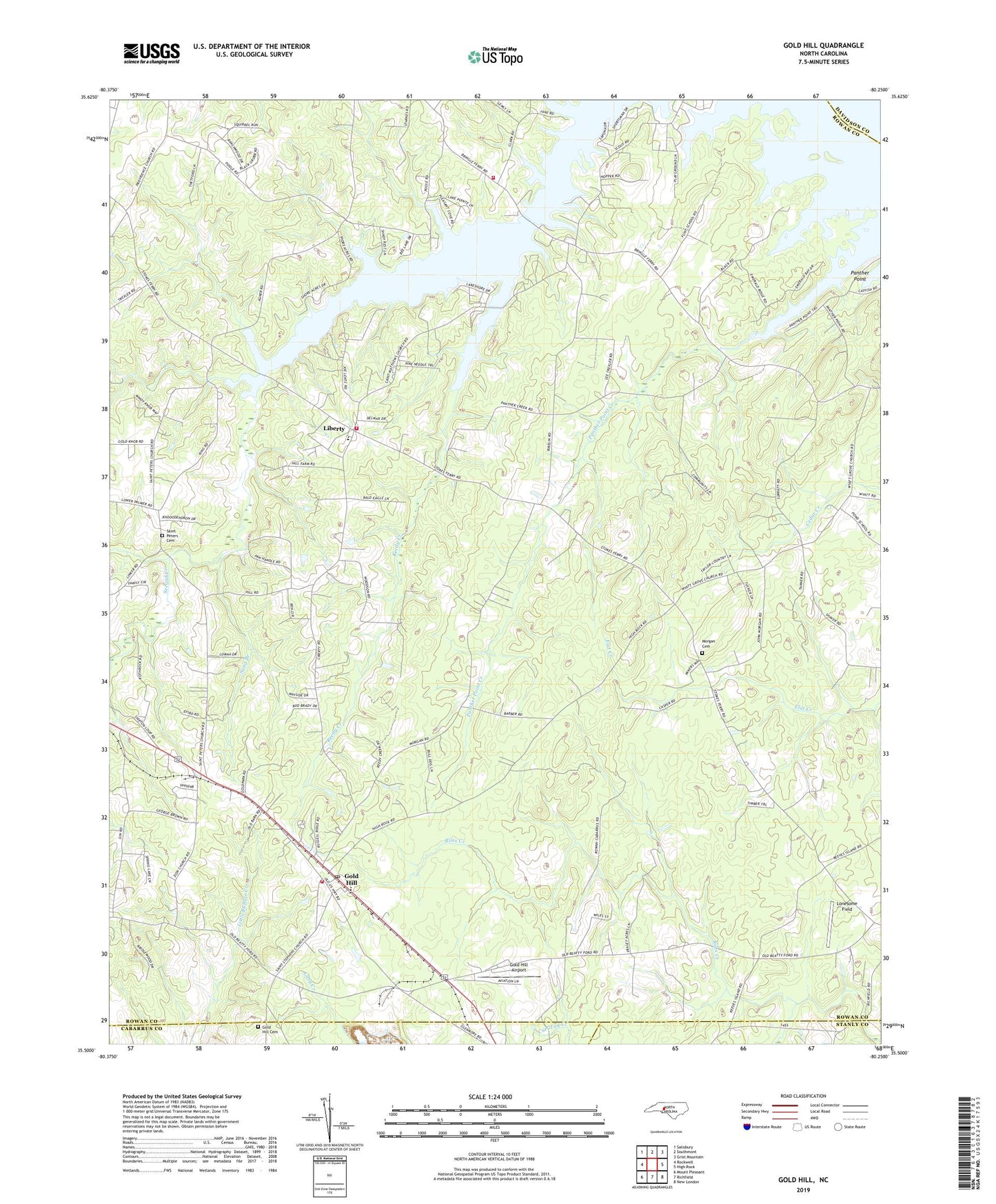
2022 topographic map quadrangle Gold Hill in the state of North Carolina. Scale: 1:24000. Based on the newly updated USGS 7.5' US Topo map series, this map is in the following counties: Rowan, Cabarrus, Stanly, Davidson. The map contains contour data, water features, and other items you are used to seeing on USGS maps, but also has updated roads and other features. This is the next generation of topographic maps. Printed on high-quality waterproof paper with UV fade-resistant inks.
Quads adjacent to this one:
West: Rockwell
Northwest: Salisbury
North: Southmont
Northeast: Grist Mountain
East: High Rock
Southeast: New London
South: Richfield
Southwest: Mount Pleasant
This map covers the same area as the classic USGS quad with code o35080e3.
Contains the following named places: Allin, East Corinth Church, East Gold Hill Fire Department, Gold Hill, Gold Hill Airport, Gold Hill Cemetery, Gold Hill Census Designated Place, Gold Hill Church, Gold Hill Post Office, Gold Hill Quarry, Liberty, Liberty Volunteer Fire Department Station 59, Liberty Volunteer Fire Department Station 60, Lonesome Field, Morgan Cemetery, Morgan Elementary School, Panther Point, Panther Point Creek, Pilgrim Church, Pool, Reedy Creek, Saint Matthews Church, Saint Paul Church, Saint Peters Cemetery, Saint Peters Church, Sand Branch, Township of Morgan, Union Copper Mine, Wyatts Grove Church, Zion Church, ZIP Code: 28071