MyTopo
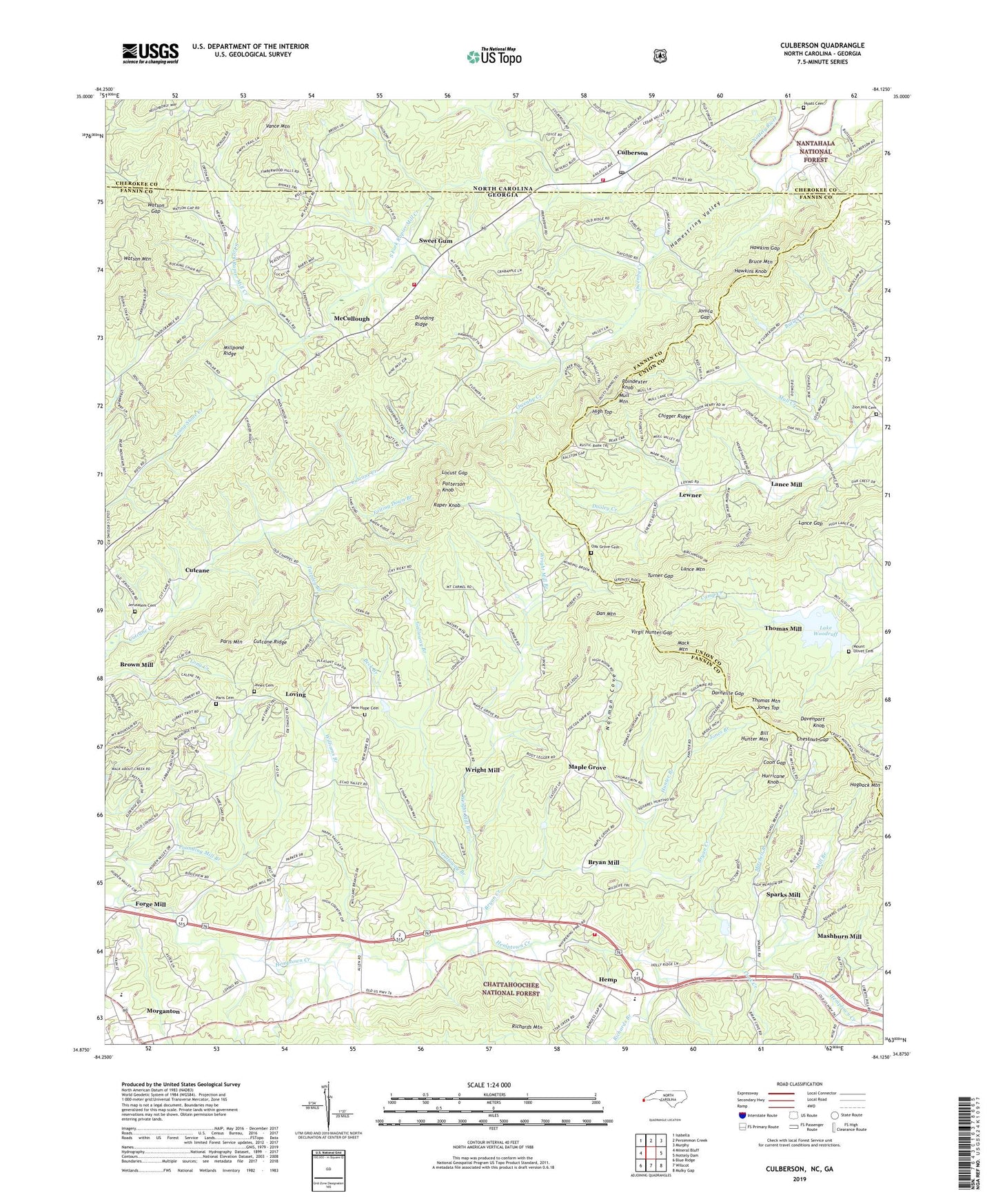
Culberson North Carolina US Topo Map
Couldn't load pickup availability
Also explore the Culberson Forest Service Topo of this same quad for updated USFS data
2022 topographic map quadrangle Culberson in the states of Georgia, North Carolina. Scale: 1:24000. Based on the newly updated USGS 7.5' US Topo map series, this map is in the following counties: Cherokee, Fannin, Union. The map contains contour data, water features, and other items you are used to seeing on USGS maps, but also has updated roads and other features. This is the next generation of topographic maps. Printed on high-quality waterproof paper with UV fade-resistant inks.
Quads adjacent to this one:
West: Mineral Bluff
Northwest: Isabella
North: Persimmon Creek
Northeast: Murphy
East: Nottely Dam
Southeast: Mulky Gap
South: Wilscot
Southwest: Blue Ridge
This map covers the same area as the classic USGS quad with code o34084h2.
Contains the following named places: Apostolic Gospel Church, Appalachia Church, Bald Knob School, Beck Branch, Bell School, Bethel Church, Bill Hunter Mountain, Brown Mill, Bruce Mountain, Bruce School, Bryan Creek, Bryan Mill, Chestnut Gap, Chigger Ridge, Cook Creek, Coon Gap, Culberson, Culberson Fire Department, Culberson Post Office, Cutcane, Cutcane Church, Cutcane Ridge, Cutcane School, Dan Mountain, Darneille Gap, Davenport Knob, Dividing Ridge, Dora, East Fannin Elementary School, Ellis Mill, Falling Down Branch, Fannin County Fire Department Station 10, Fannin County Fire Department Station 8, Flint Grove School, Flint Hill Church, Flint Mill School, Forge Mill, Friendship Church, Galloway Branch, Hamestring Valley, Harper Church, Harper School, Hawkins Gap, Hawkins Knob, Hawkins Mill, Hemp, Hemp Church, Hemp School, Hemptown Church, High Top, Hogback Mountain, Holiness Church, Hunter Branch, Hurricane Knob, Hyatt Cemetery, Jerusalem Cemetery, Jerusalem Church, Jerusalem School, Jones Branch, Jones Cemetery, Jones Top, Jonica Gap, Lake Woodruff, Lance Gap, Lance Mill, Lance Mountain, Lewner, Liberty Hill Church, Locust Gap, Long Chapel, Loving, Loving School, Mack Mountain, Maple Grove, Maple Grove Church, Mashburn Mill, McCullough, Mill Branch, Millpond Ridge, Mineral Bluff Division, Mitchell Branch, Morganton Baptist Church, Morganton School, Mount Carmel Church, Mount Herman Church, Mount Olive Church, Mount Olivet Cemetery, Mount Olivet School, Mull Creek, Mull Mountain, New Hope Cemetery, New Hope Church, New Liberty Church, New Mount Gilead Church, Norman Cove, Oak Grove Cemetery, Oak Grove Church, Old Jerusalem Church, Owenby Creek, Paris Cemetery, Paris Mountain, Patterson Knob, Pearl, Pitman Mountain, Pleasant Gap Church, Poindexter Knob, Pounding Mill Branch, Raper Knob, Richards Branch, Richards Mountain, River Valley Church, Robert W Woodruff Scout Reservation, Rocky Gap, Sparks Mill, Sweet Gum, Sweetgum Church, Tarpley Branch, Thomas Mill, Thomas Mountain, Tri - State School of Theology, Turner Gap, Van Hook Church, Virgil Hunter Gap, Watson Gap, Watson Mountain, Williams Branch, Wright Mill, Wright Mill Branch, Zion Hill Cemetery, Zion Hill Church, ZIP Code: 30560