MyTopo
Nixonton North Carolina US Topo Map
Couldn't load pickup availability
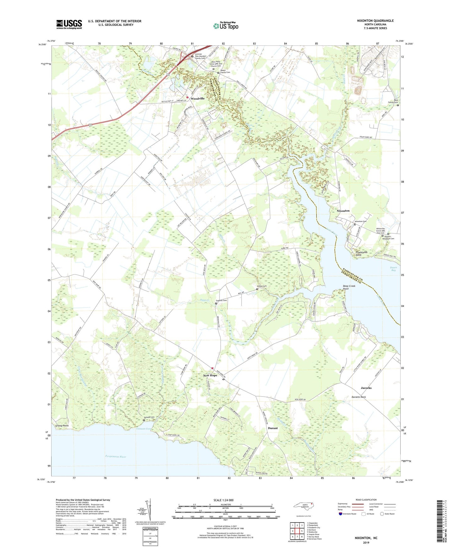
2019 topographic map quadrangle Nixonton in the state of North Carolina. Scale: 1:24000. Based on the newly updated USGS 7.5' US Topo map series, this map is in the following counties: Perquimans, Pasquotank. The map contains contour data, water features, and other items you are used to seeing on USGS maps, but also has updated roads and other features. This is the next generation of topographic maps. Printed on high-quality waterproof paper with UV fade-resistant inks.
Quads adjacent to this one:
West: Hertford
Northwest: Chapanoke
North: Pasquotank
Northeast: Elizabeth City
East: Weeksville
Southeast: Stevenson Point
South: Harvey Neck
Southwest: Yeopim River
Contains the following named places: Berea Church, Canaan Cove, Canaan Cove Creek, Dance Bay, Deep Creek, Deep Creek Point, Durant, Durants Neck, Durants Neck Fire Department, Durants Neck Post Office, Evangelical Church, Galatia Church, Godfrey Cemetery, Grassy Point, Great Run Swamp, Halls Creek, Halls Creek Church, Inter - County Volunteer Fire Department, Jackson Cemetery, Jacocks, Lorenzo Dow Munden Family Cemetery, Mary Holly Grove AME Zion Church Cemetery, Mary Holly Grove Church, Mills Creek, Moonlight Bay Mobile Park, New Hope, Nixonton, Nixonton Cemetery, Pooles Grove Baptist Church, Rabbit Corner, Redbank Landing, Reid Family Cemetery, Riddick - Whedbee Cemetery, South Haven Manor, Township of New Hope, Truebloods Point, Weeks Family Cemetery, Whitehurst Airport, Whiteville Grove AME Zion Cemetery, Wilson Cemetery, Woodland Church, Woodville, Woodville Airport