MyTopo
Pasquotank North Carolina US Topo Map
Couldn't load pickup availability
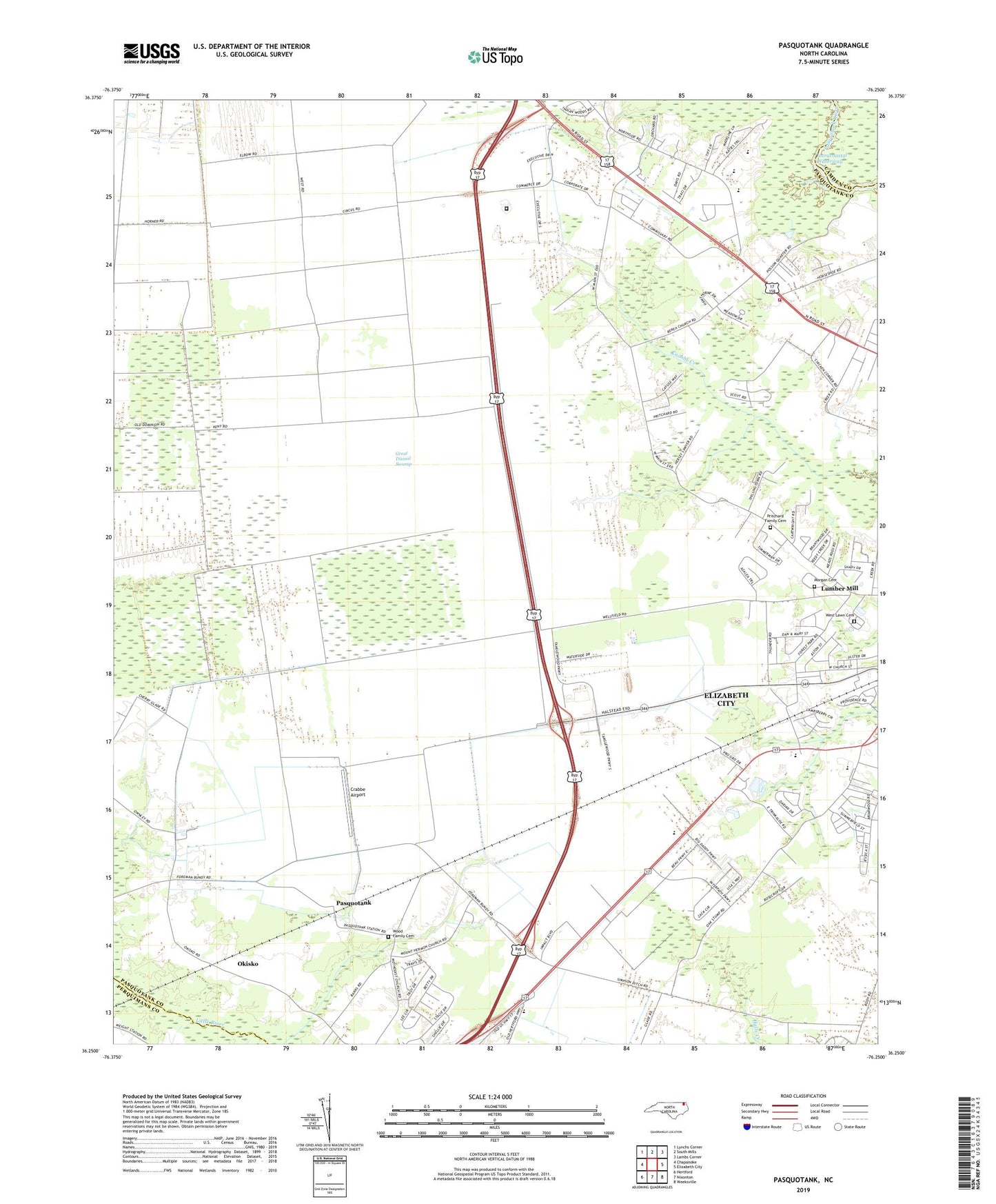
2022 topographic map quadrangle Pasquotank in the state of North Carolina. Scale: 1:24000. Based on the newly updated USGS 7.5' US Topo map series, this map is in the following counties: Pasquotank, Camden, Perquimans. The map contains contour data, water features, and other items you are used to seeing on USGS maps, but also has updated roads and other features. This is the next generation of topographic maps. Printed on high-quality waterproof paper with UV fade-resistant inks.
Quads adjacent to this one:
West: Chapanoke
Northwest: Lynchs Corner
North: South Mills
Northeast: Lambs Corner
East: Elizabeth City
Southeast: Weeksville
South: Nixonton
Southwest: Hertford
This map covers the same area as the classic USGS quad with code o36076c3.
Contains the following named places: Albermarle Academy, Berea Church, Brays Estate - Mobile Home Park, Briarwood, Central School, Chapell Gardens, Chesterfield Heights, Church of Christ, Church of God of Prophecy, Corinth Baptist Church, Crabbe Airport, Elizabeth City, Elizabeth City First Church, Faith Baptist Church, Fellowship Church, Forest Park, Grace Church, Hickory Acres, Hintonsville, King James Church, Lumber Mill, McPhersons Mobile Home Park, Morgan Cemetery, Moses Temple, Mount Herman, Mount Hermon Church, Museum of the Albermarle, North Carolina State Highway Patrol Troop A District 3, Northeastern High School, Okisko, Oxford Heights, Palmyre Church, Pasquotank, Pasquotank - Providence Volunteer Fire Department, Pasquotank Correctional Institution, Possum Quarter Landing, Pritchard Family Cemetery, Samuel Chapel, Township of Mount Hermon, Township of Providence, Ulster Gardens, West Lawn Cemetery, Wood Family Cemetery, ZIP Code: 27909