MyTopo
Norfleet North Carolina US Topo Map
Couldn't load pickup availability
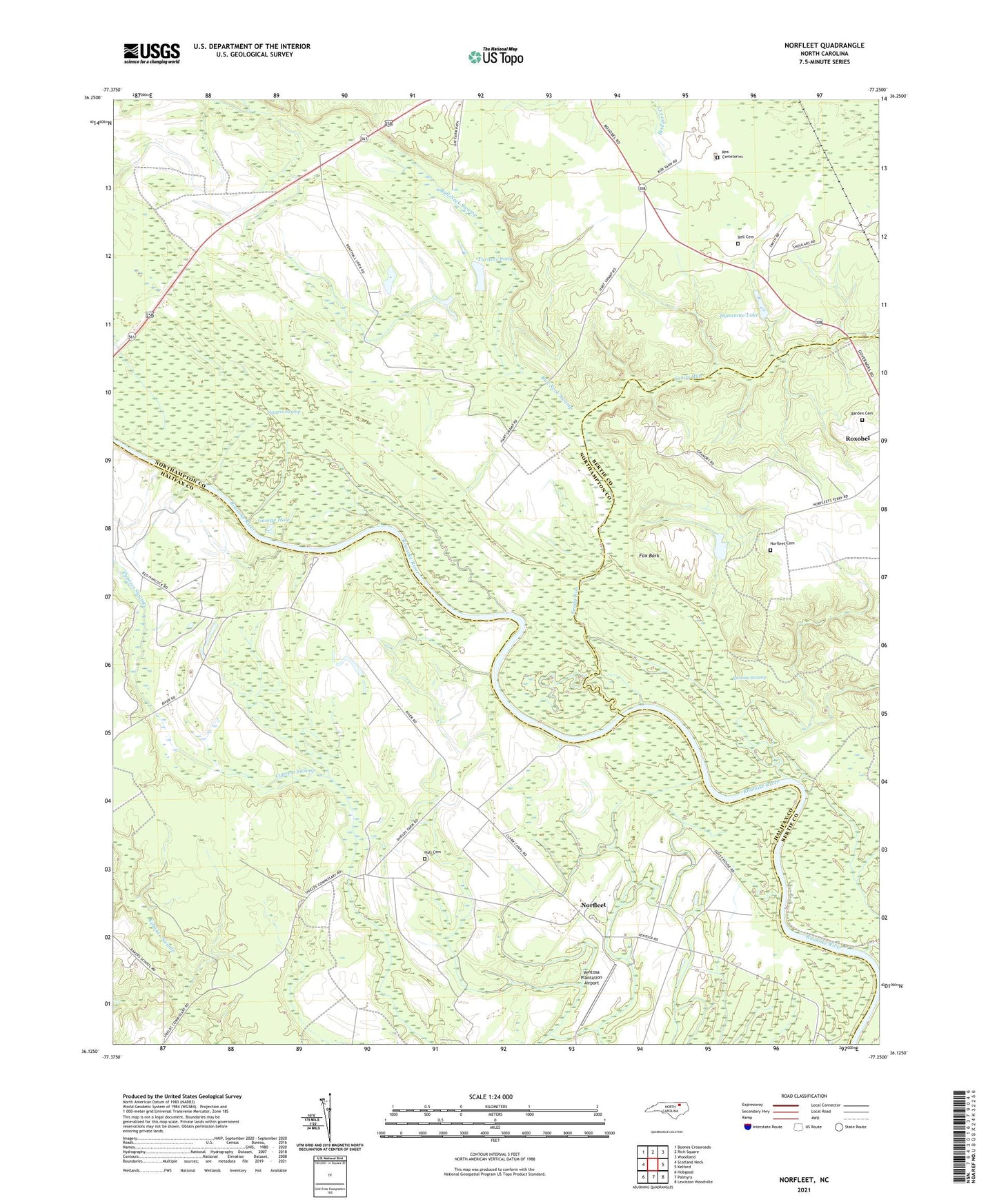
2021 topographic map quadrangle Norfleet in the state of North Carolina. Scale: 1:24000. Based on the newly updated USGS 7.5' US Topo map series, this map is in the following counties: Northampton, Halifax, Bertie. The map contains contour data, water features, and other items you are used to seeing on USGS maps, but also has updated roads and other features. This is the next generation of topographic maps. Printed on high-quality waterproof paper with UV fade-resistant inks.
Quads adjacent to this one:
West: Scotland Neck
Northwest: Boones Crossroads
North: Rich Square
Northeast: Woodland
East: Kelford
Southeast: Lewiston Woodville
South: Palmyra
Southwest: Hobgood
Contains the following named places: Barden Cemetery, Bell Cemetery, Brittons Creek, Bull Neck Swamp, Cypress Swamp, Dynamite Lake, Eason Island Landing, Fox Bark, George Hole, Hall Cemetery, Norfleet, Norfleet Cemetery, Norfleets Ferry Site, Quinine Swamp, Rea Cemeteries, Saint Stevens Church, Sandy Run, Sandy Run Church, Shields Commissary, Turners Pond, Turners Pond Dam, Ventosa Plantation Airport, William Chapel, Woods Landing, ZIP Code: 27872