MyTopo
Boones Crossroads North Carolina US Topo Map
Couldn't load pickup availability
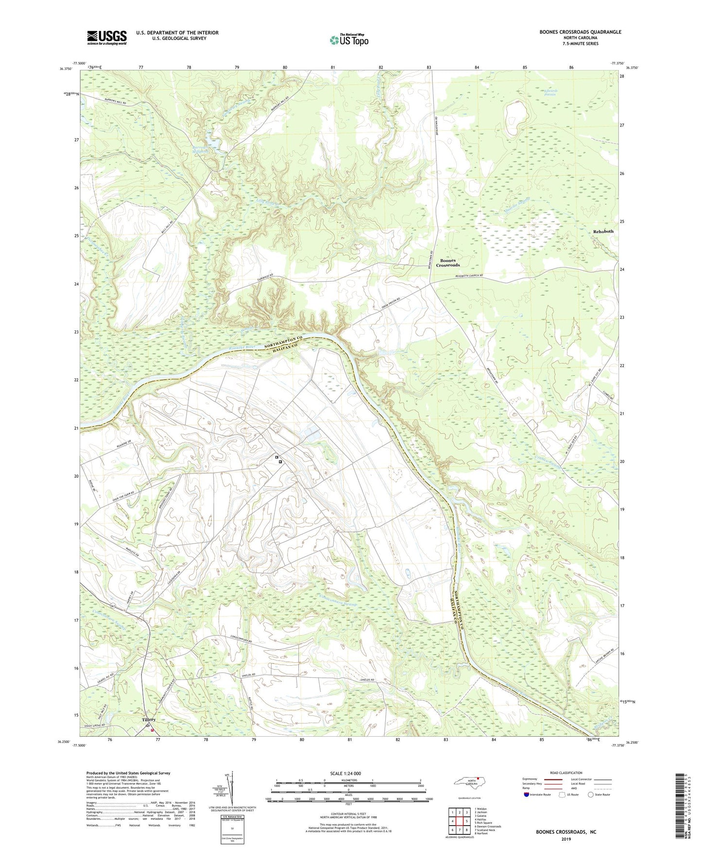
2022 topographic map quadrangle Boones Crossroads in the state of North Carolina. Scale: 1:24000. Based on the newly updated USGS 7.5' US Topo map series, this map is in the following counties: Northampton, Halifax. The map contains contour data, water features, and other items you are used to seeing on USGS maps, but also has updated roads and other features. This is the next generation of topographic maps. Printed on high-quality waterproof paper with UV fade-resistant inks.
Quads adjacent to this one:
West: Halifax
Northwest: Weldon
North: Jackson
Northeast: Galatia
East: Rich Square
Southeast: Norfleet
South: Scotland Neck
Southwest: Dawson Crossroads
This map covers the same area as the classic USGS quad with code o36077c4.
Contains the following named places: Antioch Church, Barrows Millpond, Boones Chapel, Boones Crossroads, Bridgers Creek, Burgwins Landing, Caledonia Correctional Institution Medium, Caledonia Correctional Institution Minimum, Caledonia State Prison Farm, Conoconnara Swamp, Devereaux Ferry, Edwards Pocosin, Gumberry Swamp, Lilly Pond Creek, Morris Pond, Morris Pond Dam, Occoneechee Creek, Odom State Prison Farm, Parker Chapel, Rehoboth, Tillery, Tillery Chapel, Tillery Post Office, Tillery Volunteer Fire Department, Wheeler Creek, ZIP Code: 27845