MyTopo
Ocracoke North Carolina US Topo Map
Couldn't load pickup availability
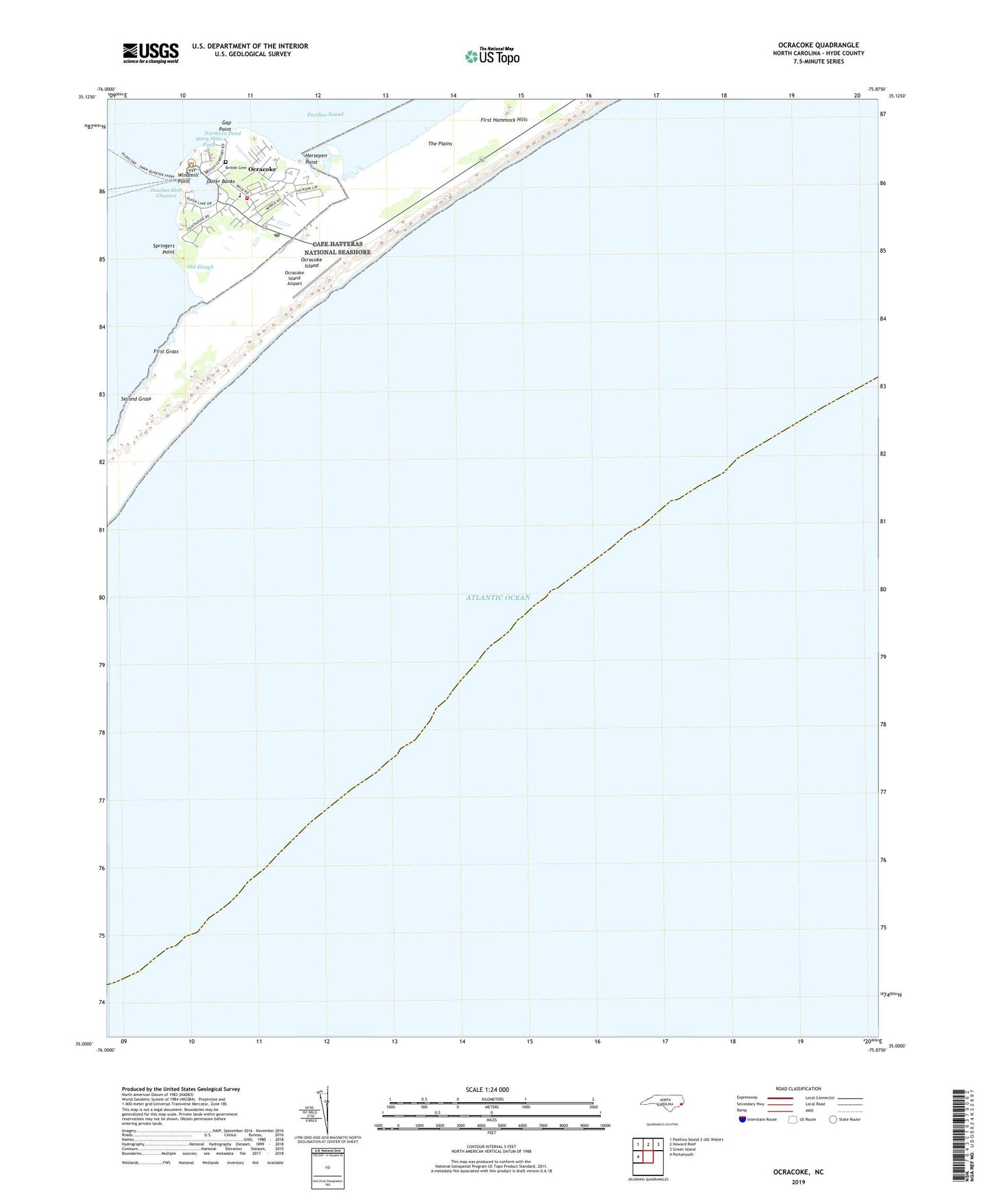
2022 topographic map quadrangle Ocracoke in the state of North Carolina. Scale: 1:24000. Based on the newly updated USGS 7.5' US Topo map series, this map is in the following counties: Hyde. The map contains contour data, water features, and other items you are used to seeing on USGS maps, but also has updated roads and other features. This is the next generation of topographic maps. Printed on high-quality waterproof paper with UV fade-resistant inks.
Quads adjacent to this one:
West: Portsmouth
North: Howard Reef
Northeast: Green Island
This map covers the same area as the classic USGS quad with code o35075a8.
Contains the following named places: Anchorage Inn, Assembly of God Church, British Cemetery, Cockle Shoal Light, Ferry Office, First Grass, First Hammock Hills, Gap Point, Horsepen Point, Hyde County EMS Ocracoke Island Station, Jackson Dunes, Mary Anns Pond, Northern Pond, Ocracoke, Ocracoke Island Airport, Ocracoke Light House, Ocracoke Post Office, Ocracoke Volunteer Fire Department, Okracoke Fire Hall, Okracoke Sheriffs Office, Old Slough, Oyster Creek, Pamlico Shores, Raleigh Bay, Second Grass, Silver Lake, Sound Shores, Springers Point, Teaches Hole Channel, Teaches Hole Channel Light, The Plains, United States Park Service Campgrounds, United States Park Service Docks, Widgen Woods, Windmill Point, ZIP Code: 27960