MyTopo
Portsmouth North Carolina US Topo Map
Couldn't load pickup availability
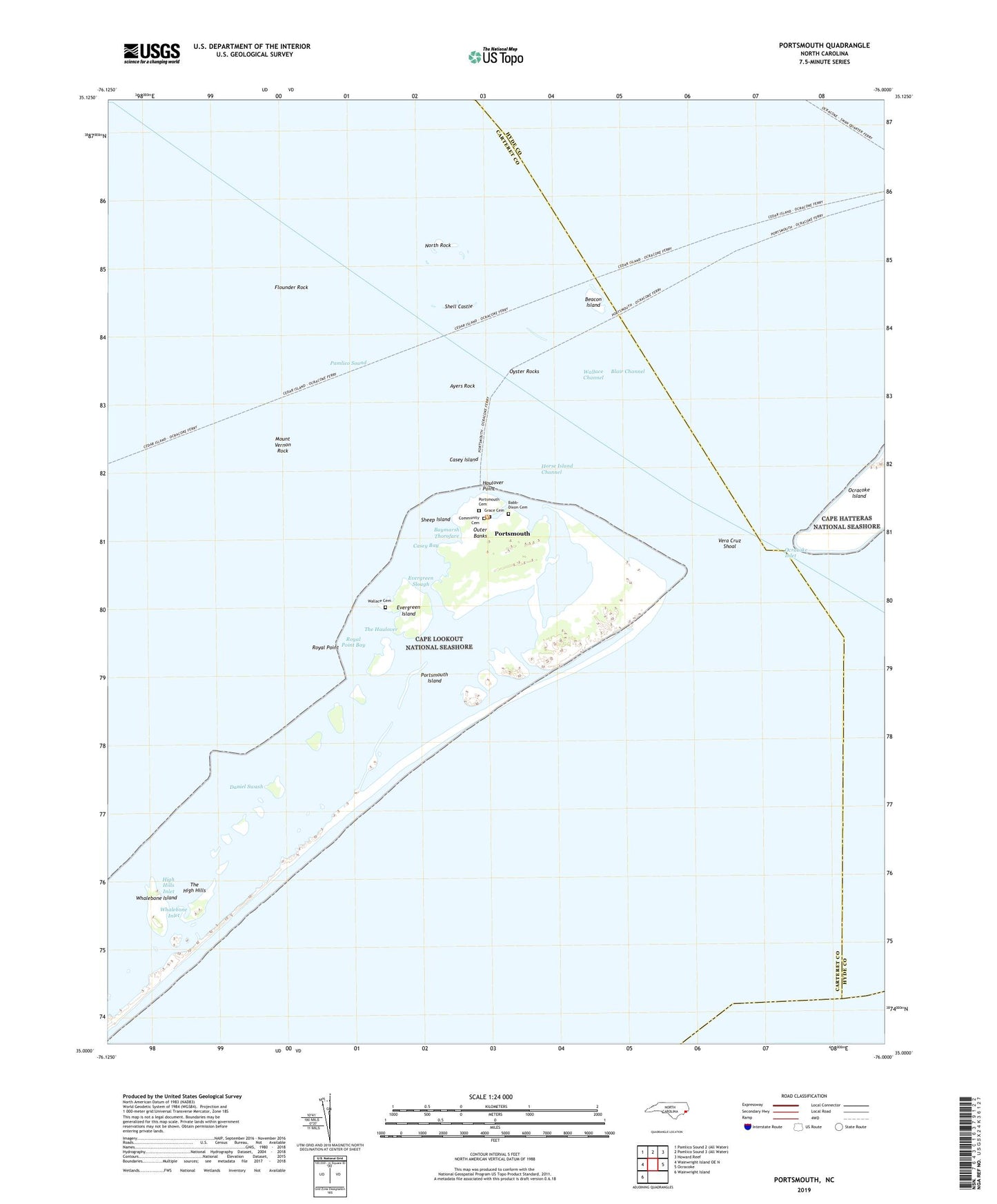
2022 topographic map quadrangle Portsmouth in the state of North Carolina. Scale: 1:24000. Based on the newly updated USGS 7.5' US Topo map series, this map is in the following counties: Carteret, Hyde. The map contains contour data, water features, and other items you are used to seeing on USGS maps, but also has updated roads and other features. This is the next generation of topographic maps. Printed on high-quality waterproof paper with UV fade-resistant inks.
Quads adjacent to this one:
West: Wainwright Island OE N
Northeast: Howard Reef
East: Ocracoke
Southwest: Wainwright Island
This map covers the same area as the classic USGS quad with code o35076a1.
Contains the following named places: Amity Shoal, Ayers Rock, Babb-Dixon Cemetery, Bay Marsh, Baymarsh Thorofare, Beacon Island, Beacon Island Roads, Blair Channel, Casey Bay, Casey Island, Community Cemetery, Daniel Swash, Evergreen Island, Evergreen Slough, Ferry Landing, Flounder Rock, Grace Cemetery, Haulover Point, High Hills Inlet, Horse Island Channel, Life Saving Service Station, Methodist Church, Mount Vernon Rock, North Rock, Ocracoke Inlet, Oyster Rocks, Portsmouth, Portsmouth Cemetery, Portsmouth Island, Portsmouth Village, Portsmouth Village Ranger Station, Royal Point, Royal Point Bay, Schoolhouse, Sheep Island, Sheep Island Slue Light, Shell Castle, The Haulover, The High Hills, Vera Cruz Shoal, Wallace Cemetery, Wallace Channel, Wallace Channel Beacon, Wallace Channel Light, Warren Gilgos Creek, Whalebone Inlet, Whalebone Island