MyTopo
Pea Ridge North Carolina US Topo Map
Couldn't load pickup availability
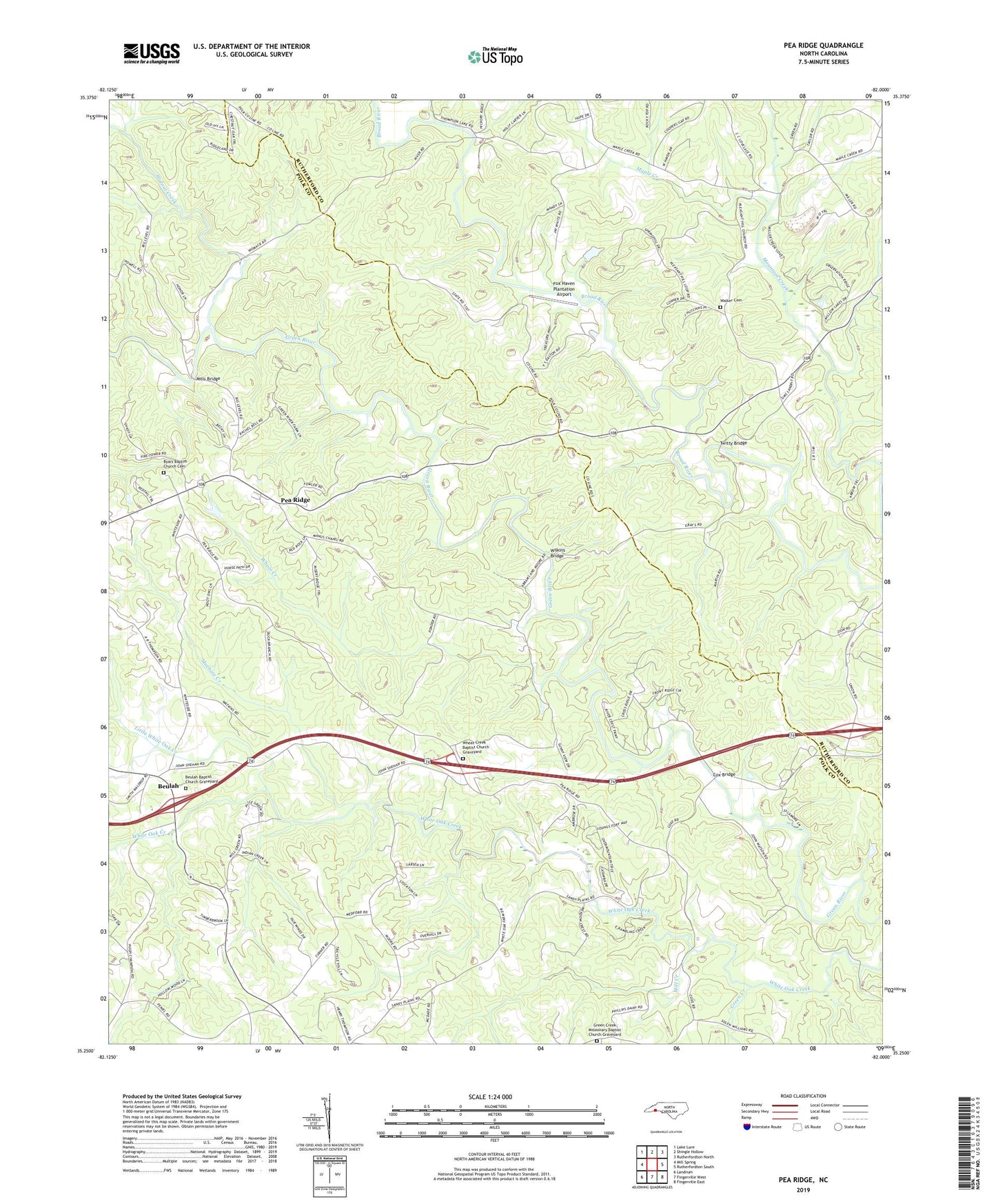
2019 topographic map quadrangle Pea Ridge in the state of North Carolina. Scale: 1:24000. Based on the newly updated USGS 7.5' US Topo map series, this map is in the following counties: Polk, Rutherford. The map contains contour data, water features, and other items you are used to seeing on USGS maps, but also has updated roads and other features. This is the next generation of topographic maps. Printed on high-quality waterproof paper with UV fade-resistant inks.
Quads adjacent to this one:
West: Mill Spring
Northwest: Lake Lure
North: Shingle Hollow
Northeast: Rutherfordton North
East: Rutherfordton South
South: Fingerville West
Southwest: Landrum
Contains the following named places: Bell Lake, Bell Lake Dam, Beulah, Beulah Baptist Church Graveyard, Beulah Church, Byars Baptist Church Cemetery, Byars Church, Cox Bridge, Cox Store, Fox Haven Plantation Airport, Grays Chapel, Green Creek, Green Creek Church, Green Creek Missionary Baptist Church Graveyard, Lebanon Church, Little White Oak Creek, Machine Creek, Mack, Maple Creek, Mill Creek, Miller Creek Quarry, Mills Bridge, New Zion Church, Pea Ridge, Pea Ridge Lookout Tower, Pleasant Grove Church, Pleasant Hill Church, Salem Church, Shehan Crossroads, South Branch Little White Oak Creek, Twitty Bridge, Walker Cemetery, Walnut Creek, Wheat Creek, Wheat Creek Baptist Church Graveyard, Wheat Creek Church, Wilkins Bridge, Zion Church, Zion Grove Church