MyTopo
Phillips Crossroads North Carolina US Topo Map
Couldn't load pickup availability
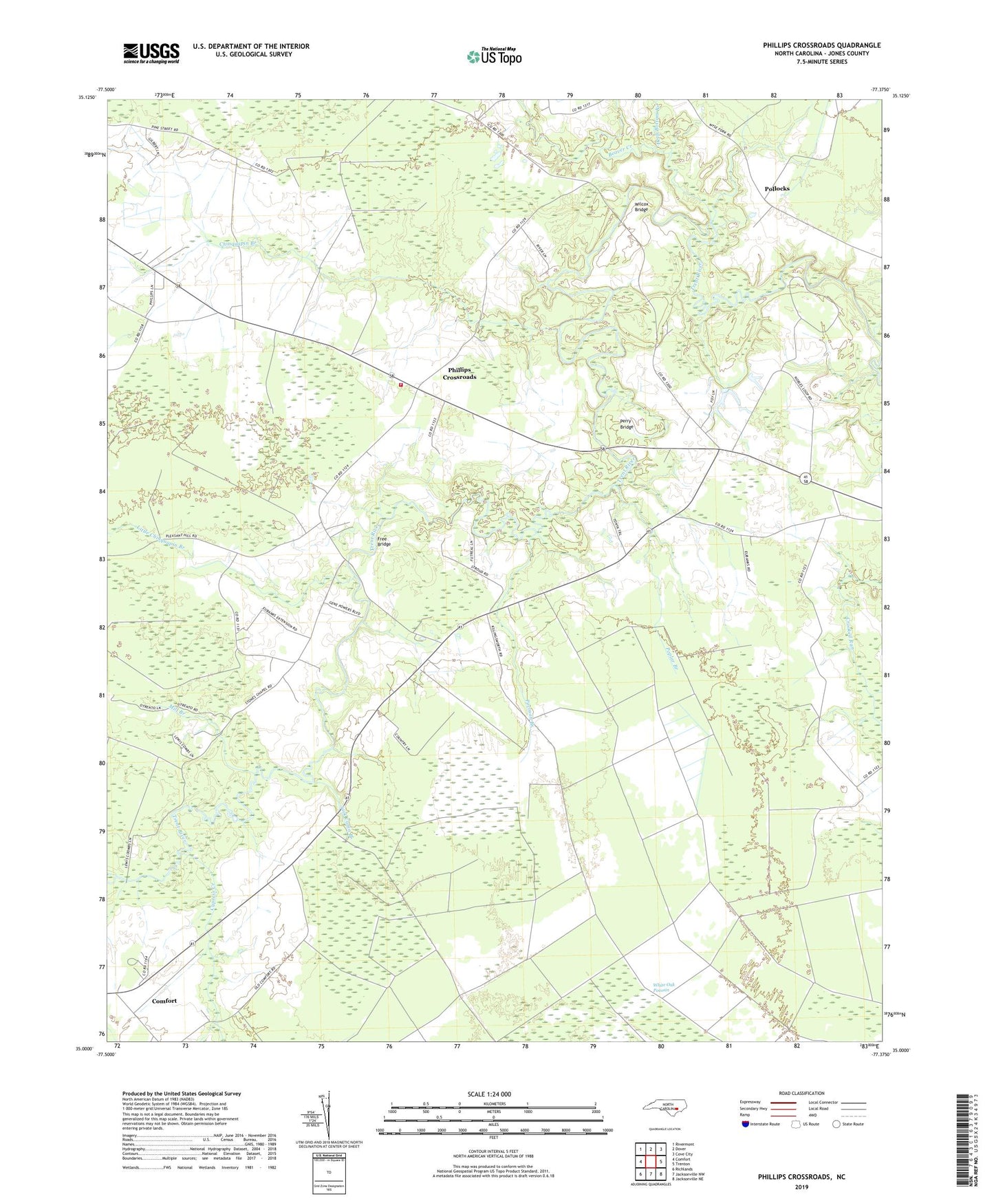
2022 topographic map quadrangle Phillips Crossroads in the state of North Carolina. Scale: 1:24000. Based on the newly updated USGS 7.5' US Topo map series, this map is in the following counties: Jones. The map contains contour data, water features, and other items you are used to seeing on USGS maps, but also has updated roads and other features. This is the next generation of topographic maps. Printed on high-quality waterproof paper with UV fade-resistant inks.
Quads adjacent to this one:
West: Comfort
Northwest: Rivermont
North: Dover
Northeast: Cove City
East: Trenton
Southeast: Jacksonville NE
South: Jacksonville NW
Southwest: Richlands
This map covers the same area as the classic USGS quad with code o35077a4.
Contains the following named places: Academy Green Church, Beaver Creek, Calvary Memorial Church, Chinquapin, Chinquapin Branch, Chinquapin Chapel, Community Church, Cypress Creek, Cypress Creek Church, Deep Bottom Branch, Free Bridge, Haughton Chapel, Jack Cabin Branch, Little Chinquapin Branch, Mill Branch, Perry Bridge, Phillips Crossroads, Phillips Crossroads Volunteer Fire Department, Pocoson Branch, Pollocks, Poplar Branch, Resolution Branch, Stones Chapel, Suter Field, Township 4-Cypress Creek, Township 6-Chinquapin, Tuckahoe, Wilcox Bridge, ZIP Code: 28585