MyTopo
Trenton North Carolina US Topo Map
Couldn't load pickup availability
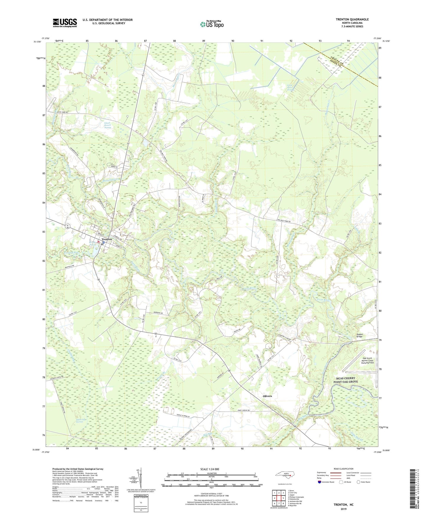
2022 topographic map quadrangle Trenton in the state of North Carolina. Scale: 1:24000. Based on the newly updated USGS 7.5' US Topo map series, this map is in the following counties: Jones, Craven. The map contains contour data, water features, and other items you are used to seeing on USGS maps, but also has updated roads and other features. This is the next generation of topographic maps. Printed on high-quality waterproof paper with UV fade-resistant inks.
Quads adjacent to this one:
West: Phillips Crossroads
Northwest: Dover
North: Cove City
Northeast: Jasper
East: Pollocksville
Southeast: Maysville
South: Jacksonville NE
Southwest: Jacksonville NW
This map covers the same area as the classic USGS quad with code o35077a3.
Contains the following named places: Andrews Chapel, Banks Landing, Beaverdam Branch, Beaverdam Creek, Brock Pond, Bryan Landing, Crooked Run, Faith Church, Foscue Landing, Free Will Chapel, French Branch, Friendship Church, Horse Landing, Island Branch Swamp, Jones County, Jones County Emergency Medical Services, Jones County Rescue Squad, Jones County Sheriff's Office, Jones High School, Jones Junior High School, Jumping Creek, Lenoir Community College, Little Hell Creek, Log Landing, Long Branch, Mallard Cove Landing, Maple Grove Church, Marsh Landing, Mill Run, Morris Chapel, Murrill Landing, Musselshell Creek, Oak Grove Marine Corps Outlying Field, Oakey Grove Church, Olivers, Olivers Crossroads, Olivers Landing, Perry Landing, Piney Grove Church, Pollocksville, Posque Landing, Prettyman Landing, Quaker Bridge, Quarter Neck Country Club, Town of Trenton, Township 3-Trenton, Trenton, Trenton Elementary School, Trenton Emergency Medical Services, Trenton Post Office, Trenton Volunteer Fire Department, Trenton Wastewater Treatment Plant, WCTI-TV (New Bern), White Bank Landing, Wooten Landing, WUNM-TV (Jacksonville)