MyTopo
Comfort North Carolina US Topo Map
Couldn't load pickup availability
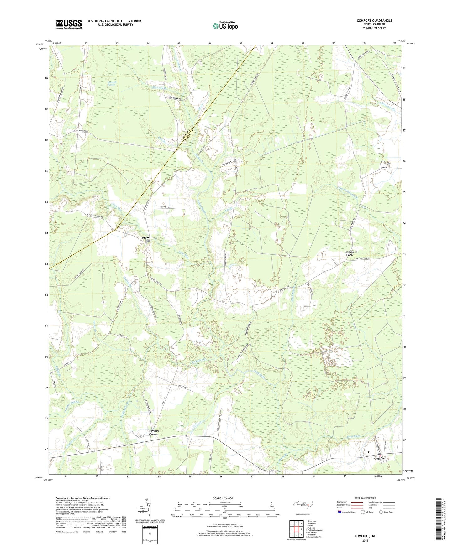
2022 topographic map quadrangle Comfort in the state of North Carolina. Scale: 1:24000. Based on the newly updated USGS 7.5' US Topo map series, this map is in the following counties: Jones, Lenoir. The map contains contour data, water features, and other items you are used to seeing on USGS maps, but also has updated roads and other features. This is the next generation of topographic maps. Printed on high-quality waterproof paper with UV fade-resistant inks.
Quads adjacent to this one:
West: Pink Hill
Northwest: Deep Run
North: Rivermont
Northeast: Dover
East: Phillips Crossroads
Southeast: Jacksonville NW
South: Richlands
Southwest: Potters Hill
This map covers the same area as the classic USGS quad with code o35077a5.
Contains the following named places: Bearwell Branch, Bearwell Pocosin, Beaverdam Swamp, Black Swamp, Buck Branch, Bull Branch, Combs Fork, Comfort, Comfort Elementary School, Comfort Post Office, Comfort Volunteer Fire Department and Emergency Medical Services, Cypress Branch, Hennon Chapel, Joshua Branch, Joshua Creek, Lanies Chapel, Pat Branch, Pleasant Hill, Pleasant Hill Church, Poplar Branch, Quaker House Church, Rattlesnake Branch, Reedy Branch, Saint Matilda Chapel, Taylors Corner, Township 5-Tuckahoe, Tuckahoe Church, Tuckahoe Creek, Tuckahoe Post Office, Tuckahoe Swamp