MyTopo
Pinetops North Carolina US Topo Map
Couldn't load pickup availability
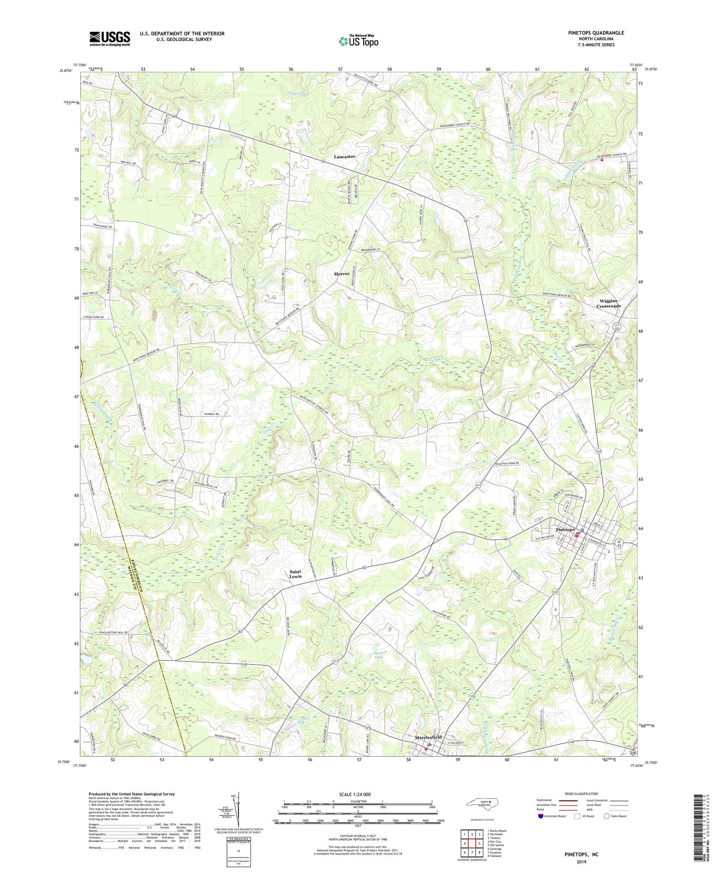
2019 topographic map quadrangle Pinetops in the state of North Carolina. Scale: 1:24000. Based on the newly updated USGS 7.5' US Topo map series, this map is in the following counties: Edgecombe, Wilson. The map contains contour data, water features, and other items you are used to seeing on USGS maps, but also has updated roads and other features. This is the next generation of topographic maps. Printed on high-quality waterproof paper with UV fade-resistant inks.
Quads adjacent to this one:
West: Elm City
Northwest: Rocky Mount
North: Hartsease
Northeast: Tarboro
East: Old Sparta
Southeast: Falkland
South: Fountain
Southwest: Saratoga
Contains the following named places: Batts Pond, Beaverdam Branch, Bethlehem Church, Bynums Mill Run, Carver Elementary School, Cokey Swamp, Corn Creek, Crisp, Eagles Church, Faith Church, Fox Hollow, Hazelwood Park, Lancaster, Lewis Community Volunteer Fire Department, Lower Town Creek Church, Macclesfield, Macclesfield Post Office, Macclesfield Rural Volunteer Fire Department, McDowell County Plaza, McKendree Church, Mercer, Morning Star Church, NC Noname Eight-Hundred Forty, Pinetops, Pinetops Police Department, Pinetops Post Office, Pinetops Volunteer Fire Department, Pitt Crossroads, Pyatts Chapel, Saint Lewis, Sasnett Mill Branch, South Edgecombe Junior High School, Southwest Edgecombe High School, Temperance Hall, Town of Macclesfield, Town of Pinetops, Township 10-Lower Town Creek, Township 13-Cokey, Triangle Sand Quarry, Wiggins Crossroads, Williamson Branch, ZIP Codes: 27852, 27864