MyTopo
Belhaven North Carolina US Topo Map
Couldn't load pickup availability
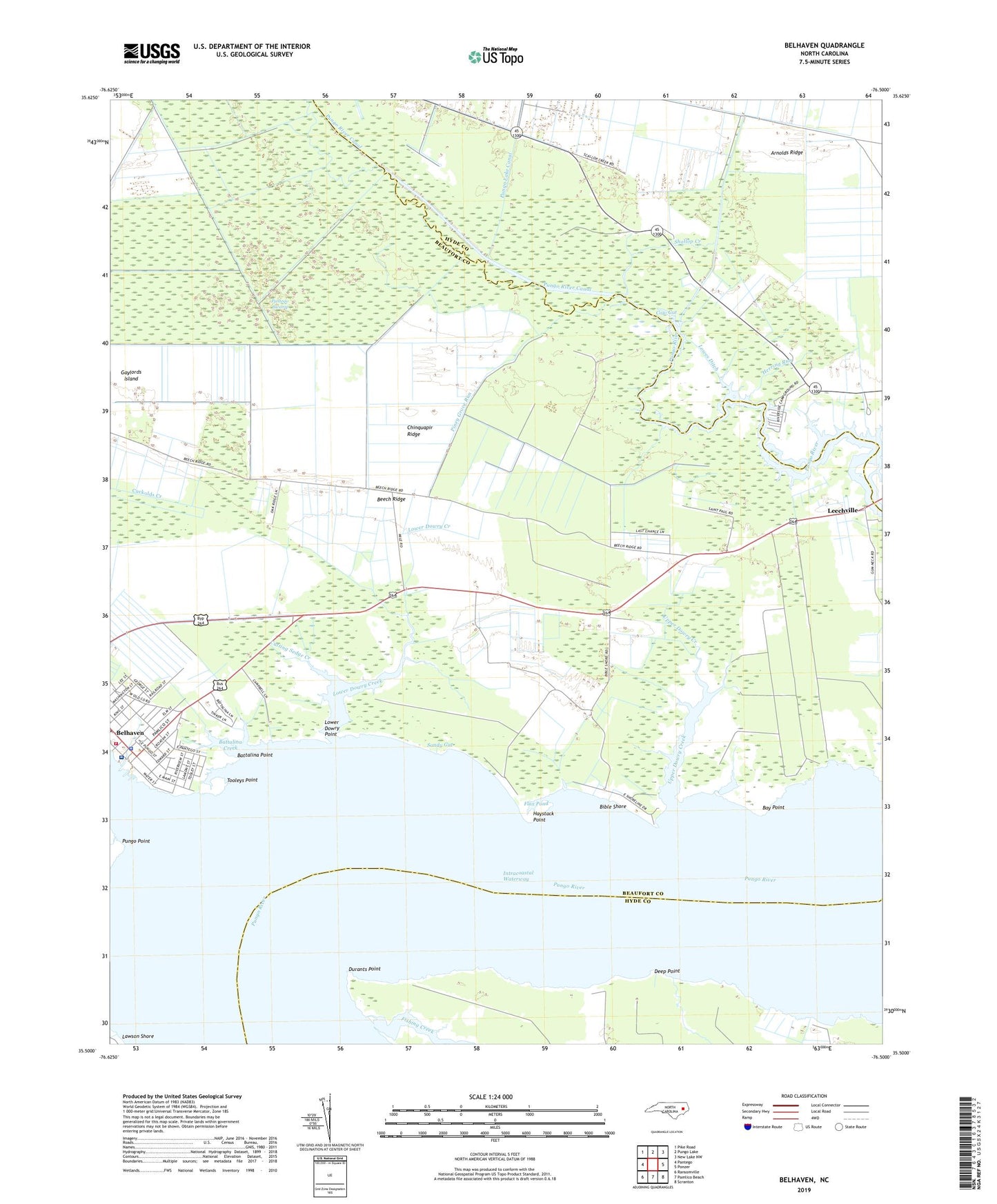
2022 topographic map quadrangle Belhaven in the state of North Carolina. Scale: 1:24000. Based on the newly updated USGS 7.5' US Topo map series, this map is in the following counties: Beaufort, Hyde. The map contains contour data, water features, and other items you are used to seeing on USGS maps, but also has updated roads and other features. This is the next generation of topographic maps. Printed on high-quality waterproof paper with UV fade-resistant inks.
Quads adjacent to this one:
West: Pantego
Northwest: Pike Road
North: Pungo Lake
Northeast: New Lake NW
East: Ponzer
Southeast: Scranton
South: Pamlico Beach
Southwest: Ransomville
This map covers the same area as the classic USGS quad with code o35076e5.
Contains the following named places: Arnolds Ridge, Battalina Creek, Battalina Point, Bay Point, Bay Shore Landing, Beech Ridge, Beech Ridge Pork Farm, Belhaven, Belhaven Elementary School, Belhaven Fire and Rescue Station 84, Belhaven Police Department, Bible Shore, Chinquapir Ridge, Clark Mill Creek, Cow Gut, Crooked Creek, Cutting Sedge Creek, Deep Point, Dowry Creek Marina, Durants Point, Fishing Creek, Flax Pond, Gaylords Island, Haslin Corner, Haslir School, Haystack Point, Herring Run, Hoggard Temple Church of God, Hoophole Landing, J A Wilkerson High School, Knights Creek, Lawson Shore, Leechville, Lower Dowry Creek, Lower Dowry Point, Lowes Ditch, Mount Olive Church of Christ, Mount Olive Pentecostal Church, Pantego Creek, Pantego Swamp, Piney Grove Landing, Piney Grove Run, Pungo Creek, Pungo District Hospital Airport, Pungo Point, Riverside Campground Airport, Saint Miller Church, Sandy Gut, Sawyers Landing, Shallop Creek, Shallop Creek School, Tooleys Creek, Tooleys Point, Town of Belhaven, Trinity United Methodist Church, Upper Dowry Creek, Vidant Pungo Hospital, Whiteplain Free Will Baptist Church, ZIP Code: 27810