MyTopo
Putnam North Carolina US Topo Map
Couldn't load pickup availability
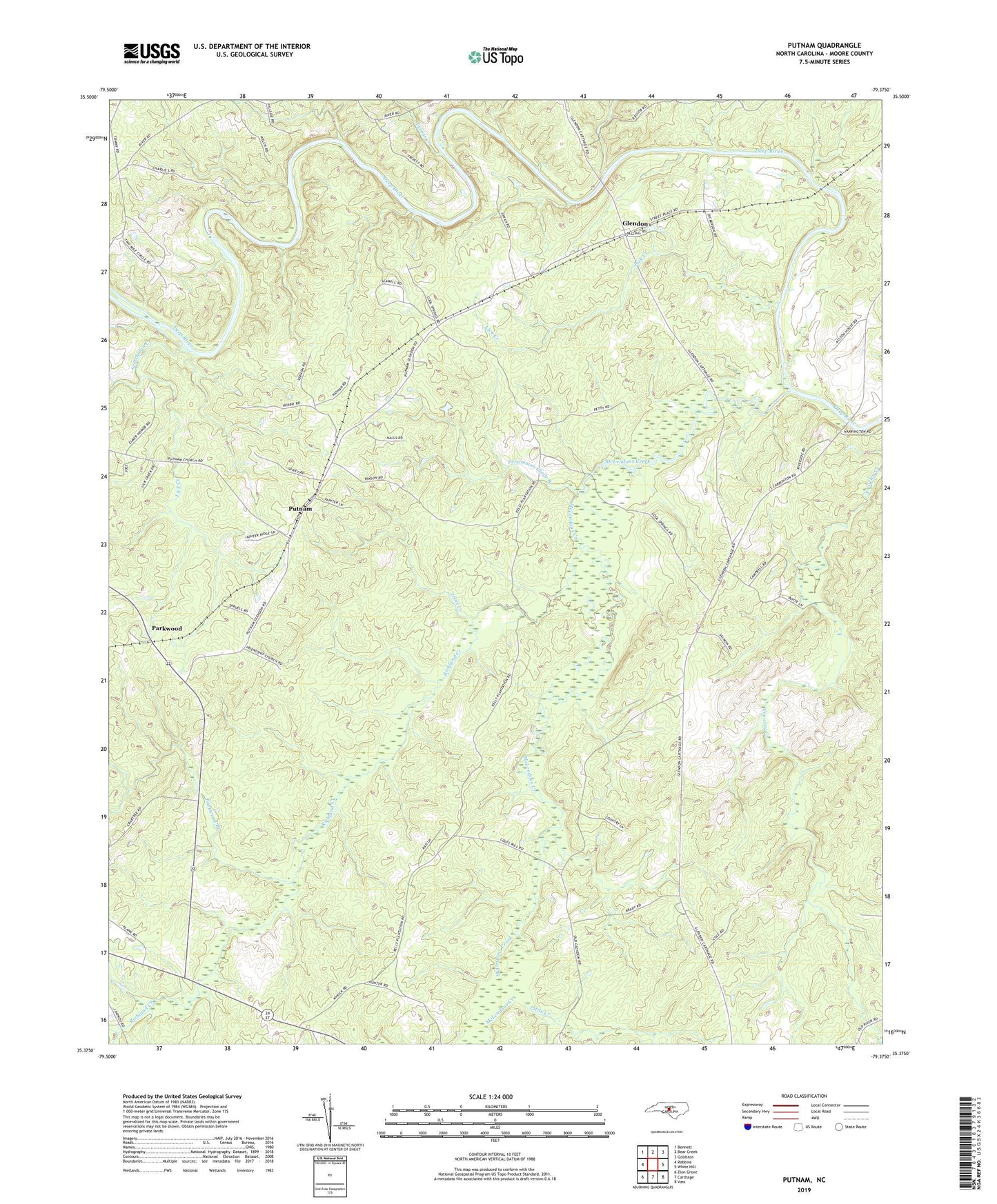
2019 topographic map quadrangle Putnam in the state of North Carolina. Scale: 1:24000. Based on the newly updated USGS 7.5' US Topo map series, this map is in the following counties: Moore. The map contains contour data, water features, and other items you are used to seeing on USGS maps, but also has updated roads and other features. This is the next generation of topographic maps. Printed on high-quality waterproof paper with UV fade-resistant inks.
Quads adjacent to this one:
West: Robbins
Northwest: Bennett
North: Bear Creek
Northeast: Goldston
East: White Hill
Southeast: Vass
South: Carthage
Southwest: Zion Grove
Contains the following named places: Cool Springs Church, Fair Promise Church, Friendship Church, Glendon, Lick Creek, Little Creek, McLendons Creek, Parkwood, Parkwood Branch, Persimmon Glade Branch, Prosperity Church, Putnam, Reives Chapel, Richland Creek, Scotchman Creek, Toms Creek, Township 5-Deep River, Tysons Creek