MyTopo
Bennett North Carolina US Topo Map
Couldn't load pickup availability
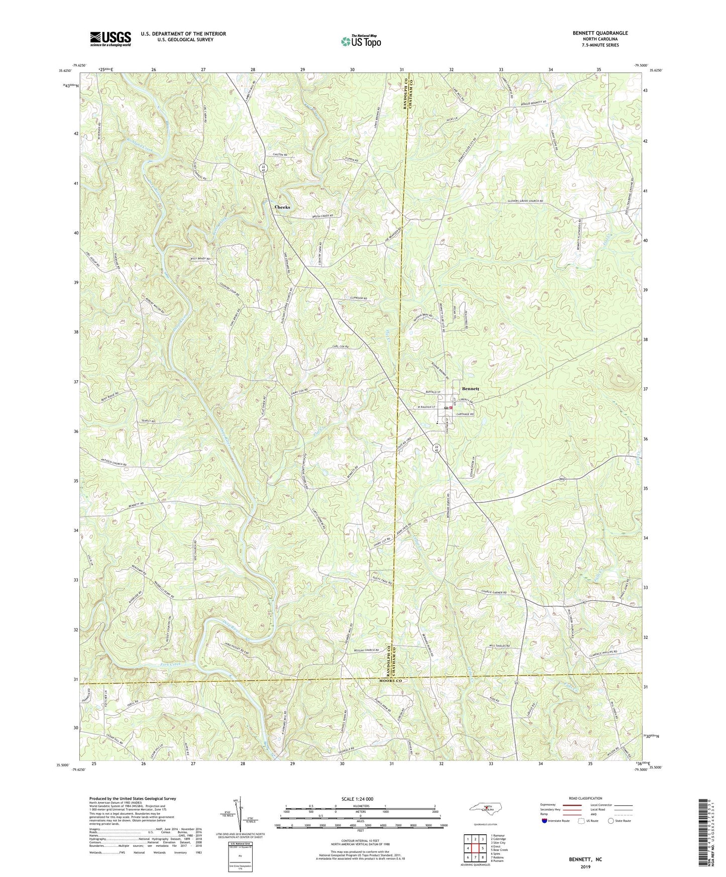
2022 topographic map quadrangle Bennett in the state of North Carolina. Scale: 1:24000. Based on the newly updated USGS 7.5' US Topo map series, this map is in the following counties: Randolph, Chatham, Moore. The map contains contour data, water features, and other items you are used to seeing on USGS maps, but also has updated roads and other features. This is the next generation of topographic maps. Printed on high-quality waterproof paper with UV fade-resistant inks.
Quads adjacent to this one:
West: Erect
Northwest: Ramseur
North: Coleridge
Northeast: Siler City
East: Bear Creek
Southeast: Putnam
South: Robbins
Southwest: Spies
This map covers the same area as the classic USGS quad with code o35079e5.
Contains the following named places: Bennett, Bennett Census Designated Place, Bennett Elementary School, Bennett Post Office, Bennett Volunteer Fire Department - Station 1, Beulah Church, Brush Creek, Cheeks, Fall Creek Church, Flat Creek, Fork Creek, Groves Chapel, Little Brush Creek, Maple Springs Church, Mount Zion Church, Pleasant Grove Church, Pleasant Hill Church, Richland Creek, Riverside Church, Township of Pleasant Grove, ZIP Code: 27208