
MyTopo
Richlands North Carolina US Topo Map
Couldn't load pickup availability
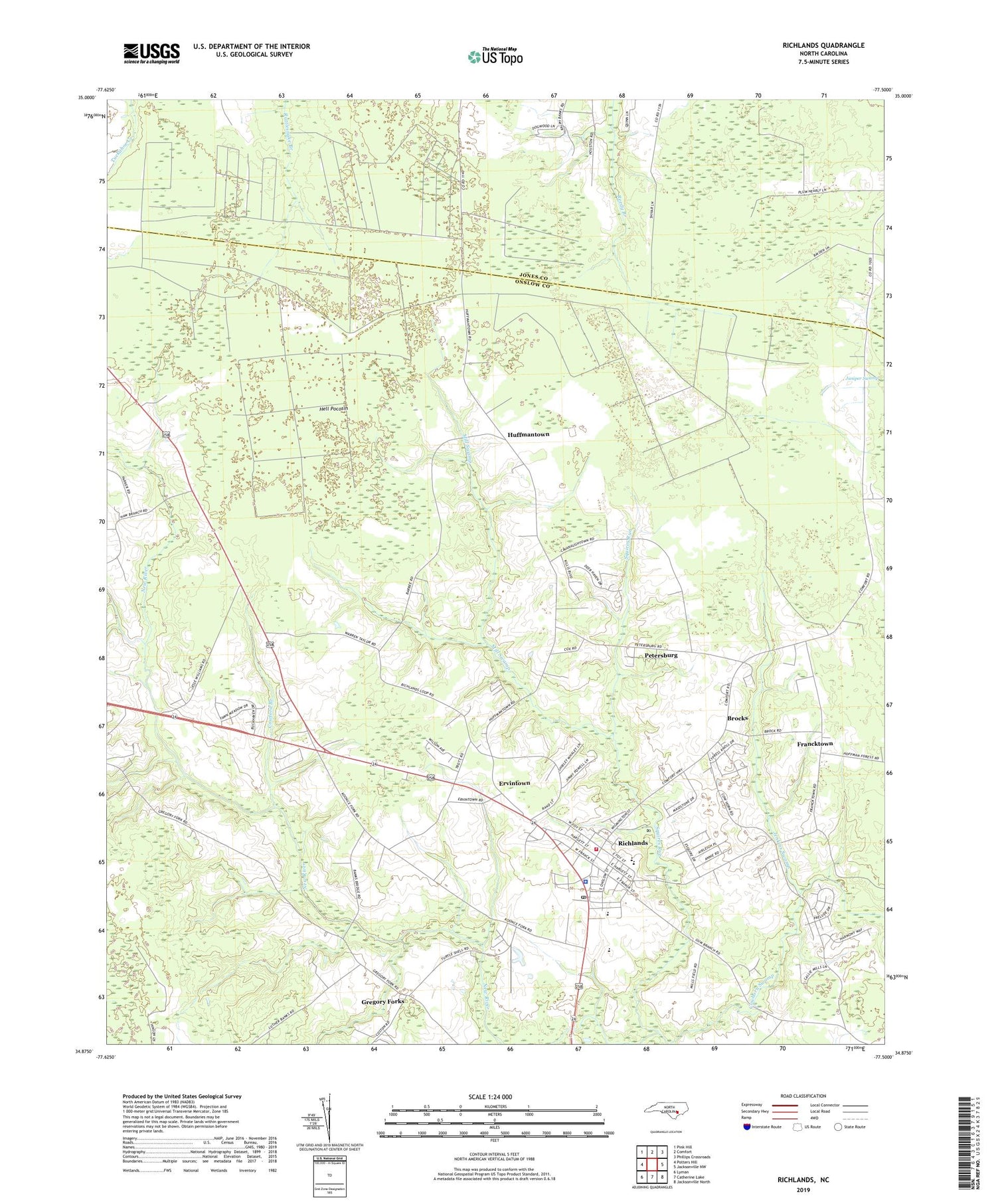
2019 topographic map quadrangle Richlands in the state of North Carolina. Scale: 1:24000. Based on the newly updated USGS 7.5' US Topo map series, this map is in the following counties: Onslow, Jones. The map contains contour data, water features, and other items you are used to seeing on USGS maps, but also has updated roads and other features. This is the next generation of topographic maps. Printed on high-quality waterproof paper with UV fade-resistant inks.
Quads adjacent to this one:
West: Potters Hill
Northwest: Pink Hill
North: Comfort
Northeast: Phillips Crossroads
East: Jacksonville NW
Southeast: Jacksonville North
South: Catherine Lake
Southwest: Lyman
Contains the following named places: Arnolds Mobile Home Park, Bloomer Hill Church, Brocks, Comfort Lookout Tower, Cowford Branch, Ervintown, Francktown, Free Mission Church, Freewill Baptist Church, Gregory Forks, Harrison Chapel, Hell and Purgatory Airport, Hell Pocosin, House of Prayer Church, Huffmantown, Jenkins Swamp, Mill Swamp, Petersburg, Praise Tabernacle, Richlands, Richlands Elementary School, Richlands Emergency Medical Services and Rescue, Richlands High School, Richlands Police Department, Richlands Post Office, Richlands Public Library, Richlands Volunteer Fire Department, Riverside Church, Saint Paul Church, Seasons Cove Assisted Living Facility, Squires Run, Town of Richlands, Trexter Junior High School, ZIP Code: 28574


